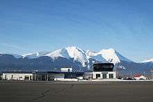
Smithers Airport
| Smithers Regional Airport | |||||||||||
|---|---|---|---|---|---|---|---|---|---|---|---|
 Smithers Airport | |||||||||||
|
IATA: YYD – ICAO: CYYD – WMO: 71950 | |||||||||||
| Summary | |||||||||||
| Airport type | Public | ||||||||||
| Operator | Town of Smithers | ||||||||||
| Serves | Smithers, Bulkley Valley | ||||||||||
| Location | Smithers, British Columbia | ||||||||||
| Time zone | PST (UTC−08:00) | ||||||||||
| • Summer (DST) | PDT (UTC−07:00) | ||||||||||
| Elevation AMSL | 1,716 ft / 523 m | ||||||||||
| Coordinates | 54°49′31″N 127°10′58″W / 54.82528°N 127.18278°WCoordinates: 54°49′31″N 127°10′58″W / 54.82528°N 127.18278°W | ||||||||||
| Map | |||||||||||
 CYYD Location in British Columbia | |||||||||||
| Runways | |||||||||||
| |||||||||||
| Statistics (2010) | |||||||||||
| |||||||||||
Smithers Airport, (IATA: YYD, ICAO: CYYD), is located 2 nautical miles (3.7 km; 2.3 mi) north of Smithers, British Columbia, Canada.
Runways
Originally the runway was 5,000 ft (1,524 m), but it has been expanded to 7,544 ft (2,299 m) so that the airport can land larger aircraft. The extension was completed by in late 2008. Once the expansion of the ski areas is complete, there would then be a need for a runway capable of landing regional aircraft as large as the Boeing 737. Even though Smithers was previously served with older generation Boeing 737 aircraft in the 80s and early 90s, the newer variants of these aircraft require longer runways.
.jpg) Landing runway 33 in 2007
Landing runway 33 in 2007
NavCanada
NavCanada operates a Flight Service Station at Smithers Airport. Staffed hours of operations were cut on April 8, 2010 from 24 hours a day to 13 hours in the winter and 16 hours in the summer.
Manned hours of operation:
- June 1 - September 30, 1300-0500 UTC
- October 1 - May 31, 1500-0400 UTC (1400-0300 UTC Daylight Savings)
Airlines
| Airlines | Destinations |
|---|---|
| Air Canada Express | Vancouver |
| Central Mountain Air | Prince George, Terrace/Kitimat |
| Pacific Coastal Airlines | Charter Flights Seasonal: Dease Lake |
See also
References
- ↑ Canada Flight Supplement. Effective 0901Z 15 September 2016 to 0901Z 10 November 2016
- ↑ Synoptic/Metstat Station Information
- ↑ Total aircraft movements by class of operation — NAV CANADA flight service stations
External links
| Wikimedia Commons has media related to Smithers Airport. |
- Past three hours METARs, SPECI and current TAFs for Smithers Airport from Nav Canada as available.
- Smithers Airport
| By name | |
|---|---|
| By location indicator | |
| By province/territory | |
| By region | |
| National Airports System | |
| Related | |
| |