List of airports in the Okanagan
The Okanagan is a region located in the British Columbia Interior of Canada that contains five airports, four heliports and three water aerodromes. Of the five cities based in the Okanagan, three of them contain aviation services.[1][2] Vernon contains two: the Vernon Regional Airport and Vernon/Wildlife Water Aerodrome,[2][3] while Kelowna provides the same number: the Kelowna International Airport and Kelowna (General Hospital) Heliport.[1][4] The Penticton Regional Airport and Penticton Water Aerodrome are situated in Penticton, making a total of two aviation services offered in the city.[2][3] Despite this, the Enderby and Armstrong cities contain no aviation services.
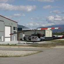
There are also communities that are not cities in the Okanagan, many of which also maintain aviation services. Winfield, a town located within the Lake Country district, provides the Winfield (Wood Lake) Water Aerodrome.[3] The West Kelowna district provides two heliports: the Kelowna (Alpine) Heliport and Kelowna (Wildcat Helicopters) Heliport,[2] while the unincorporated community of Naramata offers the Naramata Heliport.[2] Meanwhile, the towns of Oliver and Osoyoos are home to the Oliver Municipal Airport and Osoyoos Airport.[2] The districts of Peachland and Summerland, along with the town of Oyama in Lake Country, do not provide aviation services.
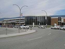
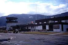
Two of the airports in the Okanagan provide public commercial flights to other destinations: the Kelowna International Airport which is part of the National Airports System and Penticton Regional Airport.[1][2][5] While the Kelowna International Airport serves as the only international airport in the Okanagan area and handles 62 commercial flights a day,[6] the Penticton Regional Airport provides three commercial flights daily, with one fewer on Sunday, to one location: the Vancouver International Airport.[5] A number of other airports in the Okanagan are generally used for personal events, or skydiving, although some have no facilities.[7][8][9]
Airports
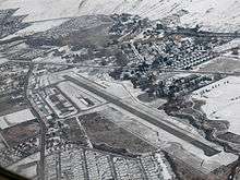
The following list contains airports, heliports, or water aerodromes that are located in the Okanagan region of British Columbia, Canada. It includes the airport name, location, type, usage, codes of the International Civil Aviation Organization (ICAO airport code) and the International Air Transport Association (IATA airport code), as well as the Transport Canada location identifier (TC LID) code, and coordinates of the airport's location. ICAO and IATA codes are not given for airports which were closed or converted to general aviation before being issued such codes. As shown in the following list, each airport contains certain codes that are given, but not all of the three.
References
- 1 2 3 4 "Destinations". Kelowna. Retrieved December 15, 2012.
- 1 2 3 4 5 6 7 8 9 10 11 12 13 14 15 16 Canada Flight Supplement. Effective 0901Z 15 September 2016 to 0901Z 10 November 2016
- 1 2 3 4 5 6 Nav Canada's Water Aerodrome Supplement. Effective 0901Z 7 March 2013 to 0901Z 3 April 2014
- 1 2 Gaffney, Biaine (October 28, 2010). "Helipad unveiled in Kelowna". Global News. Retrieved December 15, 2012.
- 1 2 "Penticton Regional Airport". Penticton Regional Airport. Retrieved November 22, 2012. Note: Information is listed under the arrivals and departures headings.
- ↑ "About YLW". Kelowna. Retrieved December 17, 2012.
- ↑ "Skydivers entertain at Oliver airport". Oliver Daily News. August 20, 2011. Retrieved December 19, 2012.
- 1 2 "Airport". Osoyoos. Retrieved December 19, 2012.
- ↑ Rolke, Richard (April 1, 2011). "Airport concerns take flight". The Morning Star. Retrieved December 19, 2012.
- ↑ "AWWS – Forecasts and Observations". Nav Canada. Retrieved December 15, 2012.
- ↑ "Airport". Oliver. Retrieved December 15, 2012.
- ↑ "Penticton Airport Car Rentals (YYF Airport)". Budget Rent a Car. Retrieved December 15, 2012.
- ↑ "Welcome to the Vernon Regional Airport". Vernon. Retrieved December 15, 2012.
External links
| Wikimedia Commons has media related to Airports in the Okanagan. |
| By name | |
|---|---|
| By location indicator | |
| By province/territory | |
| By region | |
| National Airports System | |
| Related | |
| |