Slovenská Kajňa
| Slovenská Kajňa | ||
| Village | ||
|
||
| Country | Slovakia | |
|---|---|---|
| Region | Prešov Region | |
| District | Vranov nad Topľou District | |
| Elevation | 140 m (459 ft) | |
| Coordinates | 48°58′00″N 21°45′00″E / 48.96667°N 21.75000°ECoordinates: 48°58′00″N 21°45′00″E / 48.96667°N 21.75000°E | |
| Area | 6.73 km2 (3 sq mi) | |
| Population | 783 (31 December 2012) | |
| Density | 116/km2 (300/sq mi) | |
| First mentioned | 1323 | |
| Mayor | Jozef Durkaj | |
| Timezone | CET (UTC+1) | |
| - summer (DST) | CEST (UTC+2) | |
| Postal code | 094 02 | |
| Phone prefix | 421-57 | |
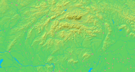  Location of Slovenská Kajňa in Slovakia | ||
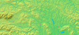  Location of Slovenská Kajňa in the Prešov Region | ||
| Wikimedia Commons: Slovenská Kajňa | ||
| Statistics: MOŠ/MIS | ||
| Website: http://www.slovenskakajna.eu/ | ||


Location of Vranov nad Topľou District in the Prešov Region.
Slovenská Kajňa (Hungarian: Alsónyírjes) is a village and municipality in Vranov nad Topľou District in the Prešov Region of eastern Slovakia.
History
In historical records the village was first mentioned in 1323.
Geography
The municipality lies at an altitude of 142 metres and covers an area of 6.729 km². It has a population of about 783 people.[1]
Gallery
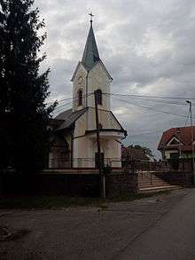
The Holy Trinity's Church
Notable people
- Marcel Matanin is a former long-distance runner, who represented his native country in the men's marathon at the 2004 Summer Olympics in Athens, Greece. There he finished in 81st and last place, clocking a total time of 2:50:26 hours. On April 23, 2006 Matanin won the Leipzig Marathon in 2:19:33 hours. Matanin was a former mayor of Slovenská Kajňa (from 1.1.2007 to 31.12.2010).[2] Currently he is a sporting director of the ČSOB Bratislava Marathon.[3]
- Tomáš Oslovič is a Slovak football defender who currently plays for Landesliga Bayern-Mitte club 1. FC Bad Kötzting in Germany. His former clubs were MFK Vranov nad Topľou, Czech 1. FC Karlovy Vary and German clubs SV Schwarzhofen e.V, SV Mitterteich.[4]
External links
References
- ↑ Slovenská Kajňa Demografia (31.12.2012) 31.12.2012, statistics.sk/
- ↑ Obec Slovenská Kajňa - Voľby a politika v obci 27.09.2013, naseobce.sk
- ↑ ČSOB Bratislava Marathon má nového športového riaditeľa 31.01.2012, http://m.webnoviny.sk/
- ↑ Tomas Oslovic 28.09.2013, fupa.net/
This article is issued from Wikipedia - version of the 2/12/2016. The text is available under the Creative Commons Attribution/Share Alike but additional terms may apply for the media files.