Simpson Creek
| Simpson Creek | |
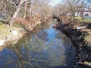 Simpson Creek in Bridgeport in 2006 | |
| Country | United States |
|---|---|
| State | West Virginia |
| Source | |
| - location | northwestern Barbour County |
| - elevation | 1,522 ft (464 m) [1] |
| - coordinates | 39°11′51″N 80°06′10″W / 39.19750°N 80.10278°W [2] |
| Mouth | West Fork River |
| - location | northeastern Harrison County |
| - elevation | 902 ft (275 m) [2] |
| - coordinates | 39°20′58″N 80°19′08″W / 39.34944°N 80.31889°WCoordinates: 39°20′58″N 80°19′08″W / 39.34944°N 80.31889°W [2] |
| Length | 28 mi (45 km) |
| Basin | 73 sq mi (189 km2) |
 Simpson Creek and its watershed | |
Simpson Creek is a tributary of the West Fork River, 28 miles (45 km) long,[3] in north-central West Virginia, USA. The stream was named for hunter and trapper John Simpson, who left his name on it ("Simpson's Creek") after building and living in a cabin there for several months in 1763 and '64.[4]
Geography
Via the West Fork, Monongahela and Ohio Rivers, Simpson Creek is part of the watershed of the Mississippi River, draining an area of 73 square miles (190 km2)[5] on the unglaciated portion of the Allegheny Plateau. It rises approximately 5 miles (8.0 km) northwest of Philippi in northwestern Barbour County and flows generally northwestwardly through southeastern Taylor County and northeastern Harrison County, passing through the communities of Flemington and Bridgeport; it flows into the West Fork River approximately 4 miles (6.4 km) south-southwest of Shinnston.[6]
According to the West Virginia Department of Environmental Protection, approximately 69% of Simpson Creek's watershed is forested, mostly deciduous. Approximately 26% is used for pasture and agriculture, and approximately 3% is urban.[5]
Pollution
The water quality of Simpson Creek has been impacted by runoff from mining operations in the region, but conditions have slowly improved in some areas; a section of the creek in Bridgeport was stocked with rainbow trout in 2006.[7]
Variant spellings
According to the Geographic Names Information System, Simpson Creek has also been known historically as:[2]
- Simpson's Creek
- Simpsons Creek
- Simpsons Crick
- Simsons Creek
- Simsons Crick
See also
- List of West Virginia rivers
- Bridgeport Lamp Chimney Company Bowstring Concrete Arch Bridge
- Simpson Creek Covered Bridge
References
- ↑ Google Earth elevation for GNIS source coordinates. Retrieved on 2007-02-12.
- 1 2 3 4 Geographic Names Information System. "Geographic Names Information System entry for Simpson Creek (Feature ID #1546817)". Retrieved 2007-02-12.
- ↑ United States Environmental Protection Agency. "Watershed Assessment, Tracking & Environmental Results: Assessment Summary for Reporting Year 2008, West Virginia, West Fork Watershed". Archived from the original on 2011-10-13. Retrieved 2011-10-13.
- ↑ Kenny, Hamill (1945). West Virginia Place Names: Their Origin and Meaning, Including the Nomenclature of the Streams and Mountains. Piedmont, West Virginia: The Place Name Press. p. 579.
- 1 2 West Virginia Department of Environmental Protection. "Watershed Atlas Project.". pp. West Fork River. Archived from the original on 2005-04-04. Retrieved 2007-02-26.
- ↑ DeLorme (1997). West Virginia Atlas & Gazetteer. Yarmouth, Maine: DeLorme. pp. 25, 36. ISBN 0-89933-246-3.
- ↑ West Virginia University Extension Service. "Fish Tales Newsletter, Vol.4 No.2, Summer 2006: Simpson Creek Comes Full Circle.". Retrieved 2010-07-03.