Silver Comet Field at Paulding Northwest Atlanta Airport
| Silver Comet Field at Paulding Northwest Atlanta Airport | |||||||||||
|---|---|---|---|---|---|---|---|---|---|---|---|
 | |||||||||||
| IATA: none – ICAO: KPUJ – FAA LID: PUJ | |||||||||||
| Summary | |||||||||||
| Airport type | Public | ||||||||||
| Owner | Paulding County Board of Commissioners | ||||||||||
| Serves | Atlanta, Georgia | ||||||||||
| Location | Dallas, Georgia | ||||||||||
| Elevation AMSL | 1,289 ft / 393 m | ||||||||||
| Coordinates | 33°54′43″N 084°56′26″W / 33.91194°N 84.94056°WCoordinates: 33°54′43″N 084°56′26″W / 33.91194°N 84.94056°W | ||||||||||
| Website | PauldingAirport.com | ||||||||||
| Map | |||||||||||
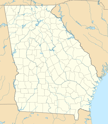 PUJ Location of airport in Georgia | |||||||||||
| Runways | |||||||||||
| |||||||||||
| Statistics | |||||||||||
| |||||||||||
Silver Comet Field at Paulding Northwest Atlanta Airport (also known as Silver Comet Field) (ICAO: KPUJ, FAA LID: PUJ) is a small public use airport in Paulding County, Georgia, United States.[2] Formerly known as Paulding Northwest Atlanta Airport and Paulding County Regional Airport,[4] it is owned by the Paulding County Board of Commissioners.[2] The airport is located in Dallas, Georgia,[5] 30 miles (48 km) northwest of Atlanta.[1] It is included in the National Plan of Integrated Airport Systems for 2011–2015, which categorized it as a general aviation facility.[6]
Paulding County, located in northwest Metro Atlanta, encompasses 314 square miles and is home to approximately 150,000 residents. Source On October 4, 2013, nearly one year after negotiations and contracts, Paulding County announced a Public Private Partnership with an entrepreneurial startup company called Propeller Investments, llc dba Propeller Airports, llc dba Silver Comet Terminal Partners, llc to develop its airport, which proposed including commercial passenger service, despite the head of the Paulding County Airport Authority's promises to the county residents of transparency and that the airport would remain a general aviation airport.[7] Paulding residents immediately filed several lawsuits, which addressed violations of Georgia's Sunshine Laws and Open Meetings Act, and an ultra vires suit against the Paulding County Industrial Building Authority for overextending its authority.[8][9]
Many of these lawsuits have been filed by attorneys associated with Delta Air Lines. October 2013: Residents file a legal challenge to bond funding for a Paulding airport taxiway expansion that will facilitate airline service. November 2013: Residents file a second legal challenge, questioning Federal Aviation Administration environmental approvals of Paulding airport plans. December 2013: A judge rules in favor of the airport and county in the bond funding case. Residents pledge to appeal. Attorneys announce a settlement of the FAA case, calling for an environmental assessment that will delay the commercialization of the airport for months. January 2014: Paulding residents file a third legal challenge, questioning airport leases and a loan made to fund the taxiway expansion. SOURCE
Paulding's airport is located on Rockmart Highway (U.S. Route 278), approximately 25 miles from the nearest interstate and 40 miles from Midtown Atlanta. Construction was completed in late 2008. It is the ninth local airport in metro Atlanta, and the first new jet-capable airport in Georgia since 1975. To date more than $70M has gone into the construction and development of the airport. Paulding County has spent roughly $10 million of its own money, about $55 million in Federal Aviation Administration grants and $7 million in state funds on the airport. It is anticipated that economic development activity at the airport could result in more than $350 Million in annual economic activity and thousands of jobs for Paulding County over the next decade.
Although many U.S. airports use the same three-letter location identifier for the FAA and IATA, this facility is assigned PUJ by the FAA[2] but has no designation from the IATA[10] (which assigned PUJ to Punta Cana International Airport in the Dominican Republic[11]).
History
In 1975, in anticipation of a second international airport, the city of Atlanta purchased 10,165 acres (41.14 km2) of land in Paulding for $925 per acre.[12] In early 2007 the county purchased 162 acres (0.7 km2) of the property for the new general aviation airport.[12] Paulding County is unserved by either rapid transit or freeways.
2012 hangar collapse
On February 22, 2012, one worker was killed and another injured while they were working on construction of the airport's second hangar and it collapsed. This hangar had earlier been delayed, in December 2011, when it was discovered that the hangar's concrete slab was not level.[13][14]
2012 tornado
On the night of March 2, 2012, the airport was struck by an EF3 tornado that tore a 12-mile (19 km) path across the county. Several million dollars in damage was done, including $1.5 million to the facility, and $5 million to the aircraft parked and stored there, destroying most of them (between 18 and 23 aircraft). The roof was ripped off the hangar, and the airport was closed until cleanup and essential repairs were completed. The hangar was so severely damaged it had to be torn down and rebuilt.[15][16][17]
Repairs to the terminal building were completed in October 2012. The airport became operational with aircraft activity near levels documented prior to the March 2012 tornado, though the airport's only charter service ceased operations there.[18] The storm was part of the early-March 2012 tornado outbreak. It is the second local airport to have been struck by a tornado in recent years, the other being Tara Field in 2005.
Facilities
Paulding Northwest Atlanta Airport covers an area of 164 acres (66 ha) at an elevation of 1,289 feet (393 m) above mean sea level.[2] It has one southeast/northwest runway designated 13/31 which measures 5,505 by 100 feet (1,678 m × 30 m).[2] Made of concrete, it is capable of landing aircraft up to 50,000 pounds (22,680 kg) for single-wheel landing gear, and 90,000 pounds (40,823 kg) for dual-wheel.
A new, 20,000-square-foot (1,900 m2) terminal building was opened in May 2010, along with the airport's new fixed-base operator, Paulding Jet Center. The airport also has an AWOS weather station, a rotating beacon, and pilot-activated runway lighting. The runway elevation averages 1,286 feet (392 m) AMSL, ±3 feet (±1m). PUJ offers an ILS and GPS approach on runway 31. The National Weather Service did not carry observations for this location until late 2012 or early 2013.
References
- 1 2 "Paulding Northwest Atlanta Airport". Retrieved August 15, 2010.
- 1 2 3 4 5 6 FAA Airport Master Record for PUJ – PAULDING NORTHWEST ATLANTA (Form 5010 PDF). Federal Aviation Administration. Effective April 5, 2012.
- ↑ "PUJ – PAULDING NORTHWEST ATLANTA". Georgia Department of Transportation. Retrieved June 25, 2012.
- ↑ "KPUJ – Paulding County Regional Airport – Dallas, Georgia". FAA information effective April 8, 2010. AirNav. Archived from the original on April 20, 2010.
- ↑ "Contact". Paulding Northwest Atlanta Airport. Retrieved June 25, 2012.
- ↑ "2011–2015 NPIAS Report, Appendix A" (PDF, 2.03 MB). National Plan of Integrated Airport Systems. Federal Aviation Administration. October 4, 2010. External link in
|work=(help) - ↑ Head of Paulding County Airport Authority, retrieved 2015-06-18
- ↑ "Residents file suit over Paulding airport authority closed...". Retrieved 2015-06-18.
- ↑ "Palling residents target authority board members in airport suit". Retrieved 2015-06-18.
- ↑ "Paulding County Regional Airport (ICAO: KPUJ, FAA: PUJ, IATA: none)". Great Circle Mapper. Retrieved August 15, 2010.
- ↑ "Punta Cana International Airport (IATA: PUJ, ICAO: MDPC)". Aviation Safety Network. Retrieved August 15, 2010.
- 1 2 "Atlanta sells back land for Paulding airport". Atlanta Business Chronicle. July 3, 2007. Retrieved October 12, 2007.
- ↑ "Kathryn's Report: 1 still critical after hangar collapse at Paulding Northwest Atlanta Airport (KPUJ), Atlanta, Georgia". www.kathrynsreport.com. Retrieved 2015-06-18.
- ↑ "Man dies from injuries in Paulding hangar collapse". Retrieved 2015-06-18.
- ↑ "An airplane sits upside down following tornado damage at the Paulding Northwest Atlanta Airport in Dallas. Photo 03/03/2012". townhall.com. Retrieved 2015-06-18.
- ↑ "Airport officials look at an overturned plane lying on its back after flipping over following tornado damage at the Paulding Northwest Atlanta Airport in Dallas Photo 03/03/2012". townhall.com. Retrieved 2015-06-18.
- ↑ "Storm Damage Closes Paulding Airport". legacy.gpb.org. Retrieved 2015-06-18.
- ↑ "Paulding Co. airport reopens after tornado". wsbtv.com. March 9, 2012.
External links
- PauldingAirport.com
- Resources for this airport:
- FAA airport information for PUJ
- AirNav airport information for KPUJ
- FlightAware airport information and live flight tracker
- SkyVector aeronautical chart for KPUJ