Siege of Burriana
| Siege of Burriana | |||||||
|---|---|---|---|---|---|---|---|
| Part of the Reconquista Aragonese Conquest of Valencia | |||||||
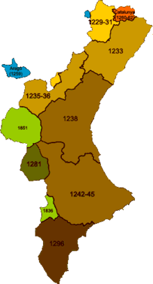 Chronological map documenting the Conquest of Valencia. | |||||||
| |||||||
| Belligerents | |||||||
|
| Taifa of Valencia | ||||||
| Commanders and leaders | |||||||
|
| Zayyan ibn Mardanish | ||||||
Part of a series on the |
|---|
| History of Spain |
.svg.png) |
| Timeline |
|
|
The Siege of Burriana was one of the battle actions that occurred during the Conquest of Valencia by James I of Aragon. Burriana was an important Muslim city, being the capital of La Plana, Valencia. It was known as the "Green City". The city was besieged for two months, finally falling to the forces of James I in July 1233.
Context
In 1229, the city of Valencia, known to the Muslims as "Balansiya", had fallen to the forces under the command of Zayyan ibn Mardanish, a local leader who was opposed to the Almohades. In capturing that city, he dethroned Zayd Abu Zayd, who subsequently fled to the Kingdom of Aragon. James I of Aragon used this as a casus belli to intervene in the Muslim civil war on the side of the Almohades, but in reality with the pretext of expanding his own territory.
Two Aragonese knights, Hugo de Follalquer, Grand Master of the Knights Hospitaller, and Blas de Aragón, who had just returned from a period of exile in Valencia, met with Jaime I at Alcañiz. They recounted stories of the prosperity of the Muslim kingdom and encouraged the king to conquer it in 1233.
Consequences
After taking Burriana, the castles to the north continued to fall into Aragonese hands one by one including; Peniscola, Castelló de la Plana, Borriol, Cuevas de Vinromá and Villafamés. Three years later, the decisive Battle of the Puig sealed the conquest in 1236.
See also
References
- The information on this page was translated from its Spanish equivalent.
Bibliography
Zurita y Castro, Jerónimo (2003). "Book III" (PDF). Anales de Aragón (Edició d'Ángel Canellas López. Edició electrònica de José Javier Iso, María Isabel Yagüe i Pilar Rivero ed.). Institución Fernando el Católico. p. 238.
Linajes de Aragón (PDF) (in Spanish). Los Cornel.
Coordinates: 39°53′22″N 0°05′03″W / 39.88944°N 0.08417°W