Shire of Peak Downs
| Shire of Peak Downs Queensland | |||||||||||||
|---|---|---|---|---|---|---|---|---|---|---|---|---|---|
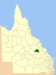 Location within Queensland | |||||||||||||
| Population | 3,285 (2001 census) | ||||||||||||
| Council seat | Capella | ||||||||||||
| Region | Central Queensland | ||||||||||||
|
| |||||||||||||
| Website | Shire of Peak Downs | ||||||||||||
| |||||||||||||
Shire of Peak Downs was a local government area in the Central Highlands of Queensland, Australia, 320 km west of both Rockhampton and Mackay. On 15 March 2008 the shires of Duaringa, Emerald, Bauhinia and Peak Downs were amalgamated to form the Central Highlands Region.[1]
History

On 11 November 1879, the Belyando Division was established as one of 74 divisions around Queensland under the Divisional Boards Act 1879.[2]
On 20 September 1884, Peak Downs Division was separated from the southern part of Belyando Division.
On 31 March 1903, Peak Downs Division became the Shire of Peak Downs.
In 1927, the shire's offices were located in Capella.[3]
Towns and localities
The Shire of Peak Downs included the following settlements:
Towns:
Economy
It had about 4,000 inhabitants, the primary economic activities in the shire are coal mining, farming and grazing.
The Shire is part of the Bowen Basin, a major coal deposit. Mining began in the shire in the late 1970s with the opening of Gregory coal mine in 1979, which was followed by Mount Isa Mines' Oaky Creek coal mine in 1983. Oaky Creek was also the reason behind the construction of the township of Tieri, whose sole purpose was to house the workforce that was required to operate Oaky Creek. Three more mines were opened in the 1990s – Ensham/Yongala, Crinum and Gordonstone (later purchased by Rio Tinto and renamed Kestrel coal mine).
Peak Downs is also an area of intensive agricultural production, which is made possible by its black soil plains and is typified by the abundance and variety of grains in the Shire. Grains planted include sorghum, wheat, barley, sunflower and more recently chickpeas.
Chairmen
- 1927: Percy Charles Allan [3]
References
- ↑ "Agency ID11030, Central Highlands Regional Council". Queensland State Archives. Retrieved 8 September 2013.
- ↑ "Proclamation [Belyando Division]". Queensland Government Gazette. 11 November 1879. p. 25:1005.
- 1 2 Pugh, Theophilus Parsons (1927). Pugh's Almanac for 1927. Retrieved 13 June 2014.
External links
- Queensland Department of Local Government & Planning - Local Government Directory
Coordinates: 23°04′59.7″S 148°01′25.6″E / 23.083250°S 148.023778°E