Shelby, Mississippi
| Shelby, Mississippi | |
|---|---|
| City | |
|
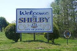
Welcome sign | |
| Nickname(s): Smoke Town | |
| Motto: "City of Justice" | |
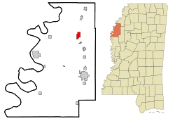 Location of Shelby, Mississippi | |
 Shelby, Mississippi Location in the United States | |
| Coordinates: 33°56′57″N 90°45′55″W / 33.94917°N 90.76528°WCoordinates: 33°56′57″N 90°45′55″W / 33.94917°N 90.76528°W | |
| Country | United States |
| State | Mississippi |
| County | Bolivar |
| Government | |
| • Mayor | Dan Harris[1] |
| Area | |
| • Total | 2.74 sq mi (7.10 km2) |
| • Land | 2.73 sq mi (7.07 km2) |
| • Water | 0.01 sq mi (0.03 km2) |
| Elevation | 154 ft (47 m) |
| Population (2010) | |
| • Total | 2,229 |
| • Density | 816/sq mi (315.1/km2) |
| Time zone | Central (CST) (UTC-6) |
| • Summer (DST) | CDT (UTC-5) |
| ZIP code | 38774 |
| Area code(s) | 662 |
| FIPS code | 28-67040 |
| GNIS feature ID | 0677634 |
| Website |
cityofshelbyms |
Shelby is a city in Bolivar County, Mississippi, United States. The population was 2,229 at the 2010 census,[2] down from 2,926 in 2000. The town of Shelby was established in 1853 by Tom Shelby, who had purchased a block of land there from the federal government.
Geography
Shelby is located at 33°56′57″N 90°45′55″W / 33.94917°N 90.76528°W (33.949293, -90.765241).[3]
According to the United States Census Bureau, the city has a total area of 2.7 square miles (7.1 km2), of which 0.012 square miles (0.03 km2), or 0.39%, is water.[2]
The rear entrance of the Mississippi State Penitentiary in unincorporated Sunflower County is about 10 miles (16 km) east of Shelby, along Mississippi Highway 32.[4]
Demographics
| Historical population | |||
|---|---|---|---|
| Census | Pop. | %± | |
| 1910 | 645 | — | |
| 1920 | 1,300 | 101.6% | |
| 1930 | 1,811 | 39.3% | |
| 1940 | 1,956 | 8.0% | |
| 1950 | 2,148 | 9.8% | |
| 1960 | 2,384 | 11.0% | |
| 1970 | 2,645 | 10.9% | |
| 1980 | 2,540 | −4.0% | |
| 1990 | 2,806 | 10.5% | |
| 2000 | 2,926 | 4.3% | |
| 2010 | 2,229 | −23.8% | |
| Est. 2015 | 2,123 | [5] | −4.8% |
As of the 2010 United States Census,[7] there were 2,229 people residing in the city. The racial makeup of the city was 94.3% Black, 4.7% White and 0.2% from two or more races. 0.8% were Hispanic or Latino of any race.
As of the census[8] of 2000, there were 2,926 people, 919 households, and 677 families residing in the city. The population density was 1,079.5 people per square mile (416.9/km²). There were 963 housing units at an average density of 355.3 per square mile (137.2/km²). The racial makeup of the city was 7.93% White, 91.08% African American, 0.07% Native American, 0.10% Asian, 0.38% from other races, and 0.44% from two or more races. Hispanic or Latino of any race were 0.99% of the population.
There were 919 households out of which 43.3% had children under the age of 18 living with them, 26.3% were married couples living together, 41.7% had a female householder with no husband present, and 26.3% were non-families. 23.1% of all households were made up of individuals and 10.0% had someone living alone who was 65 years of age or older. The average household size was 3.07 and the average family size was 3.60.
In the city the population was spread out with 37.5% under the age of 18, 9.8% from 18 to 24, 24.5% from 25 to 44, 15.8% from 45 to 64, and 12.5% who were 65 years of age or older. The median age was 27 years. For every 100 females there were 82.4 males. For every 100 females age 18 and over, there were 70.4 males.
The median income for a household in the city was $17,798, and the median income for a family was $20,368. Males had a median income of $26,250 versus $19,554 for females. The per capita income for the city was $10,567. About 39.9% of families and 44.5% of the population were below the poverty line, including 56.5% of those under age 18 and 21.3% of those age 65 or over.
Education
Shelby is served by the North Bolivar School District, home of the Broad Street High School Jaguars.
Notable people
- Walter Luzar "Choker" Campbell, musician
- Dorsett Terrell Davis, football player
- Erma Franklin, gospel and R&B singer, sister of the legendary gospel and R&B singer Aretha Franklin
- Hattie Littles, soul singer
- Sonny Boy Nelson, musician
- Vera B. Rison, Michigan state legislator
- Mississippi Slim, blues musician
- Henry Townsend, blues singer most associated with St. Louis, Missouri, on the St. Louis Walk of Fame and a Mississippi Blues Trail marker[9]
- Gerald Wilson, jazz trumpeter, composer and arranger
References
- ↑ City of Shelby website
- 1 2 "Geographic Identifiers: 2010 Demographic Profile Data (G001): Shelby city, Mississippi". U.S. Census Bureau, American Factfinder. Retrieved January 22, 2014.
- ↑ "US Gazetteer files: 2010, 2000, and 1990". United States Census Bureau. 2011-02-12. Retrieved 2011-04-23.
- ↑ Cross, Robert."A prison's family plan." Chicago Tribune. October 2, 1985. D1. Retrieved on September 23, 2010. "Ten miles east of Shelby, the sprightly cotton fields along Miss. Hwy. 32 begin to recede, and parched weeds on the shoulder squeeze the road down to a single lane of potholes. Highway 32 continues for a few more yards. Then a steel barricade, flanked by a guard tower, cuts it off."
- ↑ "Annual Estimates of the Resident Population for Incorporated Places: April 1, 2010 to July 1, 2015". Retrieved July 2, 2016.
- ↑ "Census of Population and Housing". Census.gov. Retrieved June 4, 2015.
- ↑ "American FactFinder". United States Census Bureau. Retrieved 2016-10-14.
- ↑ "American FactFinder". United States Census Bureau. Retrieved 2008-01-31.
- ↑ "Henry Townsend - Shelby". msbluestrail.org. December 4, 2009. Retrieved 31 January 2010.
External links
Municipalities and communities of Bolivar County, Mississippi, United States | ||
|---|---|---|
| Cities | 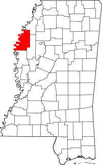 | |
| Towns | ||
| Unincorporated communities | ||
| Ghost towns | ||
| Footnotes | ‡This populated place also has portions in an adjacent county or counties | |