Shawmere River
| Shawmere River | |
| River | |
| Country | Canada |
|---|---|
| Province | Ontario |
| Region | Northeastern Ontario |
| District | Sudbury |
| Part of | James Bay drainage basin |
| Tributaries | |
| - left | Little Shawmere River |
| Source | Unnamed lake |
| - location | Gamey Township |
| - elevation | 440 m (1,444 ft) |
| - coordinates | 47°53′29″N 82°59′44″W / 47.89139°N 82.99556°W |
| Mouth | Ivanhoe River |
| - location | Oates Township |
| - elevation | 294 m (965 ft) |
| - coordinates | 48°20′23″N 82°28′38″W / 48.33972°N 82.47722°WCoordinates: 48°20′23″N 82°28′38″W / 48.33972°N 82.47722°W |
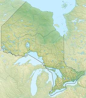 Location of the mouth of the Shawmere River in Ontario | |
The Shawmere River is a river in Sudbury District in northeastern Ontario, Canada.[1] It is in the James Bay drainage basin, and is a left tributary of the Ivanhoe River.
Course
The river begins at a small, unnamed lake in geographic Gamey Township,[2] and flows north to Yohannson Lake, where it enters geographic Crockett Township.[3] It flows briefly through the northwest corner of the township and enters geographic Sandy Township,[4] continuing its northeast course under Ontario Highway 101. It heads north into geographic Murdock Township[5] into Renée Lake, on the border of geographic Paul Township[6] to the west and geographic Warren Township[7] to the east. The river heads north out the lake on the Paul Township side, takes in the left tributary Little Shawmere River, then turns northeast back into Warren Township and continues northeast into geographic Lemoine Township. It flows into Lemoine Lake where it takes in the right tributary Carty Creek, then into Shawmere Lake where it takes in the left tributaries Lincoln Creek and Mishionga Creek. It passes northeast through the northwestern tip of geographic Folyet Township,[8] and enters geographic Oates Township.[9] It passes under the Canadian National Railway transcontinental railway main line, at that point passed but not served by Via Rail transcontinental Canadian trains, at the railway point of Shawmere, and reaches its mouth at the Ivanhoe River. The Ivanhoe River flows via the Groundhog River, the Mattagami River and the Moose River to James Bay.
Tributaries
- Mishionga Creek (left)
- Lincoln Creek (left)
- Carty Creek (right)
- Little Shawmere River (left)
References
- ↑ "Shawmere River". Geographical Names Data Base. Natural Resources Canada. Retrieved 2016-11-12.
- ↑ "Gamey" (PDF). Geology Ontario - Historic Claim Maps. Ontario Ministry of Northern Development, Mines and Forestry. Retrieved 2016-11-12.
- ↑ "Crockett" (PDF). Geology Ontario - Historic Claim Maps. Ontario Ministry of Northern Development, Mines and Forestry. Retrieved 2016-11-12.
- ↑ "Sandy" (PDF). Geology Ontario - Historic Claim Maps. Ontario Ministry of Northern Development, Mines and Forestry. Retrieved 2016-11-12.
- ↑ "Murdock" (PDF). Geology Ontario - Historic Claim Maps. Ontario Ministry of Northern Development, Mines and Forestry. Retrieved 2016-11-12.
- ↑ "Paul" (PDF). Geology Ontario - Historic Claim Maps. Ontario Ministry of Northern Development, Mines and Forestry. Retrieved 2016-11-12.
- ↑ "Warren" (PDF). Geology Ontario - Historic Claim Maps. Ontario Ministry of Northern Development, Mines and Forestry. Retrieved 2016-11-12.
- ↑ "Folyet" (PDF). Geology Ontario - Historic Claim Maps. Ontario Ministry of Northern Development, Mines and Forestry. Retrieved 2016-11-12.
- ↑ "Oates" (PDF). Geology Ontario - Historic Claim Maps. Ontario Ministry of Northern Development, Mines and Forestry. Retrieved 2016-11-12.
Other map sources:
- Map 14 (PDF) (Map). 1 : 1,600,000. Official road map of Ontario. Ministry of Transportation of Ontario. 2010-01-01. Retrieved 2016-11-12.
- Restructured municipalities - Ontario map #3 (Map). Restructuring Maps of Ontario. Ontario Ministry of Municipal Affairs and Housing. 2006. Retrieved 2016-11-12.