Shadyside, Ohio
| Shadyside, Ohio | |
|---|---|
| Village | |
|
Houses on the main street | |
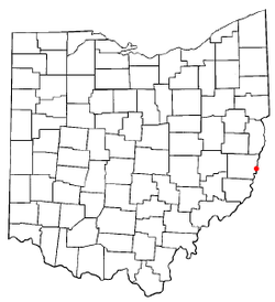 Location of Shadyside, Ohio | |
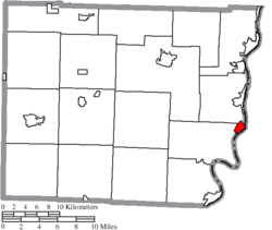 Location of Shadyside in Belmont County | |
| Coordinates: 39°58′17″N 80°45′3″W / 39.97139°N 80.75083°WCoordinates: 39°58′17″N 80°45′3″W / 39.97139°N 80.75083°W | |
| Country | United States |
| State | Ohio |
| County | Belmont |
| Area[1] | |
| • Total | 1.03 sq mi (2.67 km2) |
| • Land | 1.01 sq mi (2.62 km2) |
| • Water | 0.02 sq mi (0.05 km2) |
| Elevation[2] | 689 ft (210 m) |
| Population (2010)[3] | |
| • Total | 3,785 |
| • Estimate (2012[4]) | 3,736 |
| • Density | 3,747.5/sq mi (1,446.9/km2) |
| Time zone | Eastern (EST) (UTC-5) |
| • Summer (DST) | EDT (UTC-4) |
| ZIP code | 43947 |
| Area code(s) | 740 |
| FIPS code | 39-71640[5] |
| GNIS feature ID | 1065307[2] |

Shadyside is a village in Belmont County, Ohio, United States, along the Ohio River. It is part of the Wheeling, West Virginia Metropolitan Statistical Area. The population was 3,785 at the 2010 census.
History
Shadyside had its start in 1879 when the railroad was extended to that point.[6] The town site was platted in 1901.[7] The village was named after a local tree-lined farm.[8]
On the evening of June 14, 1990, three inches (76 mm) of rain fell in less than two hours, creating a flash flood in the Shadyside area which caused twenty-six fatalities and destroyed or damaged many buildings. Flooding occurred along Pipe Creek, Wegee Creek, and Cumberland Run. Witnesses reported seeing a "wall of water" ten to thirty feet high moving downstream.[9]
Geography
Shadyside is located at 39°58′17″N 80°45′3″W / 39.97139°N 80.75083°W (39.971385, -80.750752).[10]
According to the United States Census Bureau, the village has a total area of 1.03 square miles (2.67 km2), of which 1.01 square miles (2.62 km2) is land and 0.02 square miles (0.05 km2) is water.[1]
Demographics
| Historical population | |||
|---|---|---|---|
| Census | Pop. | %± | |
| 1920 | 3,084 | — | |
| 1930 | 4,098 | 32.9% | |
| 1940 | 4,048 | −1.2% | |
| 1950 | 4,433 | 9.5% | |
| 1960 | 5,028 | 13.4% | |
| 1970 | 5,070 | 0.8% | |
| 1980 | 4,315 | −14.9% | |
| 1990 | 3,934 | −8.8% | |
| 2000 | 3,675 | −6.6% | |
| 2010 | 3,785 | 3.0% | |
| Est. 2015 | 3,714 | [11] | −1.9% |
2010 census
As of the census[3] of 2010, there were 3,785 people, 1,717 households, and 1,045 families residing in the village. The population density was 3,747.5 inhabitants per square mile (1,446.9/km2). There were 1,863 housing units at an average density of 1,844.6 per square mile (712.2/km2). The racial makeup of the village was 99.0% White, 0.2% African American, 0.1% Native American, 0.2% Asian, and 0.5% from two or more races. Hispanic or Latino of any race were 0.5% of the population.
There were 1,717 households of which 24.1% had children under the age of 18 living with them, 45.2% were married couples living together, 11.5% had a female householder with no husband present, 4.1% had a male householder with no wife present, and 39.1% were non-families. 34.2% of all households were made up of individuals and 18.5% had someone living alone who was 65 years of age or older. The average household size was 2.15 and the average family size was 2.75.
The median age in the village was 47.9 years. 17.5% of residents were under the age of 18; 7.3% were between the ages of 18 and 24; 21.5% were from 25 to 44; 30.2% were from 45 to 64; and 23.5% were 65 years of age or older. The gender makeup of the village was 45.9% male and 54.1% female.
2000 census
As of the census[5] of 2000, there were 3,675 people, 1,721 households, and 1,044 families residing in the village. The population density was 3,844.6 people per square mile (1,478.0/km²). There were 1,856 housing units at an average density of 1,941.6 per square mile (746.5/km²). The racial makeup of the village was 99.24% White, 0.11% African American, 0.08% Native American, 0.05% Asian, 0.05% from other races, and 0.46% from two or more races. Hispanic or Latino of any race were 0.22% of the population.
There were 1,721 households out of which 23.3% had children under the age of 18 living with them, 49.3% were married couples living together, 9.1% had a female householder with no husband present, and 39.3% were non-families. 36.7% of all households were made up of individuals and 23.3% had someone living alone who was 65 years of age or older. The average household size was 2.14 and the average family size was 2.79.
In the village the population was spread out with 19.6% under the age of 18, 5.3% from 18 to 24, 24.5% from 25 to 44, 24.2% from 45 to 64, and 26.3% who were 65 years of age or older. The median age was 45 years. For every 100 females there were 86.3 males. For every 100 females age 18 and over, there were 80.8 males.
The median income for a household in the village was $28,989, and the median income for a family was $39,364. Males had a median income of $35,703 versus $18,973 for females. The per capita income for the village was $16,636. About 5.9% of families and 9.2% of the population were below the poverty line, including 6.6% of those under age 18 and 9.0% of those age 65 or over.
Education
Shadyside is home to three schools: Shadyside High School, Leona Avenue Middle School and Jefferson Elementary School. There are 853 students and 43 teachers. The student to teacher ratio is 19.9:1. The school system is 99.9% white and has a 51% (female) to 48% (male) ratio for gender.[13] The high school is located at 3890 Lincoln Avenue, Shadyside, Ohio 43947. The middle school is located at 3795 Leona Avenue, Shadyside, Ohio 43947. The elementary school is located at 4895 Jefferson Avenue, Shadyside, Ohio 43947.[14]
The school system has a strong alumni association. It provides services to the community along with scholarships, a fund to help develop academic programs within the school and reunions. As of December 31, 2001, there were 699 members in the association.[15]
Notable person
See also
References
- 1 2 "US Gazetteer files 2010". United States Census Bureau. Retrieved 2013-01-06.
- 1 2 "US Board on Geographic Names". United States Geological Survey. 2007-10-25. Retrieved 2008-01-31.
- 1 2 "American FactFinder". United States Census Bureau. Retrieved 2013-01-06.
- ↑ "Population Estimates". United States Census Bureau. Retrieved 2013-06-17.
- 1 2 "American FactFinder". United States Census Bureau. Retrieved 2008-01-31.
- ↑ Overman, William Daniel (1958). Ohio Town Names. Akron, OH: Atlantic Press. p. 125.
- ↑ Mangus, Michael; Herman, Jennifer L. (2008). Ohio Encyclopedia. North American Book Dist LLC. p. 530. ISBN 978-1-878592-68-2.
- ↑ "Profile for Shadyside, OH". ePodunk. Retrieved 11 August 2014.
- ↑ "Shadyside Ohio Flooding, June 14, 1990", National Weather Service Wilmington, Ohio office
- ↑ "US Gazetteer files: 2010, 2000, and 1990". United States Census Bureau. 2011-02-12. Retrieved 2011-04-23.
- ↑ "Annual Estimates of the Resident Population for Incorporated Places: April 1, 2010 to July 1, 2015". Retrieved July 2, 2016.
- ↑ "Census of Population and Housing". Census.gov. Retrieved June 4, 2015.
- ↑ http://www.localschooldirectory.com/city-schools/Shadyside/OH
- ↑ http://www.shadyside.k12.oh.us/
- ↑ http://shadysidealumni.org/new_site/default.asp
External links
Municipalities and communities of Belmont County, Ohio, United States | ||
|---|---|---|
| Cities | 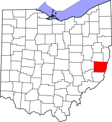 | |
| Villages | ||
| Townships | ||
| CDPs | ||
| Unincorporated communities |
| |
| Ghost town | ||
| Footnotes | ‡This populated place also has portions in an adjacent county or counties | |