Shōnandai Station
Shōnandai Station 湘南台駅 | |
|---|---|
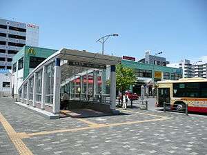 East side of the station, May 2012 | |
| Location |
2-15 Shōnandai, Fujisawa, Kanagawa (神奈川県 藤沢市湘南台2-15) Japan |
| Operated by | |
| Line(s) | |
| Connections |
|
| History | |
| Opened | 1966 |

Shōnandai Station (湘南台駅 Shōnandai-eki) is a railway station in Fujisawa, Kanagawa, Japan, jointly operated by Odakyu Electric Railway, Sagami Railway (Sōtetsu), and Yokohama City Transportation Bureau (subway service). It is 15.8 kilometers from the terminus of the Odakyū Enoshima Line at Sagami-Ōno Station and is a terminal station for both the Sagami Railway Izumino Line and the Yokohama Subway Blue Line.
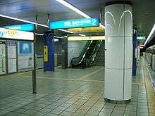
The ticket wickets of the three lines converge on one wide underground concourse.
Lines
- Odakyu Electric Railway
- Odakyū Enoshima Line - Rapid Express and Express trains stop at this station.
- Sagami Railway
- Yokohama Municipal Subway
- Blue Line (B01)
Station layout
The Odakyu Enoshima Line has two elevated opposed side platforms, connected to the station building by an underpass. The Sōtetsu and Yokohama Municipal Subway stations are both underground, and both have a single island platform.
Odakyu platforms
| 1 | ■ Enoshima Line | Fujisawa, Katase-Enoshima |
| 2 | ■ Enoshima Line | Yamato, Sagami-Ōno, Machida, and Shinjuku |
Sōtetsu platforms
| 1, 2 | ■ Izumino Line | Futamatagawa, (Main Line) Yokohama |
Yokohama Municipal Subway platforms
| 1, 2 | ■ Blue Line | Totsuka, Kami-Ōoka, Yokohama, Shin-Yokohama, and Azamino |
Adjacent stations
| ← | Service | → | ||
|---|---|---|---|---|
| Odakyū Enoshima Line | ||||
| Yamato | Rapid Express | Fujisawa | ||
| Chōgo | Express | Fujisawa | ||
| Chōgo | Local | Mutsuai-Nichidaimae | ||
| Sagami Railway Izumino Line | ||||
| Izumino | Limited Express | Terminus | ||
| Yumegaoka | Rapid | Terminus | ||
| Yumegaoka | Local | Terminus | ||
| Yokohama Municipal Subway Blue Line (B01) | ||||
| Terminus | Rapid | Shimoiida (B02) | ||
| Terminus | Local | Shimoiida (B02) | ||
History
Shōnandai Station was opened on November 7, 1966 as a station on the Odakyū Enoshima Line. The station was greatly expanded in 1999 with the addition of the Sagami Railway Izumino Line on March 10, and the Yokohama Subway Blue Line on August 29.
Surrounding area
Public facilities
- Shonandai culture centre
- Akibadai cultural gymnasium
- Shonandai park
- Engyo park
- Fujisawa North police station
- Fujisawa North fire station
References
- Harris, Ken and Clarke, Jackie. Jane's World Railways 2008-2009. Jane's Information Group (2008). ISBN 0-7106-2861-7
External links
| Wikimedia Commons has media related to Shōnandai Station. |
- Shōnandai Station information (Odakyu) (Japanese)
- Shōnandai Station information (Sōtetsu) (Japanese)
- Shōnandai Station information (Yokohama Subway) (Japanese)
Coordinates: 35°23′46″N 139°28′00″E / 35.396185°N 139.466589°E