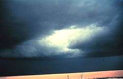
Severe thunderstorm warning
A severe thunderstorm warning (SAME code: SVR) is an alert issued when trained storm spotters or a Doppler weather radar indicate that a thunderstorm is producing or will soon produce dangerously large hail or high winds, capable of causing significant damage.[1] In the United States, severe thunderstorm warnings do not account for lightning, a significant hazard in any thunderstorm, or flooding caused by a thunderstorm's extreme rainfall (a flood advisory or Flash Flood Warning is issued in these cases).[1] A similar warning is issued by Environment Canada's Meteorological Service of Canada from their offices in Vancouver, Edmonton, Toronto, Montreal and Dartmouth.[2] Skywarn issues the severe thunderstorm warnings for the United Kingdom. Also, just as in the United States, lightning does not warrant a severe thunderstorm warning.[3]
Definition
In the United States, the National Weather Service (NWS) defines a severe thunderstorm as having large hail of at least 1 inch (2.5 cm), surface wind speeds of 58 miles per hour (93 km/h) or greater, or both.[4] Prior to January 2010, the hail size for which a thunderstorm would be considered severe was 0.75 inches (1.9 cm); public complacency due to overly frequent issuances of severe thunderstorm warnings and recent studies stating that hail did not produce significant damage on the ground until it reached one inch in diameter caused the upgrade in hail criteria.[5]
In Canada, a severe thunderstorm is defined as having wind gusts of greater than 90 kilometres per hour (56 mph), hail with a diameter of greater than 20 millimetres (0.79 in), rainfall of greater than 50 millimetres (2.0 in) in an hour or greater than 75 millimetres (3.0 in) in three hours, or tornadoes.[2]
A severe thunderstorm warning indicates that the warned area is in impending danger. Occasionally, severe thunderstorms can and do produce tornadoes without warning.[6] While not all severe thunderstorms produce tornadoes, they can produce serious straight line wind damage as severe as a tornado, which can actually cover a much wider area than a tornado usually does.[7] If a tornado is detected on radar or is sighted visually, a tornado warning will be issued either in replacement of or concurrently to the existing severe thunderstorm warning.[8] Generally, but not always, a severe thunderstorm watch or tornado watch will precede a warning.
If a tornado warning is issued, based on Doppler weather radar, it means that strong rotation has been detected within a thunderstorm. Usually, if a thunderstorm is producing only weak rotation, it will only yield hazardous weather warranting a severe thunderstorm warning. However, the public will usually be advised that this type of rotation has been detected and that the storm in question should be watched closely in the near future for further intensification. In the United States, local NWS forecast offices, particularly those in the Great Plains or Southeastern U.S., sometimes include the wording "Severe thunderstorms can produce tornadoes with no advance warning..." or a similar reference in their severe thunderstorm warnings, usually when there is a tornado threat or especially when a tornado watch is in effect.
Some storms, especially in the Great Plains, may produce massive hailstones the size of baseballs (2.75 inches (7.0 cm)) or larger which may fall fast enough to potentially kill a person by repeated blunt trauma.
Weather Forecast Offices (WFO) of the National Weather Service issue warnings for tornadoes and severe thunderstorms in polygon shapes, based on the projected path of a storm at the time of the warning's issuance as estimated by Doppler radar. Warnings were issued on a per-county basis before October 2007,[9] and they are now usually delineated on maps in polygon shapes and in text by a sections of counties, although entire counties are sometimes included, especially if they are small. Storm Prediction Center and other NWS products, as well as severe weather alert displays used by some U.S. television stations, highlight severe thunderstorm warnings with a yellow or orange polygon or filled county/parish outlines. Depending on the severity of the storm, some NWS offices may also request activation of the Emergency Alert System at their discretion.
Criteria in various countries
| Country | Tornado | Minimum hail size | Minimum wind speed | Minimum rainfall rate per hour | Source |
|---|---|---|---|---|---|
| United States | See Tornado Warning | 1 inch (25 mm) | 58 miles per hour (93 km/h) | See Flash Flood Warning | [1] |
| Canada | See Tornado warning | 20 millimetres (0.79 in) | 90 kilometres per hour (56 mph) | 50 millimetres (2.0 in) | [2] |
| Australia | All | 20 millimetres (0.79 in) | 90 kilometres per hour (56 mph) | "Conducive to flash flooding" | [10] |
| New Zealand | F1 or stronger | 20 millimetres (0.79 in) | 110 kilometres per hour (68 mph) | 25 millimetres (0.98 in) | [11] |
| Germany | All | 15 millimetres (0.59 in) | 105 kilometres per hour (65 mph) | 20 millimetres (0.79 in) | [12] |
| Mexico | All | 5 millimetres (0.20 in) | 89 kilometres per hour (55 mph) | 20 millimetres (0.79 in) | [13][14][15] |
| United Kingdom | All | 20 millimetres (0.79 in) | 55 miles per hour (89 km/h) | "Conducive to flash flooding" | [3] |
Examples of Severe Thunderstorm Warnings
 |
Severe thunderstorm warning Minnesota
 An example of a severe thunderstorm warning, this one being issued in Minnesota |
| Problems playing this file? See media help. | |
|
Severe thunderstorm warning from Columbia, SC
An example of a severe thunderstorm warning, this one being issued in South Carolina. |
| Problems playing this file? See media help. | |
Examples of Severe Thunderstorm Warnings issued by the National Weather Service in the United States:[16]
WUUS54 KJAN 092210
SVRJAN
MSC079-089-121-123-092315-
/O.NEW.KJAN.SV.W.0216.140609T2210Z-140609T2315Z/

BULLETIN - EAS ACTIVATION REQUESTED
SEVERE THUNDERSTORM WARNING
NATIONAL WEATHER SERVICE JACKSON MS
510 PM CDT MON JUN 9 2014

THE NATIONAL WEATHER SERVICE IN JACKSON HAS ISSUED A

* SEVERE THUNDERSTORM WARNING FOR...
  LEAKE COUNTY IN CENTRAL MISSISSIPPI...
  EAST CENTRAL MADISON COUNTY IN CENTRAL MISSISSIPPI...
  NORTHEASTERN RANKIN COUNTY IN CENTRAL MISSISSIPPI...
  NORTHWESTERN SCOTT COUNTY IN CENTRAL MISSISSIPPI...

* UNTIL 615 PM CDT

* AT 510 PM CDT...A SEVERE THUNDERSTORM WAS LOCATED NEAR PISGAH...AND
  MOVING NORTHEAST AT 35 MPH.

  HAZARD...60 MPH WIND GUSTS AND QUARTER SIZE HAIL.

  SOURCE...RADAR INDICATED.

  IMPACT...HAIL DAMAGE TO VEHICLES IS EXPECTED. EXPECT WIND DAMAGE TO
  ROOFS...SIDING AND TREES.

* THE SEVERE THUNDERSTORM WILL BE NEAR...
  LEESBURG AND PISGAH AROUND 515 PM CDT.
  LUDLOW AROUND 530 PM CDT.
  FARMHAVEN AROUND 535 PM CDT.
  CARTHAGE AROUND 600 PM CDT.
  THOMASTOWN AROUND 605 PM CDT.

OTHER LOCATIONS IN THE WARNING INCLUDE REDWATER.

PRECAUTIONARY/PREPAREDNESS ACTIONS...

FOR YOUR PROTECTION MOVE TO AN INTERIOR ROOM ON THE LOWEST FLOOR OF A
BUILDING.

&&

LAT...LON 3290 8972 3278 8939 3231 8981 3238 8993
TIME...MOT...LOC 2210Z 208DEG 30KT 3243 8983

HAIL...1.00IN
WIND...60MPH

$$

DL
SEVERE THUNDERSTORM WARNING
NEC037-039-119-141-167-302230-
/O.NEW.KOAX.SV.W.0024.120330T2144Z-120330T2230Z/

BULLETIN - IMMEDIATE BROADCAST REQUESTED
SEVERE THUNDERSTORM WARNING
NATIONAL WEATHER SERVICE OMAHA/VALLEY NEBRASKA
444 PM CDT FRI MAR 30 2012

THE NATIONAL WEATHER SERVICE IN OMAHA HAS ISSUED A

* SEVERE THUNDERSTORM WARNING FOR...
  COLFAX COUNTY IN EAST CENTRAL NEBRASKA...
  EXTREME SOUTHWESTERN CUMING COUNTY IN EASTERN NEBRASKA...
  EXTREME SOUTHEASTERN MADISON COUNTY IN EASTERN NEBRASKA...
  NORTHEASTERN PLATTE COUNTY IN EAST CENTRAL NEBRASKA...
  EXTREME SOUTHWESTERN STANTON COUNTY IN EASTERN NEBRASKA...

* UNTIL 530 PM CDT

* AT 441 PM CDT...TRAINED WEATHER SPOTTERS REPORTED A SEVERE
  THUNDERSTORM PRODUCING QUARTER SIZE HAIL. THIS STORM WAS LOCATED
  NEAR CRESTON...OR 19 MILES NORTH OF COLUMBUS...AND MOVING EAST AT
  30 MPH.

* LOCATIONS IMPACTED INCLUDE...
  CLARKSON...HOWELLS...LEIGH...CRESTON AND HUMPHREY.

PRECAUTIONARY/PREPAREDNESS ACTIONS...

SEVERE THUNDERSTORMS PRODUCE DAMAGING WINDS IN EXCESS OF 60 MPH...
DESTRUCTIVE HAIL...DEADLY LIGHTNING AND VERY HEAVY RAIN. FOR YOUR
PROTECTION...MOVE TO AN INTERIOR ROOM ON THE LOWEST FLOOR OF YOUR
HOME OR BUSINESS. HEAVY RAINS FLOOD ROADS QUICKLY SO DO NOT DRIVE
INTO AREAS WHERE WATER COVERS THE ROAD.

&&

LAT...LON 4179 9748 4173 9691 4145 9702 4163 9753
TIME...MOT...LOC 2141Z 285DEG 24KT 4171 9743
WIND...HAIL <50MPH 1.00IN

$$

KERN
See also
- Convective storm detection
- Severe thunderstorm watch
- Severe weather
- Severe weather terminology (United States)
- SKYWARN
- Supercell
References
- 1 2 3 "Severe Thunderstorm Warning". NOAA National Weather Service Glossary. Retrieved 2010-01-10.
- 1 2 3 Environment Canada. "Severe Thunderstorm Warning". Prairie and Northern Region Weather Watch and Weather Warning Criteria. Retrieved 2010-01-10.
- 1 2 "SkyWarn UK Warning criteria". SkyWarn UK. Retrieved 21 December 2011.
- ↑ "one inch hail severe thunderstorm warning criteria". Crh.noaa.gov. Retrieved 2012-11-02.
- ↑ McClure, Mike (2009-05-26). "New One Inch Hail Criteria for Severe Thunderstorm Warnings". Weather Home Companion. National Weather Service Quad Cities, IA/IL. Archived from the original (PDF) on December 15, 2010. Retrieved 2010-12-15.
- ↑ Howerton, Paul (2008-06-12). "Severe Thunderstorm Warning". Iowa Environmental Mesonet NWS Product Archive. Retrieved 2010-01-10.
- ↑ "Severe Thunderstorm". NOAA National Weather Service Glossary. Retrieved 2010-01-10.
- ↑ Howerton, Paul (2008-06-12). "Severe Thunderstorm Warning". Iowa Environmental Mesonet NWS Product Archive. Retrieved 2010-01-10.
- ↑ NOAA Warning Decision Training Branch (2008-02-26). "Why Storm-Based Warnings?". Storm-Based Warnings. Retrieved 2010-01-11.
- ↑ Bureau of Meteorology (October 2004). "Bureau of Meteorology: Severe Weather Warning Education". Severe Weather Warning Education. Retrieved 2010-02-06.
- ↑ Meteorological Service of New Zealand Ltd. "Severe Thunderstorm Warnings and other NZ Weather Warnings from MetService.com". Severe Thunderstorm Criteria. Retrieved 2010-02-06.
- ↑ Deutscher Wetterdienst. "Wetter und Klima - Deutscher Wetterdienst -- Warnungen". Unwetterkriterien (in German). Retrieved 2010-02-06.
- ↑ Servicio Meteorológico Nacional (2010-01-30). "Granizo". Servicio Meteorologico Nacional - Mexico - Glosario G (in Spanish). Retrieved 2010-02-06.
- ↑ Servicio Meteorológico Nacional (2010-02-05). "Escalas empleadas" (in Spanish). Retrieved 2010-02-06.
- ↑ Servicio Meteorológico Nacional (2010-02-05). "Aviso de Tormentas Intensas y Granizo" (in Spanish). Retrieved 2010-02-06.
- ↑ McGuire, Mick (2011-06-02). "NWS Wichita 2011 Severe Thunderstorm Warning #171". National Weather Service Wichita, KS. Retrieved 2012-02-03.
External links
- Bureau of Meteorology: Severe Thunderstorm Warnings
- Meteorological Service of Canada
- United States National Weather Service