Selçuklu
| Selçuklu | |
|---|---|
| District | |
|
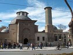
Ince Minaret, Selçuklu, Konya | |
 Location of Selçuklu within Konya Province | |
 Selçuklu Location in Turkey | |
| Coordinates: 37°55′40″N 32°28′40″E / 37.92778°N 32.47778°E | |
| Country |
|
| Province | Konya |
| Government | |
| • Mayor | Uğur İbrahim Altay (AKP) |
| Area[1] | |
| • District | 1,836.31 km2 (709.00 sq mi) |
| Elevation | 1,016 m (3,333 ft) |
| Population (2012)[2] | |
| • Urban | 540,119 |
| • District | 552,110 |
| • District density | 300/km2 (780/sq mi) |
| Time zone | EET (UTC+2) |
| • Summer (DST) | EEST (UTC+3) |
| Postal code | 42xxx |
| Area code(s) | 0332 |
| Licence plate | 42 |
| Website | www.selcuklu.bel.tr |
Selçuklu is a town and district of Konya Province in the Central Anatolia region of Turkey. Selçuklu is one of the central districts of Konya along with the districts of Karatay and Meram. According to 2000 census, population of the district is 348,329 of which 327,627 live in the urban center of Selçuklu.[3]
Notes
- ↑ "Area of regions (including lakes), km²". Regional Statistics Database. Turkish Statistical Institute. 2002. Retrieved 2013-03-05.
- ↑ "Population of province/district centers and towns/villages by districts - 2012". Address Based Population Registration System (ABPRS) Database. Turkish Statistical Institute. Retrieved 2013-02-27.
- ↑ Turkish Statistical Institute. "Census 2000, Key statistics for urban areas of Turkey" (in Turkish). Archived from the original (XLS) on 2007-07-22. Retrieved 2008-03-25.
References
- Falling Rain Genomics, Inc. "Geographical information on Konya, Turkey". Archived from the original on 2012-10-25. Retrieved 2008-03-25.
- Turkish Ministry of Education. "Statistical information on Selçuklu, Turkey" (in Turkish). Archived from the original on 2011-10-03. Retrieved 2008-03-25.
External links
- District governor's official website (Turkish)
- District municipality's official website (Turkish)
Coordinates: 37°52′53″N 32°29′32″E / 37.88139°N 32.49222°E
This article is issued from Wikipedia - version of the 9/7/2016. The text is available under the Creative Commons Attribution/Share Alike but additional terms may apply for the media files.