Sault-au-Cochon, Quebec
| Sault-au-Cochon | |
|---|---|
| Unorganized territory | |
 Location within La Côte-de-Beaupré RCM. | |
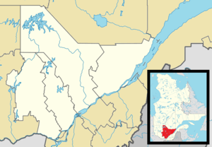 Sault-au-Cochon Location in central Quebec. | |
| Coordinates: 47°12′N 70°38′W / 47.200°N 70.633°WCoordinates: 47°12′N 70°38′W / 47.200°N 70.633°W[1] | |
| Country |
|
| Province |
|
| Region | Capitale-Nationale |
| RCM | La Côte-de-Beaupré |
| Constituted | unspecified |
| Government[2] | |
| • Federal riding |
Montmorency—Charlevoix —Haute-Côte-Nord |
| • Prov. riding | Charlevoix–Côte-de-Beaupré |
| Area[2][3] | |
| • Total | 70.30 km2 (27.14 sq mi) |
| • Land | 70.40 km2 (27.18 sq mi) |
|
There is an apparent contradiction between two authoritative sources | |
| Population (2011)[3] | |
| • Total | 0 |
| • Density | 0.0/km2 (0/sq mi) |
| • Pop 2006-2011 |
|
| • Dwellings | 0 |
| Time zone | EST (UTC−5) |
| • Summer (DST) | EDT (UTC−4) |
| Highways | No major routes |
Sault-au-Cochon is an unorganized territory in the Capitale-Nationale region of Quebec, Canada, in the La Côte-de-Beaupré Regional County Municipality. It is an unpopulated and undeveloped stretch of shoreline along the Saint Lawrence River that encompasses the promontory from Cape Tourmente to Petite-Rivière-Saint-François.
History
The Charlevoix Railway passes through the territory right along the Saint Lawrence River. The territory is named after a former rail stop on this line located about halfway between Cape Tourmente and Baie-Saint-Paul, or about 80 kilometers (50 mi) north-east of Quebec City (47°12′01″N 70°38′25″W / 47.20028°N 70.64028°W). The stop is situated the mouth of a small stream that rushes down the steep slope of the promontory. In 1676 it was reported that the stream used to be called Gouffre ("Chasm") River but had been given the name Sault au Cochon since. This name comes from the presence of Porpoise and Beluga whale in the Saint Lawrence River that were formerly called cochons de mer ("sea pigs") in French. The name "Saut au Cochon" was used by Jean Deshayes on his map of 1695, and it was thereafter also applied to the surrounding interior lands that were not part of the seigneurial domain of the Quebec Seminary.[4]
The territory has been used for logging and it was home to a sawmill in the 1930s. A small section of old-growth forest remains, some 15 kilometers (9.3 mi) north-east of Sainte-Anne-de-Beaupré (47°07′51″N 70°43′07″W / 47.13083°N 70.71861°W). It covers 62 hectares and is characterized by Yellow birch and Sugar maple, some of which are up to 320 years old and have a diameter of 90 centimeters (35 in).[5][6]
Canadian Pacific Air Lines Flight 108
On September 9, 1949, a Canadian Pacific Air Lines DC-3, en route from L'Ancienne-Lorette to Baie-Comeau, exploded and crashed at Sault-au-Cochon, killing 23 persons (19 passengers and 4 crew members). It was the result of a homemade bomb made by Genereux Ruest, a watchmaker in Quebec who had placed it on board with the help of his sister Marguerite Ruest Pitre. The plot was hatched by Albert Guay, a jeweler in Quebec who wanted to get rid of his wife Rita Morel, one of the passengers, and cash-in an insurance policy worth ten thousand dollars. All three were found guilty and hanged in the early 1950s.[6]
Demographics
Population trend:[7]
- Population in 2011: 0
- Population in 2006: 0
- Population in 2001: 0
- Population in 1996: 0
- Population in 1991: 0
See also
References
- ↑ Reference number 149591 of the Commission de toponymie du Québec (French)
- 1 2 Ministère des Affaires municipales, des Régions et de l'Occupation du territoire - Répertoire des municipalités: Sault-au-Cochon
- 1 2 Statistics Canada 2011 Census - Sault-au-Cochon census profile
- ↑ "Sault-au-Cochon (lieu-dit)" (in French). Commission de toponymie du Québec. Retrieved 2009-04-30.
- ↑ "Forêt ancienne de Sault-au-Cochon" (in French). Commission de toponymie du Québec. Retrieved 2009-04-30.
- 1 2 "Forêt de Sault-au-Cochon" (in French). GrandQuebec.com. Retrieved 2009-04-30.
- ↑ Statistics Canada: 1996, 2001, 2006, 2011 census
 |
Saint-Tite-des-Caps | Petite-Rivière-Saint-François | | |
| |
||||
| ||||
| | ||||
| Saint-Joachim | Saint Lawrence River / Montmagny | Saint Lawrence River / St-Antoine-de-l'Isle-aux-Grues |
| Cities & towns | |
|---|---|
| Municipalities | |
| Parishes | |
| Unorganized territories | |
| |