Satevó Municipality
| Satevó | |
|---|---|
| Municipality | |
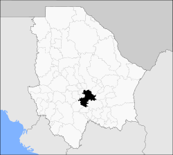 Municipality of Satevó in Chihuahua | |
|
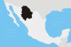
Satevó Location in Mexico | |
| Coordinates: 27°57′15″N 106°6′23″W / 27.95417°N 106.10639°WCoordinates: 27°57′15″N 106°6′23″W / 27.95417°N 106.10639°W | |
| Country |
|
| State | Chihuahua |
| Municipal seat | San Francisco Javier de Satevó |
| Area | |
| • Total | 2,185.1 km2 (843.7 sq mi) |
| Elevation | 1,380 m (4,530 ft) |
| Population (2010) | |
| • Total | 3,662 |
| • Density | 1.7/km2 (4.3/sq mi) |
| Website | www.satevo.gob.mx |
Satevó is one of the 67 municipalities of Chihuahua, in northern Mexico. The municipal seat lies at San Francisco Javier de Satevó. The municipality covers an area of 2,185.1 km².
As of 2010, the municipality had a total population of 3,662,[1] down from 3,856 as of 2005.[2]
The municipality had 244 localities, none of which had a population over 1,000.[1]
Satevó began as a Jesuit mission to the Tarahumara in about 1640.[3]
Geography
Towns and villages
The municipality has 126 localities. The largest are:
| Name | Population (2005) |
|---|---|
| San Francisco Javier de Satevó | 451 |
| El Chamizal | 244 |
| La Joya | 237 |
| San José del Sitio | 214 |
| Babonoyaba | 155 |
| Los Veranos | |
| Total Municipality | 3,856 |
References
- 1 2 "Satevó". Catálogo de Localidades. Secretaría de Desarrollo Social (SEDESOL). Retrieved 23 April 2014.
- ↑ "Satevó". Enciclopedia de los Municipios de México. Instituto Nacional para el Federalismo y el Desarrollo Municipal. Retrieved October 25, 2008.
- ↑ Edward C. Spicer, Cycles of COnquest (Tucson: University of Arizona Press, 1962) p. 29
This article is issued from Wikipedia - version of the 4/16/2016. The text is available under the Creative Commons Attribution/Share Alike but additional terms may apply for the media files.