Santa Maria, Cape Verde
| Santa Maria | |
|---|---|
| Settlement | |
|
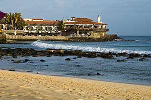
Typical street in Santa Maria | |
 Santa Maria | |
| Coordinates: 16°35′56″N 22°54′14″W / 16.599°N 22.904°WCoordinates: 16°35′56″N 22°54′14″W / 16.599°N 22.904°W | |
| Country | Cape Verde |
| Island | Sal |
| Municipality | Sal |
| Civil parish | Nossa Senhora das Dores |
| Population (2010)[1] | |
| • Total | 6,258 |

Santa Maria (Portuguese for Saint Mary) is a fishing town situated in the southern part of the island municipality of Sal, Cape Verde. Santa Maria is located about 16 km south of the Amílcar Cabral International Airport, and km south of the island capital Espargos.
Around its shores, sharks and sea turtles are found.
History
Santa Maria was founded in 1835 for the production of sea salt, in its early years, 30,000 tons of salt were shipped from Santa Maria. Most of the product was exported to Brazil, which was halted in 1887 when Brazil imposed a high tax on imported salt to protect its own salt production. The town went into a deep decline, only to recover in 1920 when Portuguese and French investors resumed salt production. In 1927, salt started to be exported to the Belgian Congo which remained until the nation became independent as Congo-Kinshasa in 1961 and nationalized its salt production, today the nation is called the Democratic Republic of the Congo. Salt production started to fell and further production lasted until 1984. More recently, tourism has become an important industry on the island which started to grow in 2004 and stretches up to about 4 km along the west shore. Many resorts and hotels, including the Riu hotels resorts Riu Garopa and Riu Funana, are situated near Santa Maria, even restaurants opened. The Senegalese forms a small majority, foreigners spend their vacation at the villas during the peak months. Additional hotels and villas recently slowed in 2014 and planned streets and buildings remains in the northern part., a small part the economic crisis in most of southern Europe lowered touristic visits
Climate
| Climate data for Santa Maria | |||||||||||||
|---|---|---|---|---|---|---|---|---|---|---|---|---|---|
| Month | Jan | Feb | Mar | Apr | May | Jun | Jul | Aug | Sep | Oct | Nov | Dec | Year |
| Average high °C (°F) | 22 (71) |
21 (69) |
23 (73) |
23 (74) |
25 (77) |
26 (79) |
27 (81) |
28 (83) |
29 (85) |
28 (83) |
26 (79) |
24 (76) |
23 (73) |
| Average low °C (°F) | 16 (61) |
15 (59) |
17 (62) |
18 (64) |
19 (67) |
22 (72) |
23 (74) |
23 (74) |
24 (76) |
22 (72) |
19 (67) |
18 (64) |
16 (60) |
| Average precipitation mm (inches) | 8 (0.3) |
5 (0.2) |
0 (0) |
0 (0) |
0 (0) |
0 (0) |
28 (1.1) |
61 (2.4) |
137 (5.4) |
25 (1.0) |
5 (0.2) |
8 (0.3) |
386 (15.2) |
| Source: Weatherbase[2] | |||||||||||||
Historical population
| Year | Population |
|---|---|
| 1990 (Census) | 1,343 |
| 2000 (Census) | about 2,500 |
| 2010 (Census)[3] | 6,258 |
Sports
Its football (soccer) club includes the island's oldest, SC Santa Maria and GD Palmeira, since the early 2010s, all plays in the honomymous municipal stadium located northwest of the island.
References
- ↑ "2010 Census results". Instituto Nacional de Estatística Cabo Verde (in Portuguese). 17 March 2014.
- ↑ "Weatherbase: Historical Weather for Santa Maria, Cape Verde". Weatherbase. 2011. Retrieved on November 24, 2011.
- ↑ "2010 Census results Sal". Instituto Nacional de Estatística Cabo Verde (in Portuguese). 19 March 2014.
External links
- Santa Maria Photos from Santa Maria
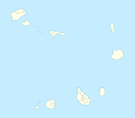
The island of Sal, Cape Verde | ||
|---|---|---|
| Settlements |  | |
| Parishes | ||
| Points and promontories | ||
| Lighthouses |
| |
| Other geographical features | ||
| Wikimedia Commons has media related to Santa Maria, Cape Verde. |