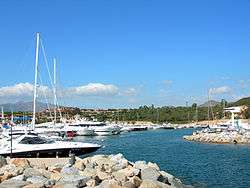
San Teodoro, Sardinia
| San Teodoro | |
|---|---|
| Comune | |
| Comune di San Teodoro | |
 | |
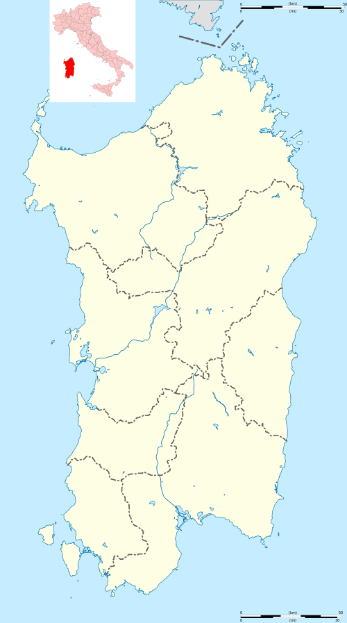 San Teodoro Location of San Teodoro in Sardinia | |
| Coordinates: 40°46′N 9°40′E / 40.767°N 9.667°ECoordinates: 40°46′N 9°40′E / 40.767°N 9.667°E | |
| Country | Italy |
| Region | Sardinia |
| Province / Metropolitan city | Sassari (SS) |
| Frazioni | Suareddha, Monte Pedrosu, Straulas, Buddhitogliu, La Traversa, Lu Fraili, Sitagliacciu |
| Area | |
| • Total | 104.8 km2 (40.5 sq mi) |
| Population (Dec. 2004) | |
| • Total | 3,565 |
| • Density | 34/km2 (88/sq mi) |
| Demonym(s) | Teodorini |
| Time zone | CET (UTC+1) |
| • Summer (DST) | CEST (UTC+2) |
| Postal code | 08020 |
| Dialing code | 0784 |
| Website | Official website |

San Teodoro (Gallurese: Santu Diadòru, Sardinian: Santu Tiadòru) is a comune (municipality) in the Province of Sassari in the Italian region Sardinia, located about 180 kilometres (110 mi) northeast of Cagliari and about 20 kilometres (12 mi) southeast of Olbia. As of 31 December 2004, it had a population of 3,565 and an area of 104.8 square kilometres (40.5 sq mi).[1]
The municipality of San Teodoro contains the frazioni (subdivisions, mainly villages and hamlets) Suareddha, Monte Pedrosu, Straulas, Buddhitogliu, La Traversa, Lu Fraili, and Sitagliacciu.
San Teodoro borders the following municipalities: Budoni, Loiri Porto San Paolo, Padru, Torpè.
The beach of "La Cinta" will be the home of the kite boarding festival from September 17–19, 2010.
There is a Mexican Cigar called "San Teodoro" produced by the Lavin & Carranza Cigar Co. This cigar is baptized under the San Teodoro Italy region.
Demographic evolution

References
External links
| Wikimedia Commons has media related to San Teodoro, Sardinia (Italy). |