Salem, Georgia
| Salem, Georgia | |
|---|---|
| CDP | |
 Location in Upson County and the state of Georgia | |
| Coordinates: 32°44′55″N 84°11′56″W / 32.74861°N 84.19889°WCoordinates: 32°44′55″N 84°11′56″W / 32.74861°N 84.19889°W | |
| Country | United States |
| State | Georgia |
| County | Upson |
| Area | |
| • Total | 8.3 sq mi (21.6 km2) |
| • Land | 8.3 sq mi (21.6 km2) |
| • Water | 0 sq mi (0 km2) |
| Elevation | 512 ft (156 m) |
| Population (2000) | |
| • Total | 339 |
| • Density | 40.8/sq mi (15.7/km2) |
| Time zone | Eastern (EST) (UTC-5) |
| • Summer (DST) | EDT (UTC-4) |
| Area code(s) | 478 |
| FIPS code | 13-68129[1] |
| GNIS feature ID | 1852876[2] |
Salem is a census-designated place (CDP) in Upson County, Georgia, United States. The population was 310 at the 2010 census.
Geography
Salem is located at 32°44′55″N 84°11′56″W / 32.74861°N 84.19889°W (32.748609, -84.198816).[3]
According to the United States Census Bureau, the CDP has a total area of 8.3 square miles (21 km2), all of it land.
Demographics
As of the 2010 census Salem had a population of 310. The racial and ethnic makeup of the population was 97.4% non-Hispanic black, 0.3% Hispanic black (1 person, also the only Hispanic), 1.6% non-Hispanic white (5 people), 0.3% Native American and 0.3% non-Hispanic reporting some other race.[4]
As of the census[1] of 2000, there were 339 people, 124 households, and 94 families residing in the CDP. The population density was 40.7 people per square mile (15.7/km²). There were 135 housing units at an average density of 16.2/sq mi (6.3/km²). The racial makeup of the CDP was 2.95% White, 96.76% African American and 0.29% Native American. Hispanic or Latino of any race were 0.88% of the population.
There were 124 households out of which 37.1% had children under the age of 18 living with them, 43.5% were married couples living together, 25.8% had a female householder with no husband present, and 23.4% were non-families. 21.0% of all households were made up of individuals and 9.7% had someone living alone who was 65 years of age or older. The average household size was 2.73 and the average family size was 3.17.
In the CDP the population was spread out with 23.9% under the age of 18, 11.2% from 18 to 24, 30.1% from 25 to 44, 26.0% from 45 to 64, and 8.8% who were 65 years of age or older. The median age was 36 years. For every 100 females there were 86.3 males. For every 100 females age 18 and over, there were 83.0 males.
The median income for a household in the CDP was $28,036, and the median income for a family was $22,788. Males had a median income of $22,143 versus $13,500 for females. The per capita income for the CDP was $12,591. About 16.0% of families and 15.5% of the population were below the poverty line, including 20.0% of those under age 18 and none of those age 65 or over.
References
- 1 2 "American FactFinder". United States Census Bureau. Retrieved 2008-01-31.
- ↑ "US Board on Geographic Names". United States Geological Survey. 2007-10-25. Retrieved 2008-01-31.
- ↑ "US Gazetteer files: 2010, 2000, and 1990". United States Census Bureau. 2011-02-12. Retrieved 2011-04-23.
- ↑ 2010 census report for Salem
Municipalities and communities of Upson County, Georgia, United States | ||
|---|---|---|
| City | 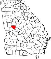 | |
| Town | ||
| CDPs | ||