Sainte-Julienne, Quebec
| Sainte-Julienne | |
|---|---|
| Municipality | |
 Location within Montcalm RCM. | |
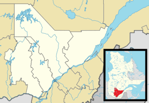 Sainte-Julienne Location in central Quebec. | |
| Coordinates: 45°58′N 73°43′W / 45.967°N 73.717°WCoordinates: 45°58′N 73°43′W / 45.967°N 73.717°W[1] | |
| Country |
|
| Province |
|
| Region | Lanaudière |
| RCM | Montcalm |
| Constituted | July 1, 1855 |
| Government[2] | |
| • Mayor | Marcel Jetté |
| • Federal riding | Montcalm |
| • Prov. riding | Rousseau |
| Area[2][3] | |
| • Total | 100.40 km2 (38.76 sq mi) |
| • Land | 99.26 km2 (38.32 sq mi) |
| Population (2011)[3] | |
| • Total | 9,331 |
| • Density | 94.0/km2 (243/sq mi) |
| • Pop 2006–2011 |
|
| Time zone | EST (UTC−5) |
| • Summer (DST) | EDT (UTC−4) |
| Postal code(s) | J0K 2T0 |
| Area code(s) | 450 and 579 |
| Highways[4] |
|
| Website |
www |
Sainte-Julienne is a community and municipality in Lanaudière, Quebec, Canada. According to the 2001 Canadian census, the community has a population of 7,182[5] The Sainte-Julienne Aerodrome is located in Sainte-Julienne.
Notable people
- Audrey De Montigny - former Canadian Idol finalist.
- Zotique Mageau (1865-1951) - Member of Provincial Parliament of Ontario
See also
References
- ↑ Reference number 341088 of the Commission de toponymie du Québec (French)
- 1 2 Geographic code 63060 in the official Répertoire des municipalités (French)
- 1 2 Statistics Canada 2011 Census - Sainte-Julienne census profile
- ↑ Official Transport Quebec Road Map
- ↑ "Community Highlights for Sainte-Julienne". Statistics Canada. Retrieved 2008-12-29.
External links
- "Municipalité de Sainte-Julienne" (in French). Retrieved 2008-12-29.
 |
Rawdon | Saint-Liguori | | |
| Saint-Calixte | |
Saint-Jacques Saint-Alexis | ||
| ||||
| | ||||
| Saint-Lin-Laurentides | Saint-Esprit |
| Cities/towns | |
|---|---|
| Municipalities | |
| Parishes | |
| |
This article is issued from Wikipedia - version of the 1/12/2015. The text is available under the Creative Commons Attribution/Share Alike but additional terms may apply for the media files.