Saddle Mountain (Clatsop County, Oregon)
| Saddle Mountain | |
|---|---|
 | |
| Highest point | |
| Elevation | 3,288 ft (1,002 m) NAVD 88[1] |
| Prominence | 2,323 ft (708 m) [2] |
| Listing | Oregon county high points |
| Coordinates | 45°58′09″N 123°41′07″W / 45.969079028°N 123.685336856°WCoordinates: 45°58′09″N 123°41′07″W / 45.969079028°N 123.685336856°W [1] |
| Geography | |
 Saddle Mountain | |
| Parent range | Northern Oregon Coast Range |
| Topo map | USGS Saddle Mountain |
| Climbing | |
| First ascent | 1841 by James Dwight Dana[3] |
| Easiest route | Trailhead from state park |
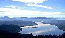
Saddle Mountain is the tallest mountain in Clatsop County in the U.S. state of Oregon.[2] Part of the Oregon Coast Range, Saddle Mountain is in Saddle Mountain State Natural Area in the northwest corner of Oregon. The peak is listed on Oregon’s Register of Natural Heritage Resources.[4]
Geology
.jpg)
Saddle Mountain was created around 15 million years ago in the Pliocene epoch when lava flows poured down the old Columbia River valley. When the lava encountered the water at the Astoria Sea, great steam explosions and thermal shocks occurred to create a large pile of basalt rocks. The mountain consists of this volcanic breccia, which is a rock made up of broken basalt fragments that are fused together in a fine-grained matrix.[5]
History
In modern time, the mountain has been viewed and described by a variety of European and American explorers. Beginning in 1788, these explorers included British captain John Meares, Lewis and Clark in 1805, and the Wilkes Expedition in 1841.[5] Meares named the peak Mont de la Selle in 1788.[5]
Access
The hike to the taller of the two peaks is a 6-mile (9.7 km) round trip consisting of challenging terrain. Elevation gain is 1,603 feet (489 m) and leads to a 360-degree view to the Pacific Ocean, Cascade Mountain peaks such as Mount Hood, and other peaks in the Coast Range. The lower peak—elevation 3,200 feet (980 m)— to the east and south does not have trail access. The trail is steep at times along rock outcroppings, but does offer views that include wildflowers in bloom in the springtime.[6]
Saddle Mountain is 7 miles (11 km) off U.S. Route 26 about 65 miles (105 km) west of Portland. The access road to the mountain and state park is paved. The area contains dense forests of spruce and hemlock, and some ancient lava flows.[7]
See also
References
- 1 2 "Saddle Mountain 3 Reset". NGS data sheet. U.S. National Geodetic Survey. Retrieved 2008-11-02.
- 1 2 "Saddle Mountain, Oregon". Peakbagger.com. Retrieved 2008-04-03.
- ↑ "Saddle Mountain, Oregon". The Columbia River: A Photographic Journey. Retrieved 2008-04-03.
- ↑ "State Register of Natural Heritage Resources". Oregon State University. Retrieved 2008-04-03.
- 1 2 3 "The Volcanoes of Lewis & Clark". U.S. Geological Survey. Retrieved 2008-04-03.
- ↑ "Saddle Mountain hikes". Northwest Hiker. Retrieved 2008-04-03.
- ↑ Crary, Jess. "Camp 18 to Saddle Mountain". The Oregonian. Archived from the original on 2011-06-09. Retrieved 2008-04-03.
External links
- "Saddle Mountain". Geographic Names Information System. United States Geological Survey. Retrieved 2008-11-02.
- "Saddle Mountain State Natural Area". Oregon Parks and Recreation Department. Retrieved 2008-04-03.