Sabaila, Nepal
| Sabaila, Nepal सवैला sabaila,Dhanusha | |
|---|---|
| municipality | |
| Nickname(s): sabaila | |
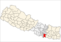
 Sabaila, Nepal Location in Nepal | |
| Coordinates: 26°49′N 86°05′E / 26.81°N 86.09°ECoordinates: 26°49′N 86°05′E / 26.81°N 86.09°E | |
| Country |
|
| Zone | Janakpur Zone |
| District | Dhanusha District |
| Population (1991) | |
| • Total | 6,860 |
| Time zone | Nepal Time (UTC+5:45) |
Sabaila is a municipality in Dhanusa District in the Janakpur Zone of south-eastern Nepal. At the time of the 1991 Nepal census it had a population of 6,860 persons living in 1246 individual households. Sabaila is one of the strongest municipality of Dhanusha district. There is on Area Police Station in Sabila which is situated at Sabaila Ward No-07. There is market which is helpful to 20 villages around there. There one temple "Durga Mandir" where "Dashain" the greatest Hindu festivals is celebrated in grant way. One things of this place is most of the people is educated mainly they are technical person like Overseer, Engineer, & Professional such as CA., Doctor, MBA, Doctorate(Phd.). Its population is of approximate 50,000 and in the election card holder is 20,000 approx. There is a one big mosque where the Muslim pray, situated near the local area police station (100M). The transport of the Sabaila is connected with Janakpur and Kathmandu & linked with the Mahendra rajmarg i.e. East West highways. There is 5 government school the school level up to 10 class.
References
- ↑ "Nepal Census 2001". Nepal's Municipality. Digital Himalaya. Retrieved 3 September 2008.