Rush Center, Kansas
| Rush Center, Kansas | |
|---|---|
| City | |
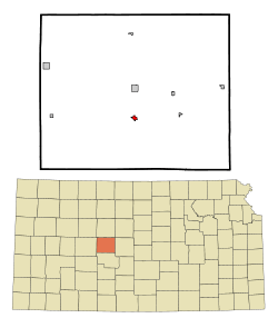 Location within Rush County and Kansas | |
 KDOT map of Rush County (legend) | |
| Coordinates: 38°27′54″N 99°18′39″W / 38.46500°N 99.31083°WCoordinates: 38°27′54″N 99°18′39″W / 38.46500°N 99.31083°W | |
| Country | United States |
| State | Kansas |
| County | Rush |
| Area[1] | |
| • Total | 0.39 sq mi (1.01 km2) |
| • Land | 0.39 sq mi (1.01 km2) |
| • Water | 0 sq mi (0 km2) |
| Elevation | 1,995 ft (608 m) |
| Population (2010)[2] | |
| • Total | 170 |
| • Estimate (2015)[3] | 162 |
| • Density | 440/sq mi (170/km2) |
| Time zone | Central (CST) (UTC-6) |
| • Summer (DST) | CDT (UTC-5) |
| ZIP code | 67575 |
| Area code(s) | 785 |
| FIPS code | 20-61775 [4] |
| GNIS feature ID | 0475611 [5] |
Rush Center is a city in Rush County, Kansas, United States. As of the 2010 census, the city population was 170.[6]
History
Rush Center was originally called Walnut City, and under the latter name was laid out in 1871. It was renamed in 1874.[7] By 1886, Rush Center had a population of about 1,000.[8]
Geography
Rush Center is located at 38°27′54″N 99°18′39″W / 38.46500°N 99.31083°W (38.464881, -99.310903).[9] According to the United States Census Bureau, the city has a total area of 0.39 square miles (1.01 km2), all of it land.[1]
Demographics
| Historical population | |||
|---|---|---|---|
| Census | Pop. | %± | |
| 1890 | 214 | — | |
| 1960 | 278 | — | |
| 1970 | 237 | −14.7% | |
| 1980 | 207 | −12.7% | |
| 1990 | 177 | −14.5% | |
| 2000 | 176 | −0.6% | |
| 2010 | 170 | −3.4% | |
| Est. 2015 | 162 | [3] | −4.7% |
| U.S. Decennial Census | |||
2010 census
As of the census[2] of 2010, there were 170 people, 83 households, and 50 families residing in the city. The population density was 435.9 inhabitants per square mile (168.3/km2). There were 100 housing units at an average density of 256.4 per square mile (99.0/km2). The racial makeup of the city was 95.9% White, 0.6% African American, 1.2% Native American, 0.6% Asian, and 1.8% from two or more races. Hispanic or Latino of any race were 2.4% of the population.
There were 83 households of which 16.9% had children under the age of 18 living with them, 53.0% were married couples living together, 6.0% had a female householder with no husband present, 1.2% had a male householder with no wife present, and 39.8% were non-families. 33.7% of all households were made up of individuals and 21.7% had someone living alone who was 65 years of age or older. The average household size was 2.05 and the average family size was 2.58.
The median age in the city was 52 years. 14.7% of residents were under the age of 18; 5.3% were between the ages of 18 and 24; 20.6% were from 25 to 44; 28.2% were from 45 to 64; and 31.2% were 65 years of age or older. The gender makeup of the city was 48.2% male and 51.8% female.
2000 census
As of the census[4] of 2000, there were 176 people, 83 households, and 52 families residing in the city. The population density was 455.5 people per square mile (174.2/km²). There were 99 housing units at an average density of 256.2 per square mile (98.0/km²). The racial makeup of the city was 98.86% White, 0.57% Native American, and 0.57% from two or more races.
There were 83 households out of which 25.3% had children under the age of 18 living with them, 55.4% were married couples living together, 4.8% had a female householder with no husband present, and 37.3% were non-families. 36.1% of all households were made up of individuals and 25.3% had someone living alone who was 65 years of age or older. The average household size was 2.12 and the average family size was 2.77.
In the city the population was spread out with 21.6% under the age of 18, 2.3% from 18 to 24, 26.1% from 25 to 44, 23.3% from 45 to 64, and 26.7% who were 65 years of age or older. The median age was 45 years. For every 100 females there were 87.2 males. For every 100 females age 18 and over, there were 86.5 males.
The median income for a household in the city was $31,500, and the median income for a family was $34,861. Males had a median income of $23,125 versus $19,375 for females. The per capita income for the city was $16,006. None of the families and 5.6% of the population were living below the poverty line, including no under eighteens and 13.2% of those over 64.
Further reading
References
- 1 2 "US Gazetteer files 2010". United States Census Bureau. Retrieved 2012-07-06.
- 1 2 "American FactFinder". United States Census Bureau. Retrieved 2012-07-06.
- 1 2 "Annual Estimates of the Resident Population for Incorporated Places: April 1, 2010 to July 1, 2015". Retrieved July 2, 2016.
- 1 2 "American FactFinder". United States Census Bureau. Retrieved 2008-01-31.
- ↑ "US Board on Geographic Names". United States Geological Survey. 2007-10-25. Retrieved 2008-01-31.
- ↑ "2010 City Population and Housing Occupancy Status". U.S. Census Bureau. Retrieved September 16, 2011.
- ↑ "History of Rush County". Rush County Economic Development. Archived from the original on March 22, 2012. Retrieved 22 June 2014.
- ↑ Blackmar, Frank Wilson (1912). Kansas: A Cyclopedia of State History, Volume 2. Standard Publishing Company. p. 611.
- ↑ "US Gazetteer files: 2010, 2000, and 1990". United States Census Bureau. 2011-02-12. Retrieved 2011-04-23.
External links
| Wikimedia Commons has media related to Rush Center, Kansas. |
- City
- Schools
- USD 395, local school district
- Historical
- History of Cities in Rush County
- Rush Center Info, Legends of Kansas
- Maps
- Rush Center City Map, KDOT
Municipalities and communities of Rush County, Kansas, United States | ||
|---|---|---|
| Cities |  | |
| Unincorporated communities | ||