Rough Castle Fort
Coordinates: 55°59′52″N 3°51′22″W / 55.997800°N 3.856000°W
| Rough Castle Fort | |
|---|---|
 | |
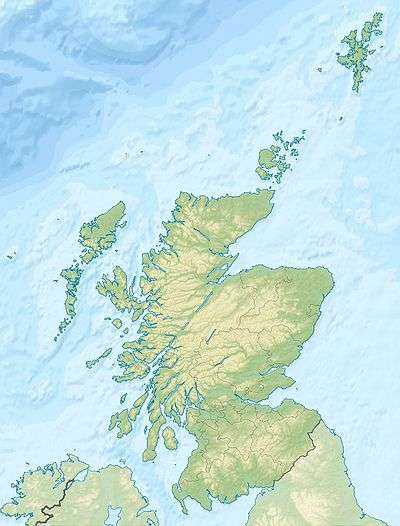 Location within UK Scotland | |
| Founded during the reign of | Antoninus Pius |
| Founded | 142 AD |
| Place in the Roman world | |
| Province | Britannia |
| Structure | |
| — Turf structure — | |
| Size and area | (0.4 ha) |
| Stationed military units | |
| — Cohorts — | |
| VI Nerviorum | |
| Location | |
| Coordinates | 55°59′52″N 3°51′22″W / 55.997800°N 3.856000°W |
| Town | Near Tamfourhill |
| County | Falkirk |
| State | Scotland |
| Country |
|
| Site notes | |
| Condition | Ruined |
Rough Castle Fort is a Roman fort on the Antonine Wall roughly 2 kilometres south east of Bonnybridge near Tamfourhill in the Falkirk council area, Scotland.
The Antonine Wall was built around 143 AD and stretched from Bo'ness on the River Forth to Old Kilpatrick on the River Clyde. The fort is the best preserved of the 19 forts constructed along the length of the Wall. Built against the southern rear face of the Wall, the fort was defended by 6 metre thick turf ramparts and surrounded by defensive ditches. Gateways were provided through the main Wall to the north, and also through the walls on the other three sides of the fort. Causeways were then constructed across the main Antonine and secondary defensive ditches, affording easy access to and from the fort.
The fort was the second smallest on the Wall and had an area of about 4,000 square metres. The fort contained several substantial stone buildings, including a headquarters, the commander's house, barracks, a bath house and a granary. Although the original buildings have not survived, the foundations of these buildings were discovered during excavations in 1902 - 1903, 1932 and 1957 - 1961.
Inscriptions found on recovered artifacts indicate that the fort was the base for 480 men of the Cohors VI Nerviorum of Nervii, an infantry unit recruited from a north-eastern Gallic tribe. The military road on the south side of the Wall, which enabled transport between all forts, is still well defined and there is also a fine length of rampart and ditch still intact to the west.
A feature of the defences at the fort, discovered during the excavations, is a series of pits lying to the north west of the causeway across the Antonine ditch. These pits, known as "lilias", would originally have contained sharpened stakes at the bottom. The lilias were positioned to help defend the vulnerable northern gateway through the Wall. Near the fort were a turf platform (beacon platform or signalling platform) and gravel pits for building of the military road. Interesting was that the bath house was built on an annexe. The fort was defended by Nervii and Flavius Betto was a commanding officer.
 A section of the Antonine Wall just to the west of the fort.
 The "lilias" north west of the fort.
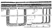 Rough Castle on the Antonine Wall, drawn by William Roy in 1755.
See also
- The new Roughcastle Tunnel
- List of places in Falkirk district
External links
-
 Media related to Rough Castle Fort at Wikimedia Commons
 - Rough Castle Fort on the Gazeteer for Scotland
- Falkirk Local History Society