Rosburg, Washington
| Rosburg, Washington | |
|---|---|
| CDP | |
 Rosburg, Washington | |
| Coordinates: 46°19′51″N 123°38′19″W / 46.33083°N 123.63861°WCoordinates: 46°19′51″N 123°38′19″W / 46.33083°N 123.63861°W | |
| Country | United States |
| State | Washington |
| County | Wahkiakum |
| Elevation | 13 ft (4 m) |
| Population (2010) | |
| • Total | 317 |
| Time zone | Pacific (PST) (UTC-8) |
| • Summer (DST) | PDT (UTC-7) |
| ZIP code | 98643 |
| Area code(s) | 360 |
| GNIS feature ID | 1511272[1] |
Rosburg is a Census-designated place (CDP) in Wahkiakum County, Washington, United States. Rosburg is located on the Grays River near Washington State Route 4, 15 miles (24 km) northwest of Cathlamet. Rosburg has a post office with ZIP code 98643.[2] The CDP includes the communities of Eden and Oneida.
Christian Rosburg, the town's first postmaster, named Rosburg for himself.[3]
References
- ↑ U.S. Geological Survey Geographic Names Information System: Rosburg, Washington
- ↑ ZIP Code Lookup
- ↑ Majors, Harry M. (1975). Exploring Washington. Van Winkle Publishing Co. p. 114. ISBN 978-0-918664-00-6.
Municipalities and communities of Wahkiakum County, Washington, United States | ||
|---|---|---|
| Town | 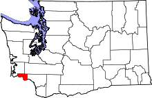 | |
| CDPs | ||
| Unincorporated communities |
| |
This article is issued from Wikipedia - version of the 10/16/2016. The text is available under the Creative Commons Attribution/Share Alike but additional terms may apply for the media files.