Rodovia dos Bandeirantes
| <span class="nickname" ">Rodovia dos Bandeirantes | |
 | |
| Type | From São Paulo to Jundiaí eight-lane highway, from Jundiaí to Santa Bárbara d'Oeste six-lane highway, from Santa Bárbara d'Oeste to Cordeirópolis four-lane highway |
|---|---|
| Length | 173 km (107 mi) |
| Location | Passes through São Paulo, Jundiaí, Campinas, Sumaré, Santa Bárbara d'Oeste, Limeira, Cordeirópolis |
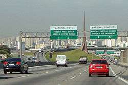
| South end | Marginal Tietê Lapa, in the city of São Paulo |
| Major junctions |
|
| North end | Cordeirópolis, in the Rodovia Anhangüera, km 158 |
| Construction | |
| Inauguration | 1978 and 2001 |
Rodovia Bandeirantes (official designation SP-348) is a highway in the state of São Paulo, Brazil.
Once the traffic capacity of Anhangüera Highway was exceeded in the 1960s, the state government decided to build another highway, with a much higher capacity and modern design, directly connecting São Paulo City to Jundiaí, Campinas and merging into the Anhangüera just after Campinas. Among the first six-lane highways in Brazil, it opened to traffic in 1978.
It has always been a toll road, and since 1998, the highway is managed by a state contract with a private company, AutoBan.
Subsequently, in 2001 it was extended to Santa Bárbara d'Oeste merging with the Washington Luis Highway, to Rio Claro, São Carlos, Araraquara and São José do Rio Preto. In 2006, it was widened to 4 lanes each way between São Paulo and Jundiaí. It is today the major thoroughfare between several mighty industrial cities around São Paulo and Campinas, and the Viracopos Airport, the second busiest cargo airport in the country.[1]
The highway is named after the bandeirantes, audacious explorers of the Brazilian hinterlands in the 16th and 17th centuries, whose treks through the rain forests become the templates for the major thoroughfares of the São Paulo highway system.
References
See also
| Rodovias | |
|---|---|
| Expressways |
|
| Surface streets |
|