Robin Glen-Indiantown, Michigan
| Robin Glen-Indiantown, Michigan | |
|---|---|
| CDP | |
 Location of Robin Glen-Indiantown within Saginaw County, Michigan | |
 Robin Glen-Indiantown, Michigan Location within the state of Michigan | |
| Coordinates: 43°27′43″N 83°50′13″W / 43.46194°N 83.83694°WCoordinates: 43°27′43″N 83°50′13″W / 43.46194°N 83.83694°W | |
| Country | United States |
| State | Michigan |
| County | Saginaw |
| Township | Buena Vista |
| Area | |
| • Total | 2.1 sq mi (5.5 km2) |
| • Land | 2.1 sq mi (5.5 km2) |
| • Water | 0.0 sq mi (0.0 km2) |
| Elevation[1] | 584 ft (178 m) |
| Population (2000) | |
| • Total | 1,158 |
| • Density | 540.7/sq mi (208.8/km2) |
| Time zone | Eastern (EST) (UTC-5) |
| • Summer (DST) | EDT (UTC-4) |
| ZIP code | 48601 (Saginaw) |
| Area code(s) | 989 |
| FIPS code | 26-68990[2] |
| GNIS feature ID | 2393209[1] |
Robin Glen-Indiantown is a census-designated place (CDP) in Buena Vista Charter Township, Saginaw County in the U.S. state of Michigan. The CDP is used for statistical purposes and has no legal status as an incorporated municipality. The population was 1,158 at the 2000 census.
The CDP includes the unincorporated community of Indiantown near the junction of N. Portsmouth Rd and Becker Rd at 43°28′20″N 83°50′12″W / 43.47222°N 83.83667°W[3] The CDP also includes the Robin Glen Mobile Home Community at the southwest corner of E. Washington Rd (M-81) and N. Portsmouth.[4][5]
Indiantown is an important location for broadcasters in Mid-Michigan, with the community being home to three 1,000 foot communications towers. Television stations WNEM and WBSF, as well as radio stations WIOG and WSGW broadcast from Indiantown. Furthermore WMJO and WHNN also broadcast from the Indiantown area, however their transmitters are physically located in Munger and Quanicassee, respectively.
Geography
According to the United States Census Bureau, the CDP has a total area of 2.1 square miles (5.4 km2), all land.
Demographics
As of the census[2] of 2000, there were 1,158 people, 463 households, and 306 families residing in the CDP. The population density was 540.7 per square mile (208.9/km²). There were 489 housing units at an average density of 228.3 per square mile (88.2/km²). The racial makeup of the CDP was 91.71% White, 2.33% African American, 0.52% Native American, 2.59% from other races, and 2.85% from two or more races. Hispanic or Latino of any race were 6.65% of the population.
There were 463 households out of which 39.5% had children under the age of 18 living with them, 41.9% were married couples living together, 19.2% had a female householder with no husband present, and 33.7% were non-families. 27.0% of all households were made up of individuals and 4.5% had someone living alone who was 65 years of age or older. The average household size was 2.50 and the average family size was 3.03.
In the CDP the population was spread out with 30.3% under the age of 18, 9.3% from 18 to 24, 35.5% from 25 to 44, 18.7% from 45 to 64, and 6.1% who were 65 years of age or older. The median age was 30 years. For every 100 females there were 99.0 males. For every 100 females age 18 and over, there were 95.9 males.
The median income for a household in the CDP was $31,613, and the median income for a family was $31,908. Males had a median income of $31,500 versus $15,625 for females. The per capita income for the CDP was $19,145. About 15.9% of families and 14.9% of the population were below the poverty line, including 24.0% of those under age 18 and 14.3% of those age 65 or over.
References
- 1 2 U.S. Geological Survey Geographic Names Information System: Robin Glen-Indiantown Census Designated Place
- 1 2 "American FactFinder". United States Census Bureau. Retrieved 2008-01-31.
- ↑ U.S. Geological Survey Geographic Names Information System: Indiantown, Michigan
- ↑ Robin Glen Mobile Home Community Mlive.com Business Finder
- ↑ Robin Glen-Indiantown CDP, Michigan - Reference Map - American FactFinder, United State Census Bureau, 2000 Census
Municipalities and communities of Saginaw County, Michigan, United States | ||
|---|---|---|
| Cities | 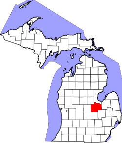 | |
| Villages | ||
| Charter townships | ||
| General law townships | ||
| CDPs | ||
| Other communities |
| |
| Footnotes | ‡This populated place also has portions in an adjacent county or counties | |