Riverside, Alabama
| Riverside, Alabama | |
|---|---|
| Town | |
 Location in St. Clair County and the state of Alabama | |
| Coordinates: 33°36′52″N 86°12′2″W / 33.61444°N 86.20056°WCoordinates: 33°36′52″N 86°12′2″W / 33.61444°N 86.20056°W | |
| Country | United States |
| State | Alabama |
| County | St. Clair |
| Area | |
| • Total | 10.5 sq mi (27.4 km2) |
| • Land | 8.9 sq mi (23.2 km2) |
| • Water | 1.6 sq mi (4.2 km2) |
| Elevation | 505 ft (154 m) |
| Population (2010) | |
| • Total | 2,208 |
| • Density | 149/sq mi (57.1/km2) |
| Time zone | Central (CST) (UTC-6) |
| • Summer (DST) | CDT (UTC-5) |
| ZIP code | 35135 |
| Area code(s) | 205 |
| FIPS code | 01-64920 |
| GNIS feature ID | 0164834 |
| Website | http://www.riverside-al.com/ |
Riverside is a town in St. Clair County, Alabama, United States. It incorporated in 1886.[1] At the 2010 census the population was 2,208, up from 1,564 in 2000.
Geography
Riverside is located at 33°36′52″N 86°12′02″W / 33.614465°N 86.200678°W.[2]
According to the U.S. Census Bureau, the town has a total area of 10.6 square miles (27 km2), of which 8.9 square miles (23 km2) is land and 1.6 square miles (4.1 km2) (15.42%) is water.
Demographics
| Historical population | |||
|---|---|---|---|
| Census | Pop. | %± | |
| 1900 | 300 | — | |
| 1910 | 277 | −7.7% | |
| 1920 | 240 | −13.4% | |
| 1930 | 131 | −45.4% | |
| 1940 | 135 | 3.1% | |
| 1950 | 116 | −14.1% | |
| 1960 | 159 | 37.1% | |
| 1970 | 351 | 120.8% | |
| 1980 | 849 | 141.9% | |
| 1990 | 1,004 | 18.3% | |
| 2000 | 1,564 | 55.8% | |
| 2010 | 2,208 | 41.2% | |
| Est. 2015 | 2,300 | [3] | 4.2% |
| U.S. Decennial Census[4] 2013 Estimate[5] | |||
As of the census[6] of 2000, there were 1,564 people, 663 households, and 464 families residing in the town. The population density was 174.8 people per square mile (67.5/km²). There were 793 housing units at an average density of 88.6 per square mile (34.2/km²). The racial makeup of the town was 85.10% White, 12.40% Black or African American, 0.83% Native American, 0.13% Asian, 0.51% from other races, and 1.02% from two or more races. 0.96% of the population were Hispanic or Latino of any race.
There were 663 households out of which 29.3% had children under the age of 18 living with them, 56.7% were married couples living together, 10.7% had a female householder with no husband present, and 29.9% were non-families. 25.9% of all households were made up of individuals and 8.4% had someone living alone who was 65 years of age or older. The average household size was 2.36 and the average family size was 2.83.
In the town the population was spread out with 23.8% under the age of 18, 6.9% from 18 to 24, 30.1% from 25 to 44, 27.8% from 45 to 64, and 11.4% who were 65 years of age or older. The median age was 38 years. For every 100 females there were 94.8 males. For every 100 females age 18 and over, there were 89.6 males.
The median income for a household in the town was $34,813, and the median income for a family was $43,456. Males had a median income of $32,604 versus $21,920 for females. The per capita income for the town was $18,932. About 10.2% of families and 12.5% of the population were below the poverty line, including 18.0% of those under age 18 and 12.4% of those age 65 or over.
2010 census
As of the census[7] of 2010, there were 2,208 people, 864 households, and 640 families residing in the town. The population density was 248.1 people per square mile (95.2/km²). There were 987 housing units at an average density of 110.9 per square mile (42.5/km²). The racial makeup of the town was 87.5% White, 10.6% Black or African American, 0.2% Native American, 0.7% Asian, 0.1% from other races, and .9% from two or more races. 1.1% of the population were Hispanic or Latino of any race.
There were 864 households out of which 30.6% had children under the age of 18 living with them, 61.0% were married couples living together, 9.3% had a female householder with no husband present, and 25.9% were non-families. 21.9% of all households were made up of individuals and 7.2% had someone living alone who was 65 years of age or older. The average household size was 2.56 and the average family size was 2.99.
In the town the population was spread out with 24.2% under the age of 18, 6.8% from 18 to 24, 27.7% from 25 to 44, 30.2% from 45 to 64, and 11.1% who were 65 years of age or older. The median age was 39.6 years. For every 100 females there were 101.8 males. For every 100 females age 18 and over, there were 97.2 males.
The median income for a household in the town was $59,250, and the median income for a family was $65,057. Males had a median income of $52,300 versus $31,713 for females. The per capita income for the town was $27,452. About 6.4% of families and 9.0% of the population were below the poverty line, including 14.2% of those under age 18 and 6.0% of those age 65 or over.
References
- ↑ http://www.encyclopediaofalabama.org/article/h-3449
- ↑ "US Gazetteer files: 2010, 2000, and 1990". United States Census Bureau. 2011-02-12. Retrieved 2011-04-23.
- ↑ "Annual Estimates of the Resident Population for Incorporated Places: April 1, 2010 to July 1, 2015". Retrieved July 2, 2016.
- ↑ "U.S. Decennial Census". Census.gov. Retrieved June 6, 2013.
- ↑ "Annual Estimates of the Resident Population: April 1, 2010 to July 1, 2013". Retrieved June 3, 2014.
- ↑ "American FactFinder". United States Census Bureau. Retrieved 2008-01-31.
- ↑ "American FactFinder". United States Census Bureau. Retrieved 2015-08-09.
Municipalities and communities of St. Clair County, Alabama, United States | ||
|---|---|---|
| Cities | 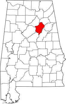 | |
| Towns | ||
| Unincorporated communities | ||
| Former towns | ||
| Footnotes | ‡This populated place also has portions in an adjacent county or counties | |