Rivadavia Partido
| Rivadavia Partido de Rivadavia | ||
|---|---|---|
| Department | ||
| ||
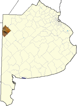 location of Rivadavia Partido in Buenos Aires Province | ||
| Coordinates: 35°29′S 62°59′W / 35.483°S 62.983°WCoordinates: 35°29′S 62°59′W / 35.483°S 62.983°W | ||
| Country | Argentina | |
| Province | Buenos Aires | |
| Established | September 30, 1910 | |
| Founded by | provincial law 3273 | |
| Seat | América | |
| Government | ||
| • Mayor | Sergio Omar Buil (UCR) | |
| Area | ||
| • Total | 3,940 km2 (1,520 sq mi) | |
| Population | ||
| • Total | 15,452 | |
| • Density | 3.9/km2 (10/sq mi) | |
| Demonym(s) | rivadaviense | |
| Postal Code | B6237 | |
| IFAM | BUE104 | |
| Area Code | 2337 | |
| Website | munirivadavia.gov.ar | |

Rivadavia is a partido in the northwest of Buenos Aires Province, Argentina, on the border with La Pampa Province. It has an area of 3,940 square kilometres, and a population of 15,452 (2001 census [INDEC]).
.jpg)
Palacio municipal
The partido, created in 1910, has the town of América as its capital, and its main economic activities are cattle, and the cultivation of wheat, maize and soya beans. Most of the Soya grown in rivadavia partido is of the genetically modified variety.
Name
.jpg)
Statue of Bernardino Rivadavia in América
The Partido is named in honour of Bernardino Rivadavia (1780–1845), veteran of the Argentine War of Independence and President of Argentina 1826–1827.
Districts (localidades)
- América (capital, or cabecera, population 10,361, 35°29′18″S 62°58′31″W / 35.48833°S 62.97528°W)
- Badano
- Cerrito
- Condarco
- Fortín Olavarría (population 1.005, 35°42′05″S 63°01′25″W / 35.70139°S 63.02361°W)
- González Moreno (population 1,663, 35°33′16″S 63°22′43″W / 35.55444°S 63.37861°W)
- Mira Pampa (population 54, 35°52′06″S 63°22′20″W / 35.86833°S 63.37222°W)
- Roosevelt (population 288, 35°50′53″S 63°17′32″W / 35.84806°S 63.29222°W)
- San Mauricio (population 28, 35°30′45″S 63°11′10″W / 35.51250°S 63.18611°W)
- Sansinena (population 468, 35°45′52″S 63°08′22″W / 35.76444°S 63.13944°W)
- Sumblad (population 96)
- Vadano
- Valentín Gómez (35°39′03″S 63°15′16″W / 35.65083°S 63.25444°W)
- Villa Sena
External links
| Wikimedia Commons has media related to Rivadavia Partido. |
- América Digital - portal (Spanish)
This article is issued from Wikipedia - version of the 6/5/2015. The text is available under the Creative Commons Attribution/Share Alike but additional terms may apply for the media files.