La Pampa Province
| La Pampa | |||
|---|---|---|---|
| Province | |||
| |||
 | |||
| Country | Argentina | ||
| Capital | Santa Rosa | ||
| Divisions | 22 departments | ||
| Government | |||
| • Governor | Carlos Verna | ||
| • Senators |
Daniel Lovera Norma Durango Juan Carlos Marino | ||
| Area | |||
| • Total | 143,440 km2 (55,380 sq mi) | ||
| Population (2010[1]) | |||
| • Total | 318,951 | ||
| • Rank | 22nd | ||
| • Density | 2.2/km2 (5.8/sq mi) | ||
| Demonym(s) | Pampeano | ||
| Time zone | ART (UTC−3) | ||
| ISO 3166 code | AR-L | ||
| Website |
www | ||

La Pampa (Spanish pronunciation: [la ˈpampa]) is a sparsely populated province of Argentina, located in the Pampas in the center of the country. Neighboring provinces are from the north clockwise San Luis, Córdoba, Buenos Aires, Río Negro, Neuquén and Mendoza.
History

In 1604 Hernandarias was the first European explorer to reach the area; it was later explored by Jerónimo Luis de Cabrera in 1662. But it was not until the 18th century that Spanish colonists established permanent settlements here.
Resistance of the local indigenous people prevented much expansion until the government of Juan Manuel de Rosas. It did not cease until Julio Roca's conquest of the desert in the 19th century. The territory was divided between the officers, and they erected the first Spanish settlements.
The Territorio Nacional de La Pampa Central was created in 1884, containing the Río Negro Province and parts of other surrounding provinces. It had around 25,000 inhabitants. By 1915 there were 110,000 residents, a reflection of movement to that area. In 1945 the territory was divided and La Pampa became a province.
In 1952 its constitution was indited and the province was renamed after Eva Perón. In 1955 after the government changed and the Peróns went into exile, both La Pampa and Chaco, which had been named for Juan Perón, were reverted to their original names.
Geography and climate
Situated in the middle of the pampas, the low, flat steppe receives 500 mm of rain a year, diminishing towards the West. The low humidity and temperate weather result in high contrast in temperature between day and night, which is reflected in the vegetation of the region.
Summers are warm throughout the province, with warmer days in the west (about 32°C, or 90F) than in the east (30°C, or 86F) and cool nights, ranging from 16°C (61F) in the north to 14°C (57F) in the south: the thermal amplitude is thus quite remarkable. Heat waves are frequent, and temperatures reach over 30°C (86F) sometimes. These are often followed by severe storms and much colder periods, where nights can be below 10°C (50F). By early March nights are already noticeably cooler, and April usually brings the first frosty nights. Averages range from 10°C (50F) to 20°C (68F) during the day, and 0°C (32F) to 7°C (44F) at night, with dryer conditions than in the summer. Winters in La Pampa are usually dry and sunny, with cool days and quite cold nights, and some marked variations between warmer and colder periods. Daytime temperatures range from 10°C (50F) in the north and west, to about 5°C (5F) in the southernmost areas. Nighttime lows range from about 0°C (32F) in the northeast corner to around -5°C (23F) or slightly below freezing in many southern and western areas. That being said, northerly winds occasionally bring days of up to 25°C (77F), while southern winds can keep daytime highs below 0°C (32F). Nights below -7°C (19F) are quite common everywhere, with temperatures below -10°C (14F) possible in most areas. Spring is marked by wide variations and periods of drought followed by severe thunderstorms: it is the season of hail, and it is not uncommon to see temperatures reach 30°C (86F) on one day, and then fail to reach 12°C (53F) two days later, with frost possible until October and perhaps later.
Overall, precipitation ranges from about 700 mm in the east/northeast, to 500 mm in the centre (agricultural frontier), and values below 400 mm in the south and west. Snow is quite common almost everywhere, although frost can be more common and happen anytime from March to October.
Northwestern La Pampa is part of the pampa húmeda, adjacent to the Province of Buenos Aires. The influence of the Cuyo region can be seen in the west, with a low mountain range of 600 meters.
There are only two major rivers in the province: the Colorado ("Red River") on the border with the Province of Río Negro, and the Salado ("Salty River") crossing it. The Salado's level has been dropping, as its tributaries in the Province of Mendoza are diverted for irrigation.
Economy
La Pampa, long Argentina's most economically agricultural province, produced an estimated US$3.144 billion in output in 2006, or, US$10,504 per capita (almost 20% above the national average).[2] Now, the GDP per capita of the province is of US$ 14.000.
Agriculture contributes a fourth to La Pampa's economy, the most important activity being cattle ranching, with 3,632,684 (2002) head, which takes place all over the province. Other livestock include 202,428 sheep, 140,498 goats and 64,118 pigs.

The Northeast, on the more fertile lands, has also an important activity with wheat (10% of the national production), sunflower (13% of NP), maize, alfalfa, barley, and other cereals.
There's also a dairy industry of 300 centres of extraction and 25 cheese factories, honey production, and salt extraction from salt basins.
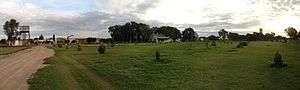
La Pampa is home to very little industry, construction or mining and, so, its services sector accounts for over two-thirds of the economy, a fairly high proportion. Tourism is an underdeveloped activity, however. Visitors start at Santa Rosa and reach Lihué Calel National Park, Parque Luro Provincial Reserve or visit one of the many estancias, some of which are dedicated to agritourism.
Political division
The province is divided in 22 departments (Spanish: departamentos).
Department (Capital)
- Atreuco Department (Macachín)
- Caleu Caleu Department (La Adela)
- Capital (Santa Rosa)
- Catriló Department (Catriló)
- Chalileo Department (Santa Isabel)
- Chapaleufú Department (Intendente Alvear)
- Chical Có Department (Algarrobo del Aguila)
- Conhelo Department (Eduardo Castex)
- Curacó Department (Puelches)
- Guatraché Department (Guatraché)
- Huncal Department (Bernasconi)
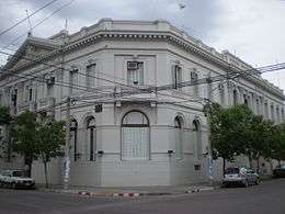 Supreme Court of La Pampa.
 - Lihué Calel Department (Cuchillo-Co)
- Limay Mahuida Department (Limay Mahuida)
- Loventué Department (Victorica)
- Maracó Department (General Pico)
- Puelén Department (Veinticinco de Mayo)
- Quemú Quemú Department (Quemú Quemú)
- Rancul Department (Parera)
- Realicó Department (Realicó)
- Toay Department (Toay)
- Trenel Department (Trenel)
- Utracán Department (General Acha)
References
- ↑ "Censo 2010 Argentina resultados definitivos: mapas". 200.51.91.231. Retrieved 2012-08-15.
- ↑ "El déficit consolidado de las provincias rondará los $11.500 millones este año" (in Spanish). Instituto Argentino para el Desarrollo de las Economías Regionales. Retrieved 10 July 2015.
External links
| Wikimedia Commons has media related to La Pampa Province. |
- Official (government) Website (Spanish)
- Provincial Tourist Office (Spanish)
- Universidad Nacional de La Pampa (Spanish)
- REGION Guide to La Pampa (Spanish/English)
- Map of La Pampa and its Departamentos (out of date)
| ||
Coordinates: 36°37′S 64°17′W / 36.617°S 64.283°W