Riemvasmaak
| Riemvasmaak | |
|---|---|
|
Steel plate building in Riemvasmaak | |
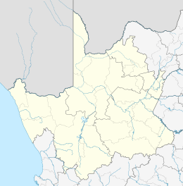 Riemvasmaak  Riemvasmaak  Riemvasmaak
| |
| Coordinates: 28°22′59″S 20°04′59″E / 28.383°S 20.083°ECoordinates: 28°22′59″S 20°04′59″E / 28.383°S 20.083°E | |
| Country | South Africa |
| Province | Northern Cape |
| District | ZF Mgcawu |
| Municipality | Kai !Garib |
| Area[1] | |
| • Total | 1.04 km2 (0.40 sq mi) |
| Population (2011)[1] | |
| • Total | 694 |
| • Density | 670/km2 (1,700/sq mi) |
| Racial makeup (2011)[1] | |
| • Black African | 23.6% |
| • Coloured | 43.7% |
| • Indian/Asian | 0.1% |
| • White | 0.3% |
| • Other | 32.3% |
| First languages (2011)[1] | |
| • Afrikaans | 95.3% |
| • English | 1.4% |
| • Xhosa | 1.0% |
| • Other | 2.3% |

Riemvasmaak is a settlement in ZF Mgcawu District Municipality in the Northern Cape province of South Africa. The name means ‘tighten the strap’ or ‘tied with straps’.[2]
Riemvasmaak is located near the Orange River, close to the Namibian border. It was originally settled in the early 1930s by people of Xhosa, Damara, Herero, Nama, and Coloured origin, but in the early 1970s the community was sent back to their ethnic homelands by the apartheid government.[3] The Damara group was sent to Khorixas in South-West Africa (today Namibia) and became known as Riemvasmakers. They were given land by Damara Chief Justus ǁGaroëb to settle in that area.[4]
Riemvasmaak became a military testing site until 1994, when a process of land restitution allowed the return of families and communities.[3] Some of the Namibian Riemvasmakers returned but a residual group founded their own traditional authority. They are seeking recognition from the Namibian government to be recognised as a separate Damara clan.[4]
The Riemvasmaakers land claim was successful and a large number returned to their ancestral lands in 1997 where the resettlement project has moved forward rather well.
Recently the Melkbosrand area, consisting of the farms or areas known as Hartebeesvlak, Blousyfer and Wabrand which covers the northern side of the Augrabies Gorge and the Augrabies Falls National Park. The area was deproclaimed by parliament (See Gov Gazette*** of ***) with the proviso that it be used for community based eco-tourism and conservation. 2015 should see the opening of this to the public.
References
- 1 2 3 4 "Main Place Riemvasmaak". Census 2011.
- ↑ "Riemvasmaak". Open Africa. Retrieved 12 January 2014.
- 1 2 "Jo Ractliffe. The Borderlands". www.stevenson.info. Retrieved 22 October 2014.
- 1 2 Miyanicwe, Clemans (22 October 2014). "Riemvasmakers seek recognition". The Namibian.
Municipalities and communities of ZF Mgcawu District Municipality, Northern Cape | ||
|---|---|---|
District seat: Upington | ||
| Kai !Garib | .svg.png) | |
| Kgatelopele | ||
| //Khara Hais | ||
| !Kheis | ||
| Mier | ||
| Tsantsabane | ||