Groblershoop
| Groblershoop | |
|---|---|
 Groblershoop  Groblershoop  Groblershoop
| |
| Coordinates: 28°53′50″S 21°59′4″E / 28.89722°S 21.98444°ECoordinates: 28°53′50″S 21°59′4″E / 28.89722°S 21.98444°E | |
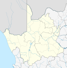
| Country | South Africa |
| Province | Northern Cape |
| District | ZF Mgcawu |
| Municipality | !Kheis |
| Established | 1936 |
| Area[1] | |
| • Total | 13.67 km2 (5.28 sq mi) |
| Population (2011)[1] | |
| • Total | 4,938 |
| • Density | 360/km2 (940/sq mi) |
| Racial makeup (2011)[1] | |
| • Black African | 9.0% |
| • Coloured | 85.1% |
| • Indian/Asian | 0.9% |
| • White | 4.2% |
| • Other | 0.8% |
| First languages (2011)[1] | |
| • Afrikaans | 93.3% |
| • Xhosa | 1.7% |
| • Tswana | 1.4% |
| • Other | 3.6% |
| Postal code (street) | 8850 |
| PO box | 8850 |
| Area code | 054 |
Groblershoop is a settlement in ZF Mgcawu District Municipality in the Northern Cape province of South Africa. It is situated about 2 km east of the Orange River.
Groblershoop was founded in 1914 on the farm Sternham, but was renamed in 1939 after Piet Grobler, a former Minister of Agriculture. The region became more developed after the construction of the Boegoeberg Dam and water channels in 1929. Known as the gateway to the Green Kalahari, the Groblershoop region is a major wine-producing area.[2]
References
- 1 2 3 4 "Main Place Groblershoop". Census 2011.
- ↑ "Groblershoop, Northern Cape". SA Travel Directory. Retrieved 12 January 2014.
Municipalities and communities of ZF Mgcawu District Municipality, Northern Cape | ||
|---|---|---|
District seat: Upington | ||
| Kai !Garib | .svg.png) | |
| Kgatelopele | ||
| //Khara Hais | ||
| !Kheis | ||
| Mier | ||
| Tsantsabane | ||
This article is issued from Wikipedia - version of the 11/25/2016. The text is available under the Creative Commons Attribution/Share Alike but additional terms may apply for the media files.