Resting Spring Range
| Resting Spring Range | |
|---|---|
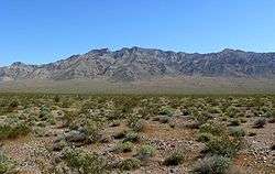
 West side of the Resting Spring Range seen from Pahrump, Nevada | |
| Highest point | |
| Elevation | 1,194 m (3,917 ft) |
| Geography | |
 location of Resting Spring Range in California [1] | |
| Country | United States |
| State | California |
| District | Inyo County |
| Range coordinates | 36°05′00″N 116°14′03″W / 36.0833°N 116.2342°WCoordinates: 36°05′00″N 116°14′03″W / 36.0833°N 116.2342°W |
| Topo map | USGS Twelvemile Spring |
East side of the Resting Spring Range seen from the Mojave Desert.
The Resting Spring Range is found in the eastern Mojave Desert of California near the Nevada state line in the United States. The range lies in a generally north-south direction to the west of the Nopah Range and southeast of the Amargosa Range and Greenwater Range.
The mountains, in Inyo County on the California side, lie between Highway 178 and Highway 127.
References
- ↑ "Resting Spring Range". Geographic Names Information System. United States Geological Survey. Retrieved 2009-05-04.
- Allan, Stuart (2005). California Road and Recreation Atlas. Benchmark Maps. p. 89. ISBN 0-929591-80-1.
This article is issued from Wikipedia - version of the 6/6/2013. The text is available under the Creative Commons Attribution/Share Alike but additional terms may apply for the media files.