Reidsville, Georgia
| Reidsville, Georgia | |
|---|---|
| City | |
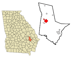 Location in Tattnall County and the state of Georgia | |
| Coordinates: 32°5′2″N 82°7′15″W / 32.08389°N 82.12083°WCoordinates: 32°5′2″N 82°7′15″W / 32.08389°N 82.12083°W | |
| Country | United States |
| State | Georgia |
| County | Tattnall |
| Area | |
| • Total | 7.7 sq mi (20 km2) |
| • Land | 7.7 sq mi (19.9 km2) |
| • Water | 0 sq mi (0.1 km2) |
| Elevation | 210 ft (64 m) |
| Population (2000) | |
| • Total | 2,235 |
| • Density | 290.3/sq mi (111.8/km2) |
| Time zone | Eastern (EST) (UTC-5) |
| • Summer (DST) | EDT (UTC-4) |
| ZIP codes | 30453, 30499 |
| Area code(s) | 912 |
| FIPS code | 13-64512[1] |
| GNIS feature ID | 0321516[2] |
Reidsville is a city in Tattnall County, Georgia, United States. The population was 2,594 at the 2010 census. The city is the county seat of Tattnall County.[3] The Georgia State Prison is near Reidsville.
History
Reidsville was founded about 1828 and was designated county seat of Tattnall County in 1832 by the Georgia General Assembly. It was incorporated as a town in 1838 and as a city in 1905.[4] The city was named after Robert R. Reid, territorial governor of Florida.[5]
Reidsville is home to the Nelson Hotel Bed & Breakfast.
During the events of World War Two, Reidsville was the home to at least one, though some reports suggest two, prisoner of war camps for captured Nazi personnel. The prison camp's location has largely been lost to time, but is believed to have stood near the current location of a gas station/self-storage company, near the fringes of the city. Archaeological research into the area has turned up a number of German artifacts, though with the development and addition of a number of houses, it is not clear if this was the location of the camp, or one of the many onion fields which the prisoners worked in.
Geography
Reidsville is located at 32°5′2″N 82°7′15″W / 32.08389°N 82.12083°W (32.083970, -82.120697).[6]
According to the United States Census Bureau, the city has a total area of 7.7 square miles (20 km2), of which 7.7 square miles (20 km2) are land and 0.04-square-mile (0.10 km2) (0.39%) is water.
Demographics
| Historical population | |||
|---|---|---|---|
| Census | Pop. | %± | |
| 1880 | 106 | — | |
| 1900 | 257 | — | |
| 1910 | 454 | 76.7% | |
| 1920 | 553 | 21.8% | |
| 1930 | 631 | 14.1% | |
| 1940 | 805 | 27.6% | |
| 1950 | 1,266 | 57.3% | |
| 1960 | 1,229 | −2.9% | |
| 1970 | 1,806 | 46.9% | |
| 1980 | 2,296 | 27.1% | |
| 1990 | 2,469 | 7.5% | |
| 2000 | 2,235 | −9.5% | |
| 2010 | 4,944 | 121.2% | |
| Est. 2015 | 2,616 | [7] | −47.1% |

As of the census[1] of 2000, there were 2,235 people, 894 households, and 544 families residing in the city. The population density was 291.1 people per square mile (112.4/km²). There were 1,131 housing units at an average density of 147.3 per square mile (56.9/km²). The racial makeup of the city was 57.58% White, 33.83% African American, 0.18% Native American, 0.45% Asian, 0.04% Pacific Islander, 6.98% from other races, and 0.94% from two or more races. Hispanic or Latino of any race were 8.37% of the population.
There were 894 households out of which 28.1% had children under the age of 18 living with them, 38.7% were married couples living together, 18.5% had a female householder with no husband present, and 39.1% were non-families. 35.5% of all households were made up of individuals and 16.2% had someone living alone who was 65 years of age or older. The average household size was 2.37 and the average family size was 3.08.
In the city, the population was spread out with 24.8% under the age of 18, 8.9% from 18 to 24, 25.6% from 25 to 44, 24.5% from 45 to 64, and 16.2% who were 65 years of age or older. The median age was 38 years. For every 100 females there were 96.7 males. For every 100 females age 18 and over, there were 92.4 males.
The median income for a household in the city was $25,901, and the median income for a family was $33,563. Males had a median income of $31,905 versus $20,184 for females. The per capita income for the city was $14,625. About 21.4% of families and 27.2% of the population were below the poverty line, including 40.2% of those under age 18 and 22.0% of those age 65 or over.
Government and infrastructure
The United States Postal Service operates the Reidsville Post Office.[9]
The Georgia Department of Corrections operates the Georgia State Prison in unincorporated Tattnall County, near Reidsville.[10]
Education
Tattnall County School District
The Tattnall County School District holds pre-school to grade twelve, and consists of three elementary schools, three middle schools, and a high school.[11] The district has 201 full-time teachers and over 3,305 students.[12]
- Collins Elementary School
- Glennville Elementary School
- Reidsville Elementary School
- Collins Middle School
- Glennville Middle School
- Reidsville Middle School
- Tattnall County High School
Notable people
- Linton McGee Collins - jurist
- Shannon Sharpe - former National Football League tight end[13]
- Sterling Sharpe - former National Football League wide receiver[14]
References
- 1 2 "American FactFinder". United States Census Bureau. Retrieved 2008-01-31.
- ↑ "US Board on Geographic Names". United States Geological Survey. 2007-10-25. Retrieved 2008-01-31.
- ↑ "Find a County". National Association of Counties. Retrieved 2011-06-07.
- ↑ Hellmann, Paul T. (May 13, 2013). Historical Gazetteer of the United States. Routledge. p. 243. Retrieved 30 November 2013.
- ↑ "Profile for Reidsville, Georgia". ePodunk. Retrieved 2010-06-14.
- ↑ "US Gazetteer files: 2010, 2000, and 1990". United States Census Bureau. 2011-02-12. Retrieved 2011-04-23.
- ↑ "Annual Estimates of the Resident Population for Incorporated Places: April 1, 2010 to July 1, 2015". Retrieved July 2, 2016.
- ↑ "Census of Population and Housing". Census.gov. Retrieved June 4, 2015.
- ↑ "Post Office Location - REIDSVILLE." United States Postal Service. Retrieved on September 14, 2010.
- ↑ "Georgia State Prison." Georgia Department of Corrections. Retrieved on September 14, 2010.
- ↑ Georgia Board of Education, Retrieved June 26, 2010.
- ↑ School Stats, Retrieved June 26, 2010.
- ↑ Shannon Sharpe
- ↑ Sterling Sharpe
Municipalities and communities of Tattnall County, Georgia, United States | ||
|---|---|---|
| Cities | 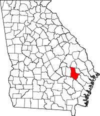 | |
| CDP | ||