Rea, Missouri
| Rea, Missouri | |
|---|---|
| City | |
|
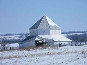
Octagonal barn in Rea on the National Register of Historic Places | |
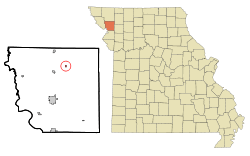 Location of Rea, Missouri | |
| Coordinates: 40°3′40″N 94°45′52″W / 40.06111°N 94.76444°WCoordinates: 40°3′40″N 94°45′52″W / 40.06111°N 94.76444°W | |
| Country | United States |
| State | Missouri |
| County | Andrew |
| Area[1] | |
| • Total | 0.12 sq mi (0.31 km2) |
| • Land | 0.12 sq mi (0.31 km2) |
| • Water | 0 sq mi (0 km2) |
| Elevation | 1,076 ft (328 m) |
| Population (2010)[2] | |
| • Total | 50 |
| • Estimate (2012[3]) | 50 |
| • Density | 416.7/sq mi (160.9/km2) |
| Time zone | Central (CST) (UTC-6) |
| • Summer (DST) | CDT (UTC-5) |
| ZIP code | 64480 |
| Area code(s) | 816 |
| FIPS code | 29-60842[4] |
| GNIS feature ID | 0730189[5] |
Rea is a city in Andrew County, Missouri, United States. The population was 50 at the 2010 census. It is part of the St. Joseph, MO–KS Metropolitan Statistical Area.
A post office called Rea has been in operation since 1888.[6] The city was named after Judge Joseph Rea, the original owner of the town site.[7]
History
The J. F. Roberts Octagonal Barn was listed on the National Register of Historic Places in 1999.[8]
Geography
Rea is located at 40°3′40″N 94°45′52″W / 40.06111°N 94.76444°W (40.061093, −94.764353).[9]
According to the United States Census Bureau, the city has a total area of 0.12 square miles (0.31 km2), all of it land.[1]
Demographics
| Historical population | |||
|---|---|---|---|
| Census | Pop. | %± | |
| 1920 | 127 | — | |
| 1930 | 94 | −26.0% | |
| 1940 | 128 | 36.2% | |
| 1950 | 110 | −14.1% | |
| 1960 | 90 | −18.2% | |
| 1970 | 54 | −40.0% | |
| 1980 | 78 | 44.4% | |
| 1990 | 62 | −20.5% | |
| 2000 | 56 | −9.7% | |
| 2010 | 50 | −10.7% | |
| Est. 2015 | 50 | [10] | 0.0% |
2010 census
As of the census[2] of 2010, there were 50 people, 25 households, and 12 families residing in the city. The population density was 416.7 inhabitants per square mile (160.9/km2). There were 25 housing units at an average density of 208.3 per square mile (80.4/km2). The racial makeup of the city was 100.0% White.
There were 25 households of which 20.0% had children under the age of 18 living with them, 40.0% were married couples living together, 4.0% had a female householder with no husband present, 4.0% had a male householder with no wife present, and 52.0% were non-families. 40.0% of all households were made up of individuals and 24% had someone living alone who was 65 years of age or older. The average household size was 2.00 and the average family size was 2.75.
The median age in the city was 49.3 years. 18% of residents were under the age of 18; 4% were between the ages of 18 and 24; 20% were from 25 to 44; 32% were from 45 to 64; and 26% were 65 years of age or older. The gender makeup of the city was 48.0% male and 52.0% female.
2000 census
As of the census[4] of 2000, there were 56 people, 24 households, and 16 families residing in the city. The population density was 461.2 people per square mile (180.2/km²). There were 25 housing units at an average density of 205.9 per square mile (80.4/km²). The racial makeup of the city was 100.00% White.
There were 24 households out of which 33.3% had children under the age of 18 living with them, 66.7% were married couples living together, and 29.2% were non-families. 25.0% of all households were made up of individuals and 8.3% had someone living alone who was 65 years of age or older. The average household size was 2.33 and the average family size was 2.76.
In the city the population was spread out with 23.2% under the age of 18, 1.8% from 18 to 24, 35.7% from 25 to 44, 26.8% from 45 to 64, and 12.5% who were 65 years of age or older. The median age was 40 years. For every 100 females there were 107.4 males. For every 100 females age 18 and over, there were 104.8 males.
The median income for a household in the city was $31,250, and the median income for a family was $37,188. Males had a median income of $35,625 versus $11,667 for females. The per capita income for the city was $13,639. There were no families and 4.3% of the population living below the poverty line, including no under eighteens and none of those over 64.
References
- 1 2 "US Gazetteer files 2010". United States Census Bureau. Retrieved 2012-07-08.
- 1 2 "American FactFinder". United States Census Bureau. Retrieved 2012-07-08.
- ↑ "Population Estimates". United States Census Bureau. Retrieved 2013-05-30.
- 1 2 "American FactFinder". United States Census Bureau. Retrieved 2008-01-31.
- ↑ "US Board on Geographic Names". United States Geological Survey. 2007-10-25. Retrieved 2008-01-31.
- ↑ "Post Offices". Jim Forte Postal History. Retrieved 30 August 2016.
- ↑ "Andrew County Place Names, 1928-1945 (archived)". The State Historical Society of Missouri. Retrieved 30 August 2016.
- ↑ National Park Service (2010-07-09). "National Register Information System". National Register of Historic Places. National Park Service.
- ↑ "US Gazetteer files: 2010, 2000, and 1990". United States Census Bureau. 2011-02-12. Retrieved 2011-04-23.
- ↑ "Annual Estimates of the Resident Population for Incorporated Places: April 1, 2010 to July 1, 2015". Retrieved July 2, 2016.
- ↑ "Census of Population and Housing". Census.gov. Retrieved June 4, 2015.
Municipalities and communities of Andrew County, Missouri, United States | ||
|---|---|---|
| Cities | 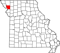 | |
| Villages | ||
| Townships | ||
| Unincorporated communities | ||
| Ghost towns | ||