Razbor, Šentjur
| Razbor | |
|---|---|
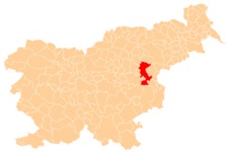
 Razbor Location in Slovenia | |
| Coordinates: 46°15′55.7″N 15°24′54.96″E / 46.265472°N 15.4152667°ECoordinates: 46°15′55.7″N 15°24′54.96″E / 46.265472°N 15.4152667°E | |
| Country |
|
| Traditional region | Styria |
| Statistical region | Savinja |
| Municipality | Šentjur |
| Area | |
| • Total | 2.69 km2 (1.04 sq mi) |
| Elevation | 326.8 m (1,072.2 ft) |
| Population (2002) | |
| • Total | 168 |
| [1] | |
Razbor (pronounced [ˈɾaːzbɔɾ]) is a settlement in the Municipality of Šentjur in eastern Slovenia. It lies in the hills between Ponikva and Dramlje. The Slovenian A1 motorway runs along the northwestern edge of the settlement's territory. The area is part of the historical Styria region. The municipality is now included in the Savinja Statistical Region.[2]
References
External links
This article is issued from Wikipedia - version of the 9/20/2016. The text is available under the Creative Commons Attribution/Share Alike but additional terms may apply for the media files.