Rathconnell (civil parish)
| Rathconnell Rú Chonaill | |
|---|---|
| Civil parish | |
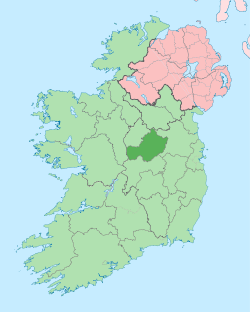
 Rathconnell Location of Rathconnell within County Westmeath in the Republic of Ireland | |
| Coordinates: 53°33′42″N 7°13′51″W / 53.56167°N 7.23083°WCoordinates: 53°33′42″N 7°13′51″W / 53.56167°N 7.23083°W | |
| Country |
|
| Province | Leinster |
| County | County Westmeath |
| Irish grid reference | N510571 |
Rathconnell (Irish: Rú Chonaill)[1] is a civil parish in County Westmeath, Ireland. It is located about 8.6 kilometres (5 mi) north–east of Mullingar.
Rathconnell is one of 3 civil parishes in the barony of Moyashel and Magheradernon in the Province of Leinster. The civil parish covers 16,206.9 acres (65.587 km2).
Rathconnell civil parish comprises 34 townlands: Aghadaugh, Ballycor, Ballynagall, Balrath North, Balrath West, Balreagh, Balreath East, Brittas, Cartron, Cloghanumera, Clondalever, Clonickilvant, Clonkill, Clonlost, Clonsheever, Cooksborough, Crosserdree, Curraghbrack, Curraghmore, County WestmeathCurraghmore, Drinmore, Edmondstown, Fennor, Jeffrystown, Killynan (Cooke), Killynan (Pratt), Knockdrin, Loughagar Beg, Loughagar More, Macetown, Moneylea, Mountrobert, Rathconnell, Reynella and Tevrin.
The neighbouring civil parishes are: Kilpatrick (barony of Fore), and Tyfarnham to the north, Killulagh (barony of Delvin), to the north–east, Killagh (Delvin) to the east, Killucan (barony of Farbill) to the south–east and south, Mullingar to the south–west and west and Portnashangan (barony of Corkaree) to the north–west.[2][3]
References
- ↑ Rathconnell civil parish Logainm.ie Retrieved on 15 June 2015.
- ↑ Rathconnell civil parish, Co. Westmeath Townlands.ie Retrieved on 15 June 2015.
- ↑ Rathconnell civil parish, Co. Westmeath The IreAtlas Townland Data Base Retrieved on 15 June 2015.
External links
- Rathconnell civil parish at the IreAtlas Townland Data Base
- Rathconnell civil parish at Townlands.ie
- Rathconnell civil parish at Logainm.ie