RAVeL network


RAVeL, French for réseau autonome de voies lentes[1] (autonomous network of slow ways), is a Walloon initiative aimed at creating a network of itineraries reserved for pedestrians, cyclists, horse riders and people with reduced mobility.
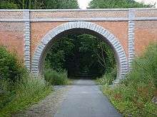
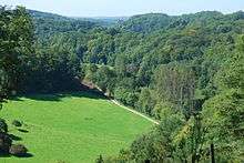
The network makes use of towpaths on river banks and disused railway or vicinal tramway lines. Old railway lines have been leased by the Walloon Government for 99 years using emphyteutic lease contracts.[2] Where necessary, new paths are created to link independent parts of the network together.
History
Before World War II, Belgium had the world's densest railway network, with around 10,000 kilometres (6,200 mi) of railway and vicinal tramway tracks. Large parts of this network were disused after the war, with the development of road infrastructure and the preference for private cars. Concurrently, towing paths along rivers were made obsolete by new, motorized boats.
In 1977, the Belgian Ministry of Public Works bought a large section of former SNCB line 142 between Hoegaarden and Eghezée, and converted a first section (in Jodoigne) into a pedestrian/cyclist path in 1985.
During the same period, other similar conversions of old railway lines are carried out in various parts of Belgium. The RAVeL project was initiated in 1995 and the first section opened in 1996, between Rochefort and Villers-sur-Lesse.[3] The project has the benefit of coordinating the various conversions to form a coherent, Wallonia wide network.
A 4 December 1997 ministerial order, aimed at classifying Walloon public roads into functional categories, provides an official status to the RAVeL network. At the end of 2004, the network spans on 885-kilometre (550 mi) of paths, and more than 1,000-kilometre (620 mi) at the end of 2008.
Characteristics
- Asphalt or concrete paths wherever possible
- Renovation of bridges, tunnels and other infrastructure along the paths
- Creation of access points such as stairs and ramps
- Creation of rest areas along the paths
- Secure road crossings
- Specific signage
Network structure
The RAVeL network is divided into :
- A backbone of five long distance itineraries (French: itinéraires), numbered from 1 to 5.
- A set of local, shorter sections (French: sections), generally named after the number of the former railway line they follow.
Additionally, sections earmarked for RAVeL conversion, with basic equipment but not yet to RAVeL standard, are labelled Pré-RAVeL.
The RAVeL is connected to similar networks in adjacent regions (Flanders) and countries (France, Luxembourg, Germany and Netherlands).
| # | Itinerary | Length | Remarks |
|---|---|---|---|
| 1 | Comines-Warneton - Tournai - Mons - Charleroi - Namur - Liège - Maastricht | 289.4-kilometre (179.8 mi) | Divided into 3 parts : - RAVeL 1 Ouest : Comines-Warneton - Mons - RAVeL 1 Centre : Mons - Namur - RAVeL 1 Est : Namur Maastricht |
| 2 | Mariembourg - Dinant - Namur - Jodoigne - Hoegaarden | 116.4-kilometre (72.3 mi) | |
| 3 | Erquelinnes - Charleroi - Tubize | 91.4-kilometre (56.8 mi) | |
| 4 | Saint-Aybert - Ath - Lessines - Geraardsbergen (Overboelare) | 52.9-kilometre (32.9 mi) | |
| 5 | Durbuy - Liège - Plombières | 90.7-kilometre (56.4 mi) | |
References
- ↑ RAVeL - Glossaire at ravel.wallonie.be
- ↑ Le RAVeL, 2004 at www.sentiers.be.
- ↑ RAVeL - Historique at ravel.wallonie.be.
External links
- Official site (French)
- Official map (French)