Erquelinnes
| Erquelinnes | ||
|---|---|---|
| Municipality | ||
 | ||
| ||
 Erquelinnes Location in Belgium | ||
|
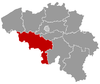
Location of Erquelinnes in Hainaut  | ||
| Coordinates: 50°18′N 04°07′E / 50.300°N 4.117°ECoordinates: 50°18′N 04°07′E / 50.300°N 4.117°E | ||
| Country | Belgium | |
| Community | French Community | |
| Region | Wallonia | |
| Province | Hainaut | |
| Arrondissement | Thuin | |
| Government | ||
| • Mayor | David Lavaux | |
| • Governing party/ies | IC | |
| Area | ||
| • Total | 44.23 km2 (17.08 sq mi) | |
| Population (1 January 2016)[1] | ||
| • Total | 9,920 | |
| • Density | 220/km2 (580/sq mi) | |
| Postal codes | 6560 | |
| Area codes | 071 | |
| Website | www.erquelinnes.be | |

Erquelinnes is a Walloon municipality located in the Belgian province of Hainaut. Located on the border with France, where the commune of Maubeuge lies, Erquelinnes had a total resident population of 9,549, in 2006. The total area is 44.23 km2 (17.08 sq mi) which gives a population density of 216 inhabitants per km².
The municipality consists of the following sub-municipalities: Erquelinnes proper, Bersillies-l'Abbaye, Grand-Reng, Hantes-Wihéries, Montignies-Saint-Christophe, and Solre-sur-Sambre.

Saint George's church
References
- ↑ Population per municipality as of 1 January 2016 (XLS; 397 KB)
External links
-
 Media related to Erquelinnes at Wikimedia Commons
 |
Estinnes | Merbes-le-Château | | |
| Vieux-Reng (FR-59) Jeumont (FR-59) |
|
|||
| ||||
| | ||||
| Colleret (FR-59) | Cousolre (FR-59), Bousignies-sur-Roc (FR-59) | Beaumont |
This article is issued from Wikipedia - version of the 12/1/2016. The text is available under the Creative Commons Attribution/Share Alike but additional terms may apply for the media files.