Râmnicu Sărat County
| Județul Râmnicu Sărat | ||
|---|---|---|
| County (Județ) | ||
| ||
 | ||
| Country |
| |
| Historic region | Wallachia | |
| Capital city (Reședință de județ) | Râmnicu Sărat | |
| Established | 1925 | |
| Ceased to exist | Administrative reform of 1950 | |
| Area | ||
| • Land | 3,324 km2 (1,283 sq mi) | |
| Population (1930) | ||
| • Total | 185,110 | |
| Time zone | EET (UTC+2) | |
| • Summer (DST) | EEST (UTC+3) | |

Râmnicu Sărat County is one of the historic counties of Wallachia, Romania. The county seat was Râmnicu Sărat.[1]
In 1938, the county was disestablished and incorporated into the newly formed Ținutul Dunării,[2] but it was re-established in 1940 after the fall of Carol II's regime - only to be abolished 10 years later by the Communist regime.[2]
Geography
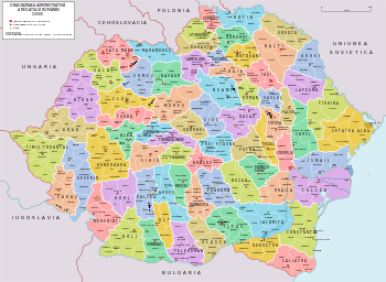
Râmnicu Sărat County covered 3,324 km2[1] and was located in Wallachia. Currently, the territory that comprised Râmnicu Sărat County is now included in the Brăila, Buzău and Vrancea counties. In the interwar period, the county neighbored Putna and Tecuci counties to the north, Covurlui County to the east, Brăila County to the southeast, and Buzău County to the southwest.[1]
Administrative organization
Administratively, Râmnicu Sărat County was divided into five districts (plăși):[1]
- Plasa Boldu
- Plasa Dumitreşti
- Plasa I. G. Duca
- Plasa Oraşul
- Plasa Plăineşti
Gallery
 Map of Râmnicu Sărat County (1938)
References
- 1 2 3 4 "Portretul României interbelice - Județul Râmnicu Sărat" (in Romanian). memoria.ro. Retrieved 17 August 2016.
- 1 2 "Organizarea administrativ-teritorială a României 1864-1989" (in Romanian). bzf.ro. 7 May 2013. Retrieved 17 August 2016.
External links
| Wikimedia Commons has media related to Interwar Râmnicu Sărat County. |
- (Romanian) Râmnicu Sărat County on memoria.ro