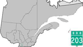
Quebec Route 203
| ||||
|---|---|---|---|---|
 | ||||
| Route information | ||||
| Maintained by Transports Québec | ||||
| Length: | 28.5 km[1] (17.7 mi) | |||
| Major junctions | ||||
| South end: |
CR-10 (Cannon Corners Rd.) Mooers, NY, USA | |||
|
| ||||
| North end: |
| |||
| Location | ||||
| Counties: | Le Haut-Saint-Laurent | |||
| Highway system | ||||
| ||||

Route 203 is a provincial highway located in the Montérégie region of Quebec south of Montreal. The highway starts from the Canada–United States border south of Havelock at the north end of County Road 10 at Cannon Corners at the Cannon Corners-Covey Hill Border Crossing in Mooers, NY. From there, it proceeds north toward Saint-Chrysostome, from there it follows the north shore of the Rivière des Anglais until it connects with Route 138 in Très-Saint-Sacrement just northeast of the enclaved municipality of Howick.
Municipalities along Route 203
Major intersections
| RCM or ET | Municipality | Km | Junction | Notes |
|---|---|---|---|---|
Southern terminus of Route 203 | ||||
| Le Haut-Saint-Laurent | Havelock | 0.0 | Cannon Corners Rd. | SOUTH: to Mooers, NY |
| 4.9 | 202 WEST: to Franklin 202 EAST: to Hemmingford (township) | |||
| Saint-Chrysostome | 11.4 | 209 SOUTH: to Franklin 209 NORTH: to Sainte-Clotilde | ||
| Très-Saint-Sacrement | 24.6 | Montée des Irlandais | EAST: to Saint-Urbain-Premier | |
| Howick | 26.0 | Rue Lambton | WEST: to Howick | |
| Très-Saint-Sacrement | 28.5 | 138 WEST: to Ormstown 138 EAST: to Sainte-Martine | ||
Northern terminus of Route 203 | ||||
See also
References
- ↑ Ministère des transports, "Distances routières", page 80, Les Publications du Québec, 2005
External links
- Official Transports Quebec road map (French)
- Route 203 on Google Maps
This article is issued from Wikipedia - version of the 11/9/2016. The text is available under the Creative Commons Attribution/Share Alike but additional terms may apply for the media files.