Pretty Prairie, Kansas
| Pretty Prairie, Kansas | |
|---|---|
| City | |
 Location within Reno County and Kansas | |
 KDOT map of Reno County (legend) | |
| Coordinates: 37°46′49″N 98°1′8″W / 37.78028°N 98.01889°WCoordinates: 37°46′49″N 98°1′8″W / 37.78028°N 98.01889°W | |
| Country | United States |
| State | Kansas |
| County | Reno |
| Area[1] | |
| • Total | 0.61 sq mi (1.58 km2) |
| • Land | 0.56 sq mi (1.45 km2) |
| • Water | 0.05 sq mi (0.13 km2) |
| Elevation | 1,572 ft (479 m) |
| Population (2010)[2] | |
| • Total | 680 |
| • Estimate (2015)[3] | 681 |
| • Density | 1,100/sq mi (430/km2) |
| Time zone | CST (UTC-6) |
| • Summer (DST) | CDT (UTC-5) |
| ZIP code | 67570 |
| Area code | 620 Exchange 459 |
| FIPS code | 20-57700 [4] |
| GNIS ID | 0473788 [5] |
Pretty Prairie is a city in Reno County, Kansas, United States. As of the 2010 census, the city population was 680.[6]
History
The first post office at Pretty Prairie was established in 1874.[7]
Pretty Prairie was laid out in 1889. It was named from its scenic setting upon the prairie.[8] Pretty Prairie was incorporated as a city in 1907.[9]
Geography
Pretty Prairie is located at 37°46′49″N 98°1′8″W / 37.78028°N 98.01889°W (37.780250, -98.018879).[10] According to the United States Census Bureau, the city has a total area of 0.61 square miles (1.58 km2), of which, 0.56 square miles (1.45 km2) is land and 0.05 square miles (0.13 km2) is water.[1]
Climate
The climate in this area is characterized by hot, humid summers and generally mild to cool winters. According to the Köppen Climate Classification system, Pretty Prairie has a humid subtropical climate, abbreviated "Cfa" on climate maps.[11]
Area events
- Pretty Prairie Rodeo, Kansas's Largest Night Rodeo.
Demographics
| Historical population | |||
|---|---|---|---|
| Census | Pop. | %± | |
| 1910 | 327 | — | |
| 1920 | 432 | 32.1% | |
| 1930 | 429 | −0.7% | |
| 1940 | 452 | 5.4% | |
| 1950 | 484 | 7.1% | |
| 1960 | 525 | 8.5% | |
| 1970 | 561 | 6.9% | |
| 1980 | 655 | 16.8% | |
| 1990 | 601 | −8.2% | |
| 2000 | 615 | 2.3% | |
| 2010 | 680 | 10.6% | |
| Est. 2015 | 681 | [3] | 0.1% |
| U.S. Decennial Census | |||
2010 census
As of the census[2] of 2010, there were 680 people, 272 households, and 190 families residing in the city. The population density was 1,214.3 inhabitants per square mile (468.8/km2). There were 304 housing units at an average density of 542.9 per square mile (209.6/km2). The racial makeup of the city was 96.0% White, 0.1% African American, 0.3% Native American, 0.1% Asian, 1.0% from other races, and 2.4% from two or more races. Hispanic or Latino of any race were 3.1% of the population.
There were 272 households of which 32.4% had children under the age of 18 living with them, 56.3% were married couples living together, 10.7% had a female householder with no husband present, 2.9% had a male householder with no wife present, and 30.1% were non-families. 27.6% of all households were made up of individuals and 16.2% had someone living alone who was 65 years of age or older. The average household size was 2.36 and the average family size was 2.84.
The median age in the city was 42.4 years. 25.3% of residents were under the age of 18; 5.1% were between the ages of 18 and 24; 21.9% were from 25 to 44; 23.1% were from 45 to 64; and 24.6% were 65 years of age or older. The gender makeup of the city was 47.2% male and 52.8% female.
2000 census
As of the census[4] of 2000, there were 615 people, 261 households, and 184 families residing in the city. The population density was 1,198.8 people per square mile (465.6/km²). There were 290 housing units at an average density of 565.3 per square mile (219.5/km²). The racial makeup of the city was 99.35% White, 0.16% Native American, 0.16% from other races, and 0.33% from two or more races. Hispanic or Latino of any race were 1.63% of the population.
There were 261 households out of which 31.0% had children under the age of 18 living with them, 61.3% were married couples living together, 7.7% had a female householder with no husband present, and 29.5% were non-families. 27.6% of all households were made up of individuals and 16.5% had someone living alone who was 65 years of age or older. The average household size was 2.36 and the average family size was 2.86.
In the city the population was spread out with 26.2% under the age of 18, 5.5% from 18 to 24, 26.7% from 25 to 44, 17.4% from 45 to 64, and 24.2% who were 65 years of age or older. The median age was 41 years. For every 100 females there were 102.3 males. For every 100 females age 18 and over, there were 94.8 males.
The median income for a household in the city was $32,857, and the median income for a family was $40,000. Males had a median income of $30,536 versus $18,125 for females. The per capita income for the city was $18,944. About 4.1% of families and 5.6% of the population were below the poverty line, including 4.1% of those under age 18 and 10.3% of those age 65 or over.
Notable people
- Walter A. Huxman, Governor of Kansas and jurist, was born in Pretty Prairie.
- Carl "Alfalfa" Switzer, who played the Alfalfa character on the Little Rascals/Our Gang series. Switzer lived in the town in 1954 while briefly married to Collingwood Grain heiress Dian Collingwood. Switzer appeared in minor roles in many movies.
- Jack Unruh Artist and Illustrator
See also
Further reading
References
- 1 2 "US Gazetteer files 2010". United States Census Bureau. Retrieved 2012-07-06.
- 1 2 "American FactFinder". United States Census Bureau. Retrieved 2012-07-06.
- 1 2 "Annual Estimates of the Resident Population for Incorporated Places: April 1, 2010 to July 1, 2015". Retrieved July 2, 2016.
- 1 2 "American FactFinder". United States Census Bureau. Retrieved 2008-01-31.
- ↑ "US Board on Geographic Names". United States Geological Survey. 2007-10-25. Retrieved 2008-01-31.
- ↑ "2010 City Population and Housing Occupancy Status". U.S. Census Bureau. Retrieved March 27, 2011.
- ↑ "Kansas Post Offices, 1828-1961, page 2". Kansas Historical Society. Retrieved 22 June 2014.
- ↑ Kansas State Historical Society (1916). Biennial Report of the Board of Directors of the Kansas State Historical Society. Kansas State Printing Plant. p. 268.
- ↑ Blackmar, Frank Wilson (1912). Kansas: A Cyclopedia of State History, Volume 2. Standard Publishing Company. p. 501.
- ↑ "US Gazetteer files: 2010, 2000, and 1990". United States Census Bureau. 2011-02-12. Retrieved 2011-04-23.
- ↑ Climate Summary for Pretty Prairie, Kansas
External links
| Wikimedia Commons has media related to Pretty Prairie, Kansas. |
- City
- Events
- Schools
- USD 311, local school district
- Historical
- Saving The Movie Theater? on YouTube, from Hatteberg's People on KAKE TV news
- Windblown, But a Pretty Prairie Restaurant Returns on YouTube, from Hatteberg's People on KAKE TV news
- Maps
- Pretty Prairie City Map, KDOT
Municipalities and communities of Reno County, Kansas, United States | ||
|---|---|---|
| Cities | 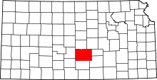 | |
| CDP | ||
| Unincorporated communities | ||
| Ghost towns | ||
| Townships |
| |