Prenj
| Prenj | |
|---|---|
 Prenj: Otiš and Zelena Glava | |
| Highest point | |
| Elevation | 2,115 m (6,939 ft) |
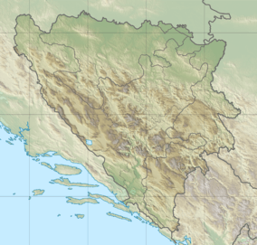
| Coordinates | 43°32′56″N 17°54′14″E / 43.549°N 17.904°ECoordinates: 43°32′56″N 17°54′14″E / 43.549°N 17.904°E |
| Geography | |
| Climbing | |
| Easiest route | 1) from Konjic through (eastern) Bijela valley into Tisovica. 2) from Mostar through (western) Bijela valley/ Grabovčići. |
Prenj is a mountain range in the Dinaric Alps of southern Bosnia and Herzegovina, located in eastern Herzegovina near Mostar, Jablanica and Konjic. The highest peak is Zelena glava at 2,115 m (6,939 ft). Prenj massif has at least 11 peaks over 2000 m.[1]
The name Prenj is derived from Perun, supreme deity of Slavic mythology. Geologically, the Prenj range is part of the Dinaric Alps and formed largely of secondary and tertiary sedimentary rock, mostly limestone and dolomite with notable characteristics of a karst landform. Due to subterranean drainage, Prenj is relatively dry with few water sources, just a few tiny lakes and some smaller streams that source from these mountains: the Baščica and the Bijela, tributaries of the Neretva.
Notable peaks are Zelena Glava (2115 m), Otiš (2097 m), Herač (2046 m), Osobac (2030 m), Velika Kapa (2007 m) and Lupoglav (1950 m).
The Prenj mountains were part of the front line during the 1992–95 war in Bosnia and heavy combat took place in the mountains surrounding the eastern Bijela valley and the slopes above Konjic. Nowadays, Prenj falls almost entirely within the territory of the Federation of Bosnia and Herzegovina. Contamination with land mines and unexploded ordnance is a serious threat, especially east of a line that can be drawn from Čelebići to the summit of Zelena Glava and then to the village of Ravni.[2] Former combat positions can be found as high up as the shoulders of Otiš at around 2000 meters. Nevertheless, Prenj is a very attractive destination for climbers and hikers. The peaks bear typical dolomitic features with vertical rock faces, soaring over green alpine valleys and dense mixed forests. Some mountain huts have re-opened (Bijele Vode, Hrasnica) and marked itineraries to the main peaks have been re-established.[3]
One of the peks of Prenj, Windy Peak, was climbed first time in October 2003. It is probably one of Europe's last virgin 2000 m peak.[1]
See also
References
- 1 2 "Dinaric Alps". SummitPost.org. Retrieved 2010-07-26.
Zelena glava 2,115 m (Prenj); North-Eastern Prenj: Borasnica (Osobac, 2,030 m) - Konjicka Bjelasnica (Velika Kapa 2,004 m); South-Western Prenj - Main Prenj Ridge: Botini (2,015 m) - Vjetrena brda (1,991 m) - Lupoglav (2,102 m) - Herac (2,046 m) - Galic (2,035 m) - Otis (2,097 m) - Zelena glava (2,115 m); Western Prenj - Vidovo (1,451 m) - Veliki Prenj (1,916 m) - Cetina (1,992 m); South-Eastern Prenj - Sivadije 1,967 m
- ↑ BiH Mine Action Centre (Annually updated) Mine Map
- ↑ Matias Gomez: Forgotten Beauty, a hiker's guide to BiH's 2000 meter peaks, page 55 to 80, ISBN 978-9958-630-59-0, Buybook, Sarajevo, 2005
External links
| Wikimedia Commons has media related to Prenj. |