Konjic
| Konjic Коњиц | ||
|---|---|---|
| Municipality and town | ||
.jpg) | ||
| ||
 Location of Konjic within Bosnia and Herzegovina. | ||
| Coordinates: 43°39′00″N 17°58′01″E / 43.650°N 17.967°E | ||
| Country | Bosnia and Herzegovina | |
| Government | ||
| • Municipality president | Emir Bubalo (SDA) | |
| Area | ||
| • Total | 1,169 km2 (451 sq mi) | |
| Population (2013 census) | ||
| • Total | 26,381 | |
| • Density | 23/km2 (60/sq mi) | |
| Time zone | CET (UTC+1) | |
| • Summer (DST) | CEST (UTC+2) | |
| Area code(s) | +387 36 | |
| Website |
www | |

Konjic is a town and municipality in Bosnia and Herzegovina. It is located in northern Herzegovina, around 50 kilometres (31 mi) southwest of Sarajevo. It is a mountainous, heavily wooded area, and is 268 m (879 ft) above sea level. The municipality extends on both sides of the Neretva River. The town of Konjic, housed about a third of the total municipality population.
The city is one of the oldest permanent settlements in Bosnia, dating back almost 4000 years; the city in its current incarnation arising as an important town in the late 14th century. Today, the population of Konjic municipality is estimated at 26,000 people.
History
The area near the town is believed to be settled up to 4000 years ago, and settlements around 2000 years ago by Illyrian tribes travelling upstream along the Neretva river have been found.[1] Konjic was earliest recorded by name in the records of the Republic of Ragusa on 16 June 1382.[2] The town, being part of the Bosnian kingdom, was incorporated into the Ottoman Empire, of which the lasting feature for the town (apart from the many mosques and bringing of Islamic faith) is the Ottoman-inspired bridge which features in the town's coat of arms, and later into the Austro-Hungarian Empire.

After World War I, the town, long with the rest of Bosnia and Herzegovina, became part of the Kingdom of Serbs, Croats and Slovenes later renamed Kingdom of Yugoslavia in 1929. During World War II, the town became part of the Independent State of Croatia, and following the war joined the Socialist Federal Republic of Yugoslavia. Between 1953 and 1979, a 611 square-metre atomic bunker, dug 300 metres into a mountain, known as ARK was built secretly by the government in the Konjic municipality, in which President Tito and about 350 people from the Yugoslav Government and ruling elite would have been able to find shelter.[3] The town grew significantly and prospered as a vibrant, multi-ethnic city with good transport links (the town is on the railway between Sarajevo and the Adriatic Sea), the large Igman ammunition factory and Yugoslav Army barracks. These factors became one of the main reasons for the conflict in the 1990s.
During the Bosnian War
During conflict in Yugoslavia, Konjic municipality was of strategic importance as it contained important communication links from Sarajevo to southern Bosnia and Herzegovina. During the siege of Sarajevo the route through Konjic was of vital importance to the Bosnian government forces. Furthermore, several important military facilities were contained in Konjic, including the Igman arms and ammunition factory, the JNA Ljuta barracks, the Reserve Command Site of the JNA, the Zlatar communications and telecommunications centre, and the Celebici barracks and warehouses.
Although the Konjic municipality did not have a majority Serb population and was not part of the declared "Serb autonomous regions", in March 1992, the self-styled "Serb Konjic Municipality" adopted a decision on the Serbian territories. The SDS, in co-operation with the JNA, had also been active in arming the Serb population of the municipality and in training paramilitary units and militias. According to Dr. Andrew James Gow, an expert witness for the Prosecution, the SDS distributed around 400 weapons to Serbs in the area.
Konjic was also included in those areas claimed by the HDZ in Bosnia and Herzegovina as part of the "Croatian Community of Herceg-Bosna", despite the fact that the Croats did not constitute a majority of the population there either (just a quarter of population in 1991, as the municipality was mixed). The Croatian Army units (known as the HVO) were established and armed in the municipality by April 1992.
Following the international recognition of the independent Bosnian state and the walk-out of SDS representatives from the Municipal Assembly a War Assembly was formed to take charge of the defence of the municipality. Between 20 April and early May 1992 Bosnian government forces seized control over most of the strategic assets of the Municipality and some armaments. However, Serb forces controlled the main access points to the municipality, effectively cutting it off from outside supply. Bosniak refugees began to arrive from outlying areas of the municipality expelled by Serbs, while Serb inhabitants of the town left for Serb-controlled villages according to the decision made by Serb leadership.[4]
On 4 May 1992, the first shells landed in Konjic town, fired by the JNA and other Serb forces from the slopes of Borasnica and Kisera. This shelling, which continued daily for over three years, until the signing of the Dayton Peace Agreement, inflicted substantial damage and resulted in the loss of many lives as well as rendering conditions for the surviving population even more unbearable. With the town swollen from the influx of refugees, there was a great shortage of accommodation as well as food and other basic necessities. Charitable organisations attempted to supply the local people with enough food but all systems of production foundered or were destroyed. It was not until August or September of that year that convoys from the United Nations High Commissioner for Refugees (UNHCR) managed to reach the town, and all communications links were cut off with the rest of the State. A clear priority for the Konjic authorities was the de-blocking of the routes to Sarajevo and Mostar. This objective required that the Serbian forces holding Bradina and Donje Selo, as well as those at Borci and other strategic points, be disarmed. Initially, an attempt was made at negotiation with the SDS and other representatives of the Serb people in Bradina and Donje Selo. This did not, however, achieve success for the Konjic authorities and plans were made for the launching of military operations by the Joint Command.[4]
The first area to be targeted was the village of Donje Selo. On 20 May 1992 forces of the TO and HVO entered the village. Bosnian government soldiers moved through Viniste towards the villages of Cerići and Bjelovcina. Cerići, which was the first shelled, was attacked around 22 May and some of its inhabitants surrendered. The village of Bjelovcina was also attacked around that time. According to witnesses heard by the ICTY, the Serb-populated village of Bradina was shelled in the late afternoon and evening of 25 May and then soldiers in both camouflage and black uniforms appeared, firing their weapons and setting fire to buildings. Many of the population sought to flee and some withdrew to the centre of the village. These people were, nonetheless, arrested at various times around 27 and 28 May, by TO, HVO and MUP soldiers and police.[5]
These military operations resulted in the arrest of many members of the Serb population and it was thus necessary to create a facility where they could be imprisoned and questioned about their role in war crimes during the siege of Konjic. The former JNA Čelebići compound was chosen out of necessity as the appropriate facilities for the detention of prisoners in Konjic. The majority of the prisoners who were detained between April and December 1992 were men, captured during and after the military operations at Bradina and Donje Selo and their surrounding areas. At the end of May, several groups were transferred to the Čelebići prison camp from various locations. In its judgement in the Delalić case the ICTY found that some Serb prisoners had been beaten, tortured and several murdered by the camp guards, and two women at the camp had been raped (one of them Grozdana Cecez, identity of other woman is unknown). Some of Čelebići prison guards (such as a guard with last name Tucaković) beheaded Sćepan Cećez and used his head as a football kicking it around.
Cultural heritage
Stara Ćuprija bridge

Konjička Stara Ćuprija (Stara Ćuprija = English: Old Bridge) was built between 1682 and 1683 by Ali-aga Hasečić (as shown by a stone plaque at the center of the bridge). It was built over six slightly pointed stone arches. It is the best preserved Ottoman bridge in Bosnia and Herzegovina. The arches were destroyed by the retreating German army in March 1945. The bridge was rebuilt in its original state between 2003 and 2009. The bridge is now proclaimed a National Monument of Bosnia and Herzegovina.
D-0 ARK Underground Biennal of Contemporary Art
Konjijc hosts a Biennial of Contemporary Art since 2011, called "D-0 ARK Underground" which is located in ARK.[6] The project, which the Council of Europe called the best cultural event in 2011, was curated by Petar Cukovic, Branislav Dimitrijevic in 2011 and Branko Franceschi and Bashak Shenove in 2013.[7]
Natural heritage
Neretva river
.JPG)
The Neretva is largest karst river in the Dinaric Alps in the entire eastern part of the Adriatic basin, which belongs to the Adriatic river watershed. The total length is 230 km (140 mi), of which 208 km (129 mi) are in Bosnia and Herzegovina, while the final 22 km (14 mi) are in the Dubrovnik-Neretva County of Croatia.[8][9] The municipality of Konjic includes at least half of the area of the Upper Neretva (Bosnian: Gornja Neretva), which is the upper course of the Neretva river. Geographically and hydrologically the Neretva is divided into three sections.[9] The upper course of the Neretva river is simply called the Upper Neretva (Bosnian: Gornja Neretva), and includes a vast area around the Neretva, numerous streams and well-springs, three major glacial lakes near the river (and even more lakes, outside the municipality of Konjic, scattered across the mountains of Treskavica and Zelengora in the wider area of the Upper Neretva), one artificial lake (Jablaničko), mountains and forests, and native flora and fauna. All this natural heritage together with the cultural heritage of the Upper Neretva, represent rich and valuable resources of Bosnia and Herzegovina as well as Europe. The Upper Neretva has water of Class I purity[10] and is almost certainly the coldest river water in the world, often as low as 7–8 °C (45–46 °F) in the summer months.
Rakitnica river
The Rakitnica river is the main tributary of the Upper Neretva. The Rakitnica forms a 26 km (16 mi)-long canyon (of its 32 km (20 mi) length), that stretches between Bjelašnica and Visočica to the southeast of Sarajevo.[11] There is a hiking trail along the ridge of the canyon, at a level of 800 m (2,600 ft) above the river, all the way to the village of Lukomir. Lukomir is the only remaining traditional semi-nomadic Bosniak mountain village in Bosnia and Herzegovina.
At almost 1,500 m (4,900 ft), the village of Lukomir, with its unique stone homes with cherry-wood roof tiles, is the highest and most isolated mountain village in the country. Indeed, access to the village is impossible from the first snows in December until late April and sometimes even later, except by skis or on foot. A newly constructed lodge is now complete to receive guests and hikers.
Boračko lake
Jablaničko lake
Jablaničko Lake (Bosnian: Jablaničko jezero) is a large artificially-formed lake on the Neretva river, right below Konjic where the Neretva briefly expands into a wide valley. The river provided much fertile, agricultural land before the lake flooded most of the valley.
The lake was created in 1953 after construction of a high gravitational hydroelectric dam near Jablanica in central Bosnia and Herzegovina.
The lake has an irregular elongated shape. Its width varies along its length. The lake is a popular vacation destination in Bosnia and Herzegovina. Swimming, boating and especially fishing are popular activities on the lake. There are 13 types of fish in the lake's ecosystem. Many weekend cottages have been built along the shores of the lake.
Prenj mountain
Endemic and endangered species
Trout
The river Neretva and its tributaries represent the main drainage system in the east Adriatic watershed and the foremost ichthyofaunal habitat of the region. Salmonidae fish from the Neretva basin show considerable variation in morphology, ecology and behaviour. Neretva also has many other endemic and fragile life forms that are near extinction. Among most endangered are three endemic species of Neretva trout: Neretvanska Mekousna (Salmo obtusirostris oxyrhynchus),[12] Zubatak (Salmo dentex)[13] and Glavatica (Salmo marmoratus).[14]
All three endemic trout species of Neretva are endangered mostly due to destruction of the habitat and hybridisation with introduced trouts and illegal fishing as well as poor management of water and fisheries (dams, overfishing, mismanagement).[15][16]
Ecology and protection
Dam problems
The benefits brought by dams have often come at a great environmental and social cost,[17][18][19] as dams destroy ecosystems and cause people to lose their homes and livelihoods.
The Neretva and two main tributaries are already harnessed, by four HE power-plants with large dams on Neretva, one HE power-plants with major dam on the Neretva tributary Rama, and two HE power-plants with one major dam on the Trebišnjica river, which is considered as part of the Neretva watershed.
Also, the government of the Federation of Bosnia and Herzegovina entity has unveiled plans to build three more hydroelectric power plants with major dams (as over 150.5 meters in height)[20] upstream from the existing plants, beginning with Glavaticevo Hydro Power Plant in the nearby Glavatičevo village, then going even more upstream Bjelimići Hydro Power Plant and Ljubuča Hydro Power Plant located near the villages with a same names; and in addition one more at the Neretva headwaters gorge, near the very source of the river in entity of Republic of Srpska by its entity government. This, if realized, would completely destroyed this jewel among rivers, so its strongly opposed and protested by numerous environmentalist organizations and NGO's, domestic[21] as well as international,[22][23][24] who wish for the canyon, considered at least beautiful as the Tara canyon in Bosnia and Herzegovina and nearby Montenegro, to remain untouched and unspoiled, hopefully protected too.[25][26]
Moreover, the same Government Of FBiH preparing a parallel plan to form a huge National Park which include entire region of Gornja Neretva (English: Upper Neretva), and within Park those three hydroelectric power plants, which is unheard in the history of environmental protection. The latest idea is that the park should be divided in two, where the Neretva should be excluded from both and, in fact, become the boundary between parks.
This is a cuning plan of engineers and related ministry in Government Of FBiH and should leave the river available for the construction of three large dams, and give them hope in order to remove the fear of contradiction in the plans for environmental protection in the area and the flooding its very heart, in terms of natural values – the Neretva. Of course, such deception failed, because the concerned citizens from the local community are not given bluff, as well as concerned citizens of whole country, and its particularly strongly opposed by NGOs and other institutions and organizations that are interested in "establishing the National Park of Upper Neretva towards the professional and scientific principles and not according to the needs of electric energy lobby".[27][28]
Settlements
- Argud
- Bale
- Bare
- Barmiš
- Bijela
- Bjelovčina
- Blace
- Blučići
- Borci
- Boždarevići
- Bradina
- Brđani
- Budišnja Ravan
- Bukovica
- Bukovlje
- Bulatovići
- Bušćak
- Buturović Polje
- Cerići
- Crni Vrh
- Čelebići
- Čelina
- Česim
- Čičevo
- Čuhovići
- Dobričevići
- Dolovi
- Doljani
- Donja Vratna Gora
- Donje Selo
- Donje Višnjevice
- Donji Čažanj
- Donji Gradac
- Donji Nevizdraci
- Donji Prijeslop
- Došćica
- Dubočani
- Dubravice
- Dudle
- Dužani
- Džajići
- Džanići
- Džepi
- Falanovo Brdo
- Gakići
- Galjevo
- Glavatičevo
- Gobelovina
- Gorani
- Goransko Polje
- Gorica
- Gornja Vratna Gora
- Gornje Višnjevice
- Gornji Čažanj
- Gornji Gradac
- Gornji Nevizdraci
- Gostovići
- Grabovci
- Gradeljina
- Grušča
- Hasanovići
- Herići
- Homatlije
- Homolje
- Hondići
- Idbar
- Jasenik
- Javorik
- Jezero
- Ježeprosina
- Jošanica
- Kale
- Kanjina
- Kašići
- Konjic
- Kostajnica
- Koto
- Krajkovići
- Kralupi
- Krtići
- Krupac
- Krušćica
- Kula
- Lađanica
- Lisičići
- Lokva
- Luka
- Lukomir
- Lukšije
- Ljesovina
- Ljubuča
- Ljuta
- Mladeškovići
- Mokro
- Mrkosovice
- Obrenovac
- Obri
- Odžaci
- Orahovica
- Orlište
- Oteležani
- Ovčari
- Pačerani
- Parsovići
- Plavuzi
- Podhum
- Podorašac
- Pokojište
- Polje Bijela
- Požetva
- Prevlje
- Radešine
- Raotići
- Rasvar
- Razići
- Redžići
- Repovci
- Repovica
- Ribari
- Ribići
- Seljani
- Seonica
- Sitnik
- Slavkovići
- Solakova Kula
- Sopot
- Spiljani
- Stojkovići
- Strgonice
- Studenčica
- Sultići
- Svijenča
- Šunji
- Tinje
- Tovarnica
- Treboje
- Trešnjevica
- Trusina
- Tuhobići
- Turija
- Ugošće
- Veluša
- Vinište
- Vrbljani
- Vrci
- Vrdolje
- Zabrđani
- Zabrđe
- Zagorice
- Zaslivlje
- Zukići
Ethnic distribution
1971
40,879 total
- Bosniaks - 21,599 (52.83%)
- Croats - 12,034 (29.43%)
- Serbs - 6,669 (16.31%)
- Yugoslavs - 202 (0.49%)
- others - 375 (0.94%)
1991
According to the 1991 census, the municipality of Konjic had 43,878 residents: 23,815 Bosniaks (54.3%), 11,513 Croats (26.2%), 6,620 Serbs (15.1%), and 1,930 others (4.4%).[29]
Notable people
- Zulfikar Džumhur, writer, painter and caricaturist
- Davor Jozić, retired footballer
- Lazar Drljača, painter
- Hazim Delić, Bosniak deputy commander and convicted war criminal
- Nermin Nikšić, Prime Minister of the Federation of Bosnia and Herzegovina
- Tijana Arnautović, model
- Ante Pavelić, Poglavnik, Fascist leader of the Axis Powers allied Independent State of Croatia
- Ante Marković, the last prime minister of the Socialist Federal Republic of Yugoslavia
- Smail Prevljak, footballer
- Dragan Stojković - Bosanac, Bosnian compositor and accordion virtuoso
References
- ↑ Bosna i Hercegovina ...::: Informativno-turisticki portal BiH :::... KONJIC
- ↑ http://www.herceg-tourism.com/towns/konjic.htm
- ↑ Exploring Tito's Cold War bunker, http://gulfnews.com/life-style/travel/exploring-tito-s-cold-war-bunker-1.1042780
- 1 2 Judgement ICTY vs Delic et al., 16 November 1998
- ↑ Paragraphs 138-139, Judgement ICTY vs Delic et al., 16 November 1998
- ↑ http://www.bijenale.ba/#about
- ↑ "Contemporary Arts Biennale kicks off in Kojic". Balkan Insight. Retrieved 13 May 2013.
- ↑ "Neretva River Sub-basin". INWEB Internationally Shared Surface Water Bodies in the Balkan Region. Retrieved 19 March 2009. External link in
|publisher=(help) - 1 2 "Hydrological characteristics of Bosnia and Herzegovina – Adriatic watershed". Hydro-meteorological institute of Federation of B&H. Retrieved 10 March 2009. External link in
|publisher=(help) - ↑ "Water Quality Protection Project – Environmental Assessment". World Bank. Retrieved 18 June 2009. External link in
|publisher=(help) - ↑ BHTourism - Rakitnica
- ↑ "Salmo obtusirostris". Balkan Trout Restoration Group. Retrieved 10 March 2009. External link in
|publisher=(help) - ↑ "Salmo dentex". Balkan Trout Restoration Group. Retrieved 10 March 2009. External link in
|publisher=(help) - ↑ "Salmo marmoratus". Balkan Trout Restoration Group. Retrieved 10 March 2009. External link in
|publisher=(help) - ↑ Freyhof, J.; Kottelat, M. (2008). "Salmo dentex". 2008 IUCN Red List of Threatened Species. Retrieved 5 August 2007. External link in
|publisher=(help) - ↑ Crivelli, A.J. (2006). "Salmo marmoratus". 2006 IUCN Red List of Threatened Species. Retrieved 5 August 2007. External link in
|publisher=(help) - ↑ "Hydroelectric power's dirty secret revealed". New Scientist - Environment. Retrieved 18 June 2009. External link in
|publisher=(help) - ↑ "Our view of the Hydroelectrical Power Station System "Upper Neretva"" (PDF). ZELENI-NERETVA Konjic NGO For Preservation Of The Neretva River And Environment Protection. Retrieved 22 June 2009. External link in
|publisher=(help) - ↑ "Dams–Impact of dams". Science Encyclopedia, vol.2.
- ↑ "Methodology and Technical Notes". Watersheds of the World. Archived from the original on 4 July 2007. Retrieved 1 August 2007.
A large dam is defined by the industry as one higher than 15 meters high and a major dam as higher than 150.5 meters.
- ↑ "ZELENI-NERETVA Konjic NGO For Preservation Of The Neretva River And Environment Protection". Retrieved 10 March 2009.
- ↑ "Water power: the upper Neretva River, Bosnia-Herzegovina". WWF - World Wide Fund. Retrieved 10 March 2009. External link in
|publisher=(help) - ↑ "Fondacija Heinrich Böll". Retrieved 24 March 2009.
- ↑ "REC – The Regional Environmental Center for Central and Eastern Europe". Retrieved 24 March 2009.
- ↑ "Living Neretva". WWF - World Wide Fund. Retrieved 18 March 2009. External link in
|publisher=(help) - ↑ "Declaration For The Protection Of The Neretva River". ZELENI-NERETVA Konjic NGO For Preservation Of The Neretva River And Environment Protection. Retrieved 22 June 2009. External link in
|publisher=(help) - ↑ Silenced Rivers: The Ecology and Politics of Large Dams, by Patrick McCully, Zed Books, London, 1996
- ↑ "Arguments Pro&Contra – Why Are We Contra The Hydroelectrical Power Station System "Upper Neretva"" Check
|url=value (help). ZELENI-NERETVA Konjic NGO For Preservation Of The Neretva River And Environment Protection. Retrieved 22 June 2009. External link in|publisher=(help) - ↑ Paragraph 121, Judgement ICTY vs Delic et al., 16 November 1998
External links
| Wikimedia Commons has media related to Konjic. |
- Municipal Website of Konjic (Bosnian)
- Website of Konjic (Bosnian) (English)
Municipalities of the Herzegovina-Neretva Canton | ||
|---|---|---|
| Countries | 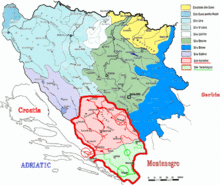 | ||||||
|---|---|---|---|---|---|---|---|
| Places | |||||||
| Tributaries |
| ||||||
| Lakes |
| ||||||
| Related articles | |||||||
Coordinates: 43°39′15.9″N 17°57′38.8″E / 43.654417°N 17.960778°E