Pottsville, Arkansas
| Pottsville, Arkansas | |
|---|---|
| City | |
|
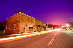
"Downtown" Pottsville | |
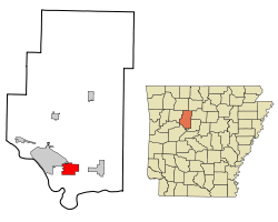 Location in Pope County and the state of Arkansas | |
| Coordinates: 35°14′56″N 93°2′49″W / 35.24889°N 93.04694°WCoordinates: 35°14′56″N 93°2′49″W / 35.24889°N 93.04694°W | |
| Country | United States |
| State | Arkansas |
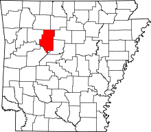
| County | Pope |
| Area | |
| • Total | 7.5 sq mi (19.4 km2) |
| • Land | 7.5 sq mi (19.4 km2) |
| • Water | 0 sq mi (0 km2) |
| Elevation | 381 ft (116 m) |
| Population (2000) | |
| • Total | 1,271 |
| • Density | 169.5/sq mi (65.5/km2) |
| Time zone | Central (CST) (UTC-6) |
| • Summer (DST) | CDT (UTC-5) |
| ZIP code | 72858 |
| Area code(s) | 479 |
| FIPS code | 05-56990 |
| GNIS feature ID | 0078087 |
Pottsville is a city[1] in Pope County, Arkansas, United States. As of the 2010 census the population was 2,838. It is part of the Russellville Micropolitan Statistical Area.
Geography
Pottsville is located at 35°14′56″N 93°2′49″W / 35.24889°N 93.04694°W (35.248856, -93.046820).[2] It is surrounded by Russellville to the west, Atkins to the east, and Crow Mountain to the north.
According to the United States Census Bureau, the town has a total area of 7.5 square miles (19 km2). 7.5 square miles (19 km2) of it is land and 0.04 square miles (0.10 km2) of it (0.27%) is water.
Demographics
| Historical population | |||
|---|---|---|---|
| Census | Pop. | %± | |
| 1900 | 192 | — | |
| 1910 | 205 | 6.8% | |
| 1920 | 275 | 34.1% | |
| 1930 | 293 | 6.5% | |
| 1940 | 308 | 5.1% | |
| 1950 | 224 | −27.3% | |
| 1960 | 250 | 11.6% | |
| 1970 | 411 | 64.4% | |
| 1980 | 564 | 37.2% | |
| 1990 | 984 | 74.5% | |
| 2000 | 1,271 | 29.2% | |
| 2010 | 2,838 | 123.3% | |
| Est. 2015 | 3,082 | [3] | 8.6% |
As of the 2000 census the population stood at 1,271, with 475 households and 372 families residing in the town. The population density was 169.3 inhabitants per square mile (65.3/km²). There were 500 housing units at an average density of 66.6 per square mile (25.7/km²). The racial makeup of the town was 95.67% White, 0.79% Black or African American, 0.71% Native American, 0.79% Asian, 0.16% from other races, and 1.89% from two or more races. 0.55% of the population were Hispanic or Latino of any race.
There were 475 households out of which 38.1% had children under the age of 18 living with them, 63.4% were married couples living together, 9.1% had a female householder with no husband present, and 21.5% were non-families. 18.1% of all households were made up of individuals and 8.8% had someone living alone who was 65 years of age or older. The average household size was 2.68 and the average family size was 3.02.
In the town the population was spread out with 26.8% under the age of 18, 7.6% from 18 to 24, 31.2% from 25 to 44, 22.5% from 45 to 64, and 11.9% who were 65 years of age or older. The median age was 36 years. For every 100 females there were 100.2 males. For every 100 females age 18 and over, there were 99.8 males.
The median income for a household in the town was $32,841, and the median income for a family was $37,763. Males had a median income of $27,237 versus $18,625 for females. The per capita income for the town was $15,066. About 12.6% of families and 16.7% of the population were below the poverty line, including 27.8% of those under age 18 and 10.0% of those age 65 or over.
Life
There are few large businesses in Pottsville with most or all being family- or self-owned. Workers for large companies usually commute to larger cities like Russellville.
The major events in the year are Butterfield Days, celebrating the history of the town when the Butterfield stagecoach Route ran through the town. This directly caused the rise of the town when the Potts family set up a boarding house for travellers to rest, creating a place for people to stay, instead of continuing onward. The Potts Inn is now a museum.
Basketball was the crowning sport in Pottsvile, before the recreation of a football team in 2002, which was the first Pottsville football team since the 1930s). Ultra-modern facilities have been in place at the high school for about seven years, replacing most of the older gymnasium which is now at the Middle Grades and Elementary grounds. That gym itself was the replacement for the old rock gym which was torn down in 2000 to build an annex to the Middle Grades building. These were probably inspired by the age and unique pine smell of the building. Recently there has been a new football facility added to further advance the beloved football team.
A large portion of people who are affiliated with Pottsville, though not inside the rather small city limits and thus not a portion of the population, reside on Crow Mountain - a hill which covers nearly as much area as the town of Pottsville itself and rises no more than about 250 feet in any area. Landmarks include Galla Creek. While the majority of people living here were once of the Jones clan, times have caused diversification and thinning of that family, showing how the community has grown.
References
- ↑ Local.Arkansas.gov - Pottsville, retrieved September 3, 2012
- ↑ "US Gazetteer files: 2010, 2000, and 1990". United States Census Bureau. 2011-02-12. Retrieved 2011-04-23.
- ↑ "Annual Estimates of the Resident Population for Incorporated Places: April 1, 2010 to July 1, 2015". Retrieved July 2, 2016.
- ↑ "Census of Population and Housing". Census.gov. Retrieved June 4, 2015.
External links
- Pottsville High School Web Site