Porterville Municipal Airport
| Porterville Municipal Airport Porterville Army Airfield | |||||||||||
|---|---|---|---|---|---|---|---|---|---|---|---|
|
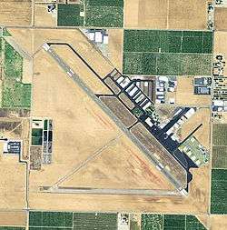
2006 USGS Photo | |||||||||||
| IATA: PTV – ICAO: KPTV – FAA LID: PTV | |||||||||||
| Summary | |||||||||||
| Airport type | Public | ||||||||||
| Owner | City of Porterville | ||||||||||
| Serves | Porterville, California | ||||||||||
| Elevation AMSL | 442 ft / 135 m | ||||||||||
| Coordinates | 36°01′47″N 119°03′46″W / 36.02972°N 119.06278°W | ||||||||||
| Map | |||||||||||
 KPTV Location of Porterville Municipal Airport | |||||||||||
| Runways | |||||||||||
| |||||||||||
| Statistics (2009) | |||||||||||
| |||||||||||
Porterville Municipal Airport (IATA: PTV, ICAO: KPTV, FAA LID: PTV) is a city-owned public-use airport located three nautical miles (6 km) southwest of the central business district of Porterville, a city in Tulare County, California, United States.[1] According to the FAA's National Plan of Integrated Airport Systems for 2009–2013, it is categorized as a general aviation facility.[2]
History
The airport was opened in September 1942 as Porterville Army Airfield and was used by the United States Army Air Forces Fourth Air Force as a training base during World War II. It was a sub-base to Lemoore AAF, being used as a pilot training facility. Improvements to the site included a fueling system utilizing nine underground storage tanks. These tanks were filled and abandoned in place. Also located on site are ten fueling pits, which are presently unused. The field had the Air Echelon element from the Western Signal Aviation Unit Training Center at Camp Pinedale.
At the end of the war the airfield was determined to be excess by the military and turned over to the local government for civil use. The War Assets Administration disposed of the property between 1948 and 1953. In 1948, 835 acres (3.38 km2) were returned to Porterville. The remaining land was sold to the Tulare County Housing Authority. [3]
Facilities and aircraft
Porterville Municipal Airport covers an area of 940 acres (380 ha) at an elevation of 442 feet (135 m) above mean sea level. It has one runway designated 12/30 with an asphalt surface measuring 5,908 by 150 feet (1,801 x 46 m).[1] A shorter east-west runway (25/7), once occasionally closed and used for NHRA sanctioned drag racing in the mid-1960s, was permanently closed during the 1980s.
For the 12-month period ending January 30, 2009, the airport had 43,550 aircraft operations, an average of 119 per day: 98% general aviation, 2% air taxi, and <1% military. At that time there were 92 aircraft based at this airport: 73% single-engine, 11% multi-engine, 10% helicopter and 6% ultralight.[1]
Airlines and Destinations
Passenger
| Airlines | Destinations |
|---|---|
| WestAir | Las Vegas, Reno, Mammoth Lakes |
See also
References
![]() This article incorporates public domain material from the Air Force Historical Research Agency website http://www.afhra.af.mil/.
This article incorporates public domain material from the Air Force Historical Research Agency website http://www.afhra.af.mil/.
- 1 2 3 4 FAA Airport Master Record for PTV (Form 5010 PDF). Federal Aviation Administration. Effective 3 June 2010.
- ↑ National Plan of Integrated Airport Systems for 2009–2013: Appendix A: Part 1 (PDF, 1.33 MB). Federal Aviation Administration. Updated 15 October 2008.
- ↑ Thole, Lou (1999), Forgotten Fields of America : World War II Bases and Training, Then and Now - Vol. 2. Publisher: Pictorial Histories Pub, ISBN 1-57510-051-7
External links
- FAA Terminal Procedures for PTV, effective December 8, 2016
- Resources for this airport:
- FAA airport information for PTV
- AirNav airport information for KPTV
- ASN accident history for PTV
- FlightAware airport information and live flight tracker
- NOAA/NWS latest weather observations
- SkyVector aeronautical chart, Terminal Procedures
| Airfields |
| .svg.png) |
|---|---|---|
| Units | ||