Port de Lers
| Port de Lers | |
|---|---|
 | |
| Elevation | 1,517 m (4,977 ft)[1] |
| Traversed by | D18 |
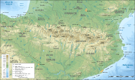
| Location | Ariège, France |
| Range | Pyrenees |
| Coordinates | 42°48′23″N 1°24′41″E / 42.80639°N 1.41139°ECoordinates: 42°48′23″N 1°24′41″E / 42.80639°N 1.41139°E |
 Port de Lers Location of Port de Lers | |
The Port de Lers (or Port de l'Hers or Port de Massat) (elevation 1,517 m (4,977 ft)) is a mountain pass in the French Pyrenees in the department of Ariège, between the communities of Aulus-les-Bains (west), Massat (north) and Vicdessos (east).
Details of climb
Starting from Vicdessos, the climb is 11.5 km (7.1 mi) long. Over this distance, the climb is 807 m (2,648 ft) (an average of 7.0%), with the steepest section being at 10.9%.[2]
Starting from Massat, the climb is 16.6 km (10.3 mi) long. Over this distance, the climb is 868 m (2,848 ft) (an average of 5.2%), with the steepest sections being at 8.9%.[3] At 3.8 km (2.4 mi) from the summit is the junction with the climb to the Col d'Agnes.
Appearances in Tour de France
The Port de Lers was first used in the Tour de France in 1995, since when it has featured four times, most recently in 2012.[4]
| Year | Stage | Category | Start | Finish | Leader at the summit |
|---|---|---|---|---|---|
| 2012 | 14 | 1 | Limoux | Foix | |
| 2011 | 14 | 3 | Saint-Gaudens | Plateau de Beille | |
| 2004 | 13 | 3 | Lannemezan | Plateau de Beille | |
| 1995 | 14 | 2 | Saint-Orens-de-Gameville | Guzet-Neige |
References
- ↑ IGN map
- ↑ "Port de Lers – Vicdessos". www.climbbybike.com. Retrieved 19 September 2011.
- ↑ "Port de Lers – Massat". www.climbbybike.com. Retrieved 19 September 2011.
- ↑ "Le Port de Lers dans le Tour de France" (in French). Retrieved 16 July 2012.