Point Hope, Alaska
| Point Hope Tikiġaq | |
|---|---|
| City | |
 Point Hope Location in Alaska | |
| Coordinates: 68°20′49″N 166°45′47″W / 68.34694°N 166.76306°WCoordinates: 68°20′49″N 166°45′47″W / 68.34694°N 166.76306°W | |
| Country | United States |
| State | Alaska |
| Borough | North Slope |
| Incorporated | January 5, 1966[1] |
| Government | |
| • Mayor | Jack Schaefer[2] |
| • State senator | Donald Olson (D) |
| • State rep. | Benjamin Nageak (D) |
| Area | |
| • Total | 6.4 sq mi (16.6 km2) |
| • Land | 6.3 sq mi (16.4 km2) |
| • Water | 0.1 sq mi (0.2 km2) |
| Elevation | 7 ft (2 m) |
| Population (2010) | |
| • Total | 674 |
| • Density | 110/sq mi (41/km2) |
| Time zone | Alaska (AKST) (UTC-9) |
| • Summer (DST) | AKDT (UTC-8) |
| ZIP code | 99766 |
| Area code | 907 |
| FIPS code | 02-61630 |
Point Hope (Inupiaq: Tikiġaq) is a city in North Slope Borough, Alaska, United States. At the 2010 census the population was 674.
History

Before any modern settlement, the Ipiutak lived here.
The descriptive Inuit name of the place, "Tikarakh" or "Tikigaq", commonly spelled "Tiagara", means "forefinger". It was recorded as "Tiekagagmiut" in 1861 by P. Tikhmeniev Wich of the Russian Hydrographic Department and on Russian Chart 1495 it became "Tiekaga". This ancient village site was advantageous, because the protrusion of Point Hope into the sea brought the whales close to the shore. At Tikigaq, they built semi-subterranean houses using mainly whalebone and driftwood. Point Hope is one of the oldest continually occupied sites in North America. While some of the earlier dwellings have been lost to erosion as the point shrinks, it still provides a welter of valuable information to archaeologists on how early Eskimos survived in their harsh environment. The Tikigaq site is "by far the most extensive and complete one-period site yet discovered and described in the entire circumpolar region." - Helge Larsen.[3]
The first recorded Europeans to sight this cape were Russian explorers Mikhail Vasiliev and Gleb Shishmaryov of the Imperial Russian Navy on the ships Otkrietie and Blagonamierennie. Vasiliev and Shishmaryov named this landhead Mys Golovnina, after Vice Admiral Vasily Golovnin (1776–1831).
The cape at Point Hope was renamed by Captain Frederick William Beechey of the Royal Navy, who wrote on August 2, 1826: "I named it Point Hope in compliment to Sir William Johnstone Hope". According to Archdeacon Stuck[4] Hope was from a "well-known house long connected with the sea".[5]
Point Hope residents successfully opposed Project Chariot in 1958. The project would have involved buried thermonuclear detonations some 30 miles (48 km) from the village to create a deep-water artificial harbor, which would only have been usable about three months out of the year.
Geography
Point Hope is located in the Point Hope landhead, at the northwestern end of the Lisburne Peninsula, on the Chukchi Sea coast, 40 mi. SW of Cape Lisburne, Arctic Slope at 68°20′49″N 166°45′47″W / 68.34694°N 166.76306°W (68.347052, -166.762917).[6]
According to the United States Census Bureau, the city has a total area of 6.4 square miles (17 km2), of which, 6.3 square miles (16 km2) of it is land and 0.1 square miles (0.26 km2) of it (1.09%) is water.
Climate
| Climate data for Point Hope | |||||||||||||
|---|---|---|---|---|---|---|---|---|---|---|---|---|---|
| Month | Jan | Feb | Mar | Apr | May | Jun | Jul | Aug | Sep | Oct | Nov | Dec | Year |
| Average high °C (°F) | −16 (3) |
−16 (3) |
−16 (3) |
−8 (18) |
0 (32) |
6 (43) |
11 (52) |
10 (50) |
7 (45) |
0 (32) |
−7 (19) |
−11 (12) |
−3.3 (26) |
| Average low °C (°F) | −21 (−6) |
−22 (−8) |
−22 (−8) |
−14 (7) |
−4 (25) |
1 (34) |
6 (43) |
7 (45) |
3 (37) |
−4 (25) |
−12 (10) |
−17 (1) |
−8.2 (17.1) |
| Average relative humidity (%) | 77 | 76 | 72 | 71 | 79 | 79 | 76 | 76 | 73 | 80 | 79 | 82 | 76.7 |
| Source: http://www.tititudorancea.com/z/weather_point_hope_alaska_united_states.htm | |||||||||||||
Demographics
| Historical population | |||
|---|---|---|---|
| Census | Pop. | %± | |
| 1890 | 301 | — | |
| 1900 | 623 | 107.0% | |
| 1910 | 243 | −61.0% | |
| 1940 | 257 | — | |
| 1950 | 264 | 2.7% | |
| 1960 | 324 | 22.7% | |
| 1970 | 386 | 19.1% | |
| 1980 | 464 | 20.2% | |
| 1990 | 639 | 37.7% | |
| 2000 | 757 | 18.5% | |
| 2010 | 674 | −11.0% | |
| Est. 2015 | 701 | [7] | 4.0% |
As of the 2010 United States Census, there were 674 people residing in the city. The racial makeup of the city was 87.8% Native American, 5.8% White, 0.4% Black, 0.1% from some other race and 3.9% from two or more races. 1.9% were Hispanic or Latino of any race.
As of the census[9] of 2000, there were 757 people, 186 households, and 151 families residing in the city. The population density was 119.4 people per square mile (46.1/km²). There were 215 housing units at an average density of 33.9 per square mile (13.1/km²). The racial makeup of the city was 8.72% White, 0.13% Black or African American, 87.05% Native American, 0.13% Asian, 0.13% from other races, and 3.83% from two or more races. 1.72% of the population were Hispanic or Latino of any race.
There were 186 households out of which 54.8% had children under the age of 18 living with them, 50.0% were married couples living together, 19.4% had a female householder with no husband present, and 18.3% were non-families. 13.4% of all households were made up of individuals and 2.2% had someone living alone who was 65 years of age or older. The average household size was 4.07 and the average family size was 4.50.
In the city the age distribution of the population shows 42.5% under the age of 18, 11.6% from 18 to 24, 26.0% from 25 to 44, 14.7% from 45 to 64, and 5.2% who were 65 years of age or older. The median age was 22 years. For every 100 females there were 122.6 males. For every 100 females age 18 and over, there were 118.6 males.
The median income for a household in the city was $63,125, and the median income for a family was $66,250. Males had a median income of $41,750 versus $35,625 for females. The per capita income for the city was $16,641. About 13.9% of families and 14.8% of the population were below the poverty line, including 17.3% of those under age 18 and 16.2% of those age 65 or over.
Sports
The high-school boys' basketball team has won three consecutive Class 2-A Alaska championships. Basketball became popular before a gymnasium was built, and passing became important as dribbling was difficult on makeshift courts and on snow. An up-tempo, skillful passing game has characterized play since then by the Harpooners and Harponerettes, as the boys' and girls' teams are known, enabling them to beat rival schools from districts with much larger population bases.[10]
Notable people
- John B. Driggs a physician who wrote Short Sketches of Oldest America (1905), a collection of stories and sketches of the Inupiat natives of Point Hope.
- Caroline Cannon was awarded the Goldman Environmental Prize in 2012. In addition to her environmental activism, Cannon has served on Point Hope's city council on and off for many years, including serving as mayor from 1998 to 2001. She is a current member of the city council.[2]
References
- ↑ "Directory of Borough and City Officials 1974". Alaska Local Government. Juneau: Alaska Department of Community and Regional Affairs. XIII (2): 66. January 1974.
- 1 2 2015 Alaska Municipal Officials Directory. Juneau: Alaska Municipal League. 2015. p. 127.
- ↑ The Firecracker Boys, O'Neill
- ↑ 1920, p. 96
- ↑ USGS
- ↑ "US Gazetteer files: 2010, 2000, and 1990". United States Census Bureau. 2011-02-12. Retrieved 2011-04-23.
- ↑ "Annual Estimates of the Resident Population for Incorporated Places: April 1, 2010 to July 1, 2015". Retrieved July 2, 2016.
- ↑ "Census of Population and Housing". Census.gov. Retrieved June 4, 2015.
- ↑ "American FactFinder". United States Census Bureau. Retrieved 2008-01-31.
- ↑ Point Hope Alaska Basketball, NYTimes, 5 Nov 2011
Municipalities and communities of North Slope Borough, Alaska, United States | ||
|---|---|---|
| Cities | 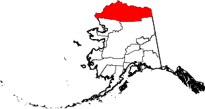 | |
| CDPs | ||
| Unincorporated communities | ||
| Ghost towns | ||