Wainwright, Alaska
| Wainwright Ulġuniq | |
|---|---|
| City | |
|
Wainwright during the summer months with the Arctic Ocean in the background | |
 Wainwright Location in Alaska | |
| Coordinates: 70°38′50″N 160°00′58″W / 70.64722°N 160.01611°WCoordinates: 70°38′50″N 160°00′58″W / 70.64722°N 160.01611°W | |
| Country | United States |
| State | Alaska |
| Borough | North Slope |
| Incorporated | December 31, 1962[1] |
| Government | |
| • Mayor | John Hopson, Jr.[2] |
| • State senator | Donald Olson (D) |
| • State rep. | Benjamin Nageak (D) |
| Area | |
| • Total | 42.5 sq mi (109.9 km2) |
| • Land | 17.6 sq mi (45.5 km2) |
| • Water | 24.9 sq mi (64.5 km2) |
| Elevation | 26 ft (8 m) |
| Population (2010)[3] | |
| • Total | 556 |
| • Density | 13/sq mi (5.1/km2) |
| Time zone | Alaska (AKST) (UTC-9) |
| • Summer (DST) | AKDT (UTC-8) |
| ZIP code | 99782 |
| Area code | 907 |
| FIPS code | 02-82750 |
| GNIS feature ID | 1411728, 2418869 |

Wainwright (WANE-rite)[4] (Ulġuniq in Iñupiaq), also known as Ulguniq or Kuuk, is a city[3][5] in North Slope Borough, Alaska, United States. At the 2010 census the population was 556,[3] making it the third largest city in the North Slope Borough. The community was named after Wainwright Lagoon, which in turn was named after Lt. John Wainwright, an officer under Capt. F.W. Beechey, who both discovered the lagoon in 1826. Wainwright was founded in 1904.
Geography and climate
Wainwright is located at 70°38′50″N 160°0′58″W / 70.64722°N 160.01611°W (70.647185, -160.016216),[6] on the Chukchi Sea about 72 miles southwest of Barrow.
According to the United States Census Bureau, the city has a total area of 42.5 square miles (110 km2), of which, 17.6 square miles (46 km2) of it is land and 24.9 square miles (64 km2) of it (58.63%) is water.
Wainwright has an Arctic climate with temperatures all the way from -56 to 80°F. There is little precipitation, mostly snow. The Chukchi Sea is unfrozen from mid-July through September.
| Climate data for Wainwright | |||||||||||||
|---|---|---|---|---|---|---|---|---|---|---|---|---|---|
| Month | Jan | Feb | Mar | Apr | May | Jun | Jul | Aug | Sep | Oct | Nov | Dec | Year |
| Record high °F (°C) | 38 (3) |
35 (2) |
36 (2) |
40 (4) |
45 (7) |
66 (19) |
80 (27) |
76 (24) |
70 (21) |
43 (6) |
37 (3) |
30 (−1) |
80 (27) |
| Average high °F (°C) | −6.4 (−21.3) |
−12.9 (−24.9) |
−8.3 (−22.4) |
7.9 (−13.4) |
26.9 (−2.8) |
41.6 (5.3) |
50 (10) |
47.3 (8.5) |
36.7 (2.6) |
23 (−5) |
8 (−13) |
−5.5 (−20.8) |
17.36 (−8.1) |
| Daily mean °F (°C) | −13.8 (−25.4) |
−19.9 (−28.8) |
−15.4 (−26.3) |
0.6 (−17.4) |
21.1 (−6.1) |
36 (2) |
43.2 (6.2) |
41.7 (5.4) |
32.4 (0.2) |
17.6 (−8) |
1.7 (−16.8) |
−12.1 (−24.5) |
11.09 (−11.62) |
| Average low °F (°C) | −21.2 (−29.6) |
−26.9 (−32.7) |
−22.4 (−30.2) |
−6.8 (−21.6) |
15.2 (−9.3) |
30.3 (−0.9) |
36.3 (2.4) |
36.1 (2.3) |
28.1 (−2.2) |
12.2 (−11) |
−4.7 (−20.4) |
−18.6 (−28.1) |
4.8 (−15.11) |
| Record low °F (°C) | −50 (−46) |
−56 (−49) |
−49 (−45) |
−38 (−39) |
−14 (−26) |
14 (−10) |
22 (−6) |
21 (−6) |
6 (−14) |
−19 (−28) |
−37 (−38) |
−50 (−46) |
−56 (−49) |
| Average rainfall inches (mm) | 0.15 (3.8) |
0.1 (3) |
0.15 (3.8) |
0.3 (8) |
0.2 (5) |
0.26 (6.6) |
1.57 (39.9) |
2.06 (52.3) |
0.56 (14.2) |
0.77 (19.6) |
0.17 (4.3) |
0.08 (2) |
6.37 (162.5) |
| Average precipitation days | 3 | 2 | 3 | 5 | 5 | 4 | 9 | 12 | 8 | 9 | 5 | 2 | 67 |
| Source: WRCC | |||||||||||||
Demographics
| Historical population | |||
|---|---|---|---|
| Census | Pop. | %± | |
| 1920 | 99 | — | |
| 1930 | 197 | 99.0% | |
| 1940 | 341 | 73.1% | |
| 1950 | 227 | −33.4% | |
| 1960 | 253 | 11.5% | |
| 1970 | 315 | 24.5% | |
| 1980 | 405 | 28.6% | |
| 1990 | 492 | 21.5% | |
| 2000 | 546 | 11.0% | |
| 2010 | 556 | 1.8% | |
| Est. 2015 | 580 | [7] | 4.3% |
As of the 2010 United States Census, there were 556 people residing in the city. The racial makeup of the city was 90.1% Native American, 7.9% White and 1.6% from two or more races. 0.4% were Hispanic or Latino of any race.
At the 2000 census,[9] there were 546 people, 148 households and 117 families residing in the city. The population density was 31.1 per square mile (12.0/km²). There were 179 housing units at an average density of 10.2 per square mile (3.9/km²). The racial makeup of the city was 6.78% White, 0.18% Black or African American, 90.29% Native American, and 2.75% from two or more races.
There were 148 households of which 50.0% had children under the age of 18 living with them, 50.7% were married couples living together, 16.2% had a female householder with no husband present, and 20.3% were non-families. 18.2% of all households were made up of individuals and 3.4% had someone living alone who was 65 years of age or older. The average household size was 3.69 and the average family size was 4.17.
37.7% of the population were under the age of 18, 13.4% from 18 to 24, 27.8% from 25 to 44, 14.3% from 45 to 64, and 6.8% who were 65 years of age or older. The median age was 24 years. For every 100 females there were 114.1 males. For every 100 females age 18 and over, there were 117.9 males.
The median household income was $54,722 and the median family income was $58,125. Males had a median income of $36,667 versus $40,313 for females. The per capita income for the city was $16,709. About 8.5% of families and 12.5% of the population were below the poverty line, including 18.4% of those under age 18 and 5.3% of those age 65 or over.
Education
There is one school in Wainwright, the Alak School, which serves students pre-k through grade 12.[10]
See also
References
- ↑ 1996 Alaska Municipal Officials Directory. Juneau: Alaska Municipal League/Alaska Department of Community and Regional Affairs. January 1996. p. 157.
- ↑ 2015 Alaska Municipal Officials Directory. Juneau: Alaska Municipal League. 2015. p. 161.
- 1 2 3 "Wainwright city, Alaska". Profile of General Population and Housing Characteristics: 2010 Demographic Profile Data. United States Census Bureau. Retrieved January 23, 2013.
- ↑ "Wainwright". Division of Community and Regional Affairs, Alaska Department of Commerce, Community and Economic Development. Retrieved January 23, 2013.
- ↑ "Alaska Taxable 2011: Municipal Taxation - Rates and Policies" (PDF). Division of Community and Regional Affairs, Alaska Department of Commerce, Community and Economic Development. January 2012.
- ↑ "US Gazetteer files: 2010, 2000, and 1990". United States Census Bureau. 2011-02-12. Retrieved 2011-04-23.
- ↑ "Annual Estimates of the Resident Population for Incorporated Places: April 1, 2010 to July 1, 2015". Retrieved July 2, 2016.
- ↑ "Census of Population and Housing". Census.gov. Retrieved June 4, 2015.
- ↑ "American FactFinder". United States Census Bureau. Retrieved 2008-01-31.
- ↑ Alak School / Homepage. N.p., n.d. Web. 08 Aug. 2013. <http://www.nsbsd.org/Domain/12>.
External links
Municipalities and communities of North Slope Borough, Alaska, United States | ||
|---|---|---|
| Cities | 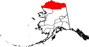 | |
| CDPs | ||
| Unincorporated communities | ||
| Ghost towns | ||