Plattsburgh (town), New York
| Plattsburgh | |
|---|---|
| Town | |
| Town of Plattsburgh | |
|
Cumberland Head on Lake Champlain | |
_highlighted.svg.png) Location in Clinton County and the state of New York. | |
 Plattsburgh Location within the state of New York | |
| Coordinates: 44°41′17″N 73°29′44″W / 44.68806°N 73.49556°WCoordinates: 44°41′17″N 73°29′44″W / 44.68806°N 73.49556°W | |
| Country | United States |
| State | New York |
| County | Clinton |
| Government | |
| • Type | Town Council |
| • Town Supervisor | Michael S. Cashman (D) |
| • Town Council |
Members' List
|
| Area | |
| • Total | 68.2 sq mi (176.7 km2) |
| • Land | 45.9 sq mi (118.9 km2) |
| • Water | 22.3 sq mi (57.7 km2) |
| Elevation | 276 ft (84 m) |
| Population (2010) | |
| • Total | 11,870 |
| • Density | 258/sq mi (99.8/km2) |
| Time zone | Eastern (EST) (UTC-5) |
| • Summer (DST) | EDT (UTC-4) |
| ZIP codes | 12901, 12903 |
| Area code(s) | 518 |
| FIPS code | 36-58585 |
| GNIS feature ID | 0979377 |
| Website |
townofplattsburgh |
%2C_1832-1910.jpg)
Plattsburgh is a town in Clinton County, New York, in the United States. The population was 11,870 at the 2010 census.[1] The town is named after Zephaniah Platt, an early land owner. The town of Plattsburgh surrounds the separate and more populous city of Plattsburgh. The town is in the eastern part of the county, in the state of New York. The region's airport, Plattsburgh International Airport, is located in the southern part of the town.
History
The town was established in 1785, but parts were removed later to form other towns of the county: Peru (1792), Beekmantown (1820), Saranac (1824), and Schuyler Falls (1848).
The Battle of Plattsburgh was fought in 1814 on Lake Champlain during the War of 1812.
The village of Plattsburgh set itself off from the town by incorporation in 1815. The village became the city of Plattsburgh in 1902.
Geography
According to the United States Census Bureau, the town has a total area of 68.2 square miles (176.7 km2), of which 45.9 square miles (118.9 km2) is land and 22.3 square miles (57.7 km2), or 32.68%, is water.[1]
The town borders Lake Champlain, which separates it from Vermont. The Saranac River flows eastward through the town to Lake Champlain.
The Adirondack Northway (Interstate 87), U.S. Route 9, and New York State Route 22 are north-south highways through the town. New York State Route 3, New York State Route 22B, and New York State Route 374 are east-west highways. New York State Route 190 intersects NY-22B and NY-374 in Plattsburgh.
Demographics
| Historical population | |||
|---|---|---|---|
| Census | Pop. | %± | |
| 1820 | 3,519 | — | |
| 1830 | 4,913 | 39.6% | |
| 1840 | 6,416 | 30.6% | |
| 1850 | 5,618 | −12.4% | |
| 1860 | 6,680 | 18.9% | |
| 1870 | 8,414 | 26.0% | |
| 1880 | 8,283 | −1.6% | |
| 1890 | 2,490 | −69.9% | |
| 1900 | 3,178 | 27.6% | |
| 1910 | 2,362 | −25.7% | |
| 1920 | 2,085 | −11.7% | |
| 1930 | 2,132 | 2.3% | |
| 1940 | 3,163 | 48.4% | |
| 1950 | 3,713 | 17.4% | |
| 1960 | 13,390 | 260.6% | |
| 1970 | 15,881 | 18.6% | |
| 1980 | 16,384 | 3.2% | |
| 1990 | 17,231 | 5.2% | |
| 2000 | 11,184 | −35.1% | |
| 2010 | 11,870 | 6.1% | |
| Est. 2014 | 11,839 | [2] | −0.3% |
As of the census[4] of 2000, there were 11,190 people, 4,367 households, and 3,091 families residing in the town. The population density was 244.9 people per square mile (94.6/km²). There were 4,875 housing units at an average density of 106.7 per square mile (41.2/km²). The racial makeup of the town was 96.68% White, 1.07% Black or African American, 0.38% Native American, 0.55% Asian, 0.01% Pacific Islander, 0.44% from other races, and 0.88% from two or more races. Hispanic or Latino of any race were 1.04% of the population.
There were 4,367 households out of which 33.8% had children under the age of 18 living with them, 55.0% were married couples living together, 10.9% had a female householder with no husband present, and 29.2% were non-families. 21.9% of all households were made up of individuals and 7.9% had someone living alone who was 65 years of age or older. The average household size was 2.53 and the average family size was 2.94.
In the town the population was spread out with 25.6% under the age of 18, 7.6% from 18 to 24, 29.7% from 25 to 44, 25.0% from 45 to 64, and 12.2% who were 65 years of age or older. The median age was 37 years. For every 100 females there were 98.4 males. For every 100 females age 18 and over, there were 94.1 males.
The median income for a household in the town was $41,713, and the median income for a family was $50,277. Males had a median income of $36,542 versus $25,565 for females. The per capita income for the town was $19,385. About 8.8% of families and 11.9% of the population were below the poverty line, including 14.2% of those under age 18 and 14.4% of those age 65 or over.
Law and government
As of 2016 the Town Board consisted of:
- Michael S. Cashman – supervisor
- Meg LeFevre – deputy supervisor/councilor
- Tom Wood – councilor
- Martin Mannix – councilor
- Barb Hebert– councilor
Regular meetings of the board are the first and third Monday of each month at 6:00 p.m. Informal open meetings of the board are on the second and fourth Monday of each month at 6:00 p.m.
Other elected town officials include:
- Jim Woods - highway superindentant
- Jacqueline Bellew – receiver of taxes
- Rickey J Collins – town clerk
Communities and locations in the town
- Cadyville – A hamlet in the southwestern part of the town on NY-3 and the Saranac River.
- Champlain Park – A hamlet on Cumberland Head in the northeastern part of the town.
- Cliff Haven – A neighborhood on the shore of Lake Champlain south of the city of Plattsburgh.
- Clinton County Airport (PLB) – A closed airport west of the city by NY-22B.
- Colligan Point – A location on the east shore of Cumberland Head.
- Crab Island – A small island and undeveloped state park in Lake Champlain east of Cliff Haven.
- Cumberland Bay – A bay of Lake Champlain formed by Cumberland Head on its east side. The city of Plattsburgh is sited on the west shore of the bay.
- Cumberland Bay State Park – A state park in the northeast part of the town, on Cumberland Head.
- Cumberland Head – A peninsula on the Lake Champlain shoreline, known for its unique style of Monte Cristo sandwich.
- Elsinor – A hamlet at the west town line on NY-3 and the Saranac River.
- Everest Rabideau Park – A park on Cumberland Head.
- Halseys Corners – A hamlet near the city of Plattsburgh by the Northway.
- Lawless Corners – A hamlet on the north town line, north of West Plattsburgh.
- Martin Point – A location on the east shore of Cumberland Head.
- Morrisonville – A hamlet at the south town line on NY-22B and the Saranac River.
- Plattsburgh – The city of Plattsburgh is situated in what was once the east-central part of the town.
- Plattsburgh International Airport – The current airport of the area, located on the site of the former Plattsburgh Air Force Base south of the city of Plattsburgh.
- Pleasant Ridge Corners – A hamlet southwest of the city and north of South Plattsburgh.
- Rocky Point – A hamlet on Cumberland Head.
- South Junction – A hamlet near Lake Champlain in the southeast part of the town.
- South Plattsburgh – A hamlet by the town line in the southeast part of the town on NY-22.
- Valcour Island – The north end of the island is in the town.
- West Plattsburgh – A hamlet in the north central part of the town on NY-374.
- Woodruff Pond – A small lake north of Cumberland Head.
Census-designated places in the town
- Cumberland Head, New York
- Morrisonville, New York (partially in the town)
- Parc, New York
- Plattsburgh West, New York
References
- 1 2 "Geographic Identifiers: 2010 Demographic Profile Data (G001): Plattsburgh town, Clinton County, New York". U.S. Census Bureau, American Factfinder. Retrieved December 4, 2014.
- ↑ "Annual Estimates of the Resident Population for Incorporated Places: April 1, 2010 to July 1, 2014". Retrieved June 4, 2015.
- ↑ "Census of Population and Housing". Census.gov. Retrieved June 4, 2015.
- ↑ "American FactFinder". United States Census Bureau. Retrieved 2008-01-31.
External links
- Official Town of Plattsburgh website
- Plattsburgh-North Country Chamber of Commerce
- Historic and cultural information and photos
- Northern New York American Canadian Genealogical Society - Genealogy and Family History for Clinton County, NY
Municipalities and communities of Clinton County, New York, United States | ||
|---|---|---|
| City | 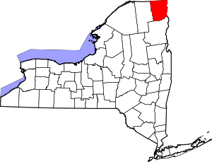 | |
| Towns | ||
| Villages | ||
| CDPs | ||
| Other hamlets | ||
| Footnotes | ‡This populated place also has portions in an adjacent county or counties | |