Pitogo, Quezon
| Pitogo | |
|---|---|
| Municipality | |
|
Conversion of Saint Paul Church; Pitogo, Quezon | |
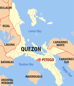 Map of Quezon showing the location of Pitogo | |
.svg.png) Pitogo Location within the Philippines | |
| Coordinates: 13°47′N 122°05′E / 13.783°N 122.083°ECoordinates: 13°47′N 122°05′E / 13.783°N 122.083°E | |
| Country | Philippines |
| Region | CALABARZON (Region IV-A) |
| Province | Quezon |
| District | 3rd district of Quezon |
| Barangays | 39 |
| Government[1] | |
| • Mayor | Paulino S. Sayat |
| Area[2] | |
| • Total | 73.39 km2 (28.34 sq mi) |
| Population (2015)[3] | |
| • Total | 23,019 |
| • Density | 310/km2 (810/sq mi) |
| Time zone | PST (UTC+8) |
| ZIP code | 4308 |
| Dialing code | 42 |
| Income class | 4th class |

Pitogo is a fourth class municipality in the province of Quezon, Philippines. According to the 2015 census, it has a population of 23,019 people.[3]
Barangays
Pitogo is politically subdivided into 39 barangays.[2]
- Amontay
- Cometa
- Biga
- Bilucao
- Cabulihan
- Cawayanin
- Gangahin
- Ibabang Burgos
- Ibabang Pacatin
- Ibabang Piña
- Ibabang Soliyao
- Ilayang Burgos
- Ilayang Pacatin
- Ilayang Piña
- Ilayang Soliyao
- Nag-Cruz
- Osmeña
- Payte
- Pinagbayanan
- Masaya (Pob.)
- Manggahan (Pob.)
- Dulong Bayan (Pob.)
- Pag-Asa (Pob.)
- Castillo (Pob.)
- Maaliw (Pob.)
- Mayubok (Pob.)
- Pamilihan (Pob.)
- Dalampasigan (Pob.)
- Poctol
- Quezon
- Quinagasan
- Rizalino
- Saguinsinan
- Sampaloc
- San Roque
- Sisirin
- Sumag Este
- Sumag Norte
- Sumag Weste
History

The fact that Pitogo is built on a promontory of rolling hills has a great rationale behind. Historical records show that this site was selected by the town’s founders in 1766 because its lofty elevation provided them with good look out points for the marauding vintas of Muslim pirates who were then threatening the safety of the natives.
In 1754, a band of Christian settlers led by Juan Mauricio founded the town farther inland, a few miles up the Mayubok River, (now Pinagbayanan), to be safe from Moro depredations. But despite this preacaution, the Moros came and raided the town. They came along the coastal town of Kalilayan (Tayabas).
Two years later, in 1756, Alejo Bautista became the next ruler. Again, the Moros remembering the place, visited Mayubok, burned the settlement and killed many of its inhabitants. Due to so much fright, the people placed the biggest church bell in a banca but the banca capsized at Aasnan. Expert divers tried to recover the historic bell but their toil remained futile and all in vain.
The survivors built another settlement in 1760 along the banks of Cawayanin River under Bernabe Rafael. Likewise, this community was destroyed by the Moros. St. Paul (the patron saint) was lost. He was found in a nearby barrio. The people stayed for a short time in the said barrio naming it “Adia” meaning safety.
In 1766, Buenaventura Salvador selected a well-located hill, the Maaliw Hill where few fishing huts could be found. The place was chosen because from its summit, where a native watchtower (Castillo) could be found, the approaching Moro Vintas could easily be detected while still afar.
The founding of Pitogo became very sure when a strong ruler in the person of Geronimo Santiago took care of the poblacion. He was known as Maniago whom the pirates feared so much. He ruled for almost ten years from 1771 to 1780. During that time the patron saint became famous too. The belief was that St. Paul was protecting miraculously the new town. On one occasion, when the Moros were about to enter the town, the place became all darkness and so the Moros had not other recourse but to go away.
1781 came and Juan Encarnacion became the ruler. According to legend, this was the time when St. Paul the Apostle was found under a big Pitogo tree on the promontory of Maaliw Hill. Taking this as a good omen and believing that St. Paul liked the place to be the permanent location of the poblacion, the people named the place after this palm tree known as “Pitogo” and began to settle here. This name later applied to this whole town as the community grew.
Another Mauricio became the ruler in 1814. The town was burned for the first time due to the carelessness of the inhabitants.
A very good ruler in the person of Geronimo de los Angeles came in 1817. During his time the stone church was built on the same place where St. Paul was once found on Maaliw Hill.
For two centuries, Pitogo had survived Muslim raids, epidemic conflagrations and two major wars to emerge as a thriving, pulsating community that has seen some progress during the past decades.
Demographics
| Population census of Pitogo | ||
|---|---|---|
| Year | Pop. | ±% p.a. |
| 1990 | 17,086 | — |
| 1995 | 18,832 | +1.84% |
| 2000 | 20,558 | +1.90% |
| 2007 | 21,095 | +0.36% |
| 2010 | 21,380 | +0.49% |
| 2015 | 23,019 | +1.42% |
| Source: Philippine Statistics Office[3] | ||
Places of interest
- Conversion of Saint Paul Parish Church
- Countryside Hotel
- Soliyao Beach Resort
- Puting Buhangin Beach
- Parola / Kastilyo
- Villa Rosa Ancestral House
- Taklob Beach
- Pacatin (Tapat-Ibayo)Beach
- Pitogo Wharf
Educational institutions
Secondary schools:
- Western Tayabas High School
- Amontay National High School
- Cabulihan National High School
- Pitogo Community High School
- Sampaloc National High School
Elementary schools:
- Amontay Elementary School
- Cabulihan Elementary School
- Cawayanin Elementary School
- Dulong Bayan Elementary School
- Gangahin Elementary School
- Pacatin Elementary School
- Piña Elementary School
- Pitogo Central School Bldg. 1
- Pitogo Central School Bldg. 2
- Poctol Elementary School
- Quinagasan Elementary School
- Rizalino Elementary School
- Sampaloc Elementary School
- Soliyao Elementary School
- Sumag Elementary School
References
- ↑ "Official City/Municipal 2013 Election Results". Intramuros, Manila, Philippines: Commission on Elections (COMELEC). 11 September 2013. Retrieved 25 November 2013.
- 1 2 "Province: QUEZON". PSGC Interactive. Makati City, Philippines: National Statistical Coordination Board. Retrieved 25 November 2013.
- 1 2 3 "Highlights of the Philippine Population 2015 Census of Population". 2015 Census of Population and Housing. Philippine Statistics Office. Retrieved 27 May 2016.
External links
| Wikimedia Commons has media related to Pitogo, Quezon. |
- Philippine Standard Geographic Code
- Philippine Census Information
- Local Governance Performance Management System
 |
Gumaca | | ||
| Unisan | |
Macalelon | ||
| ||||
| | ||||
| Tayabas Bay |
Lucena (capital) | |
| Municipalities |
|
| Component city | |
| Highly urbanized city |
|